Severe Weather Ramps Up Across Texas, Oklahoma, Arkansas, Missouri and Illinois as 10-Day Gulf Moisture Surge Targets the Midwest
UNITED STATES — Severe weather season appears ready to shift into high gear as a sprawling high-pressure system near Florida drives persistent Gulf moisture northward into the Heartland and Midwest for an extended stretch beginning mid-next week.
Long-range guidance signals not just one storm system, but an active pattern featuring repeated cold fronts and multiple severe weather opportunities from Texas and Oklahoma through Arkansas, Missouri, Kentucky, Tennessee, and into Illinois.
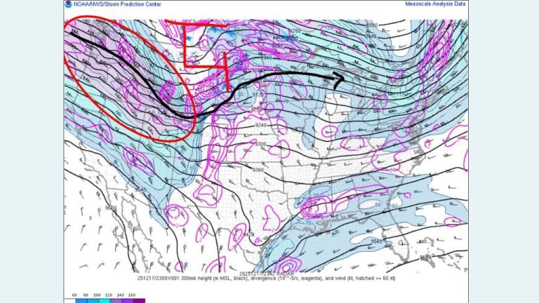
10 Days of Gulf Moisture Feeding the Midwest
Forecast models show strong easterly flow across Florida tied to a large high-pressure system. This setup acts like a pump, funneling rich Gulf air northward into the Plains and Midwest.
The moisture corridor is expected to extend across:
- Texas
- Oklahoma
- Arkansas
- Missouri
- Kentucky
- Tennessee
- Southern and central Illinois
When Gulf moisture lingers for days at a time, each passing cold front has access to fuel for thunderstorm development — a classic recipe for an active severe stretch.
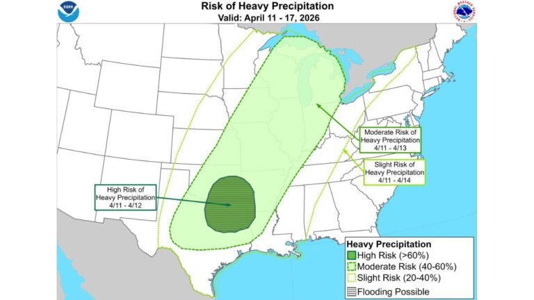
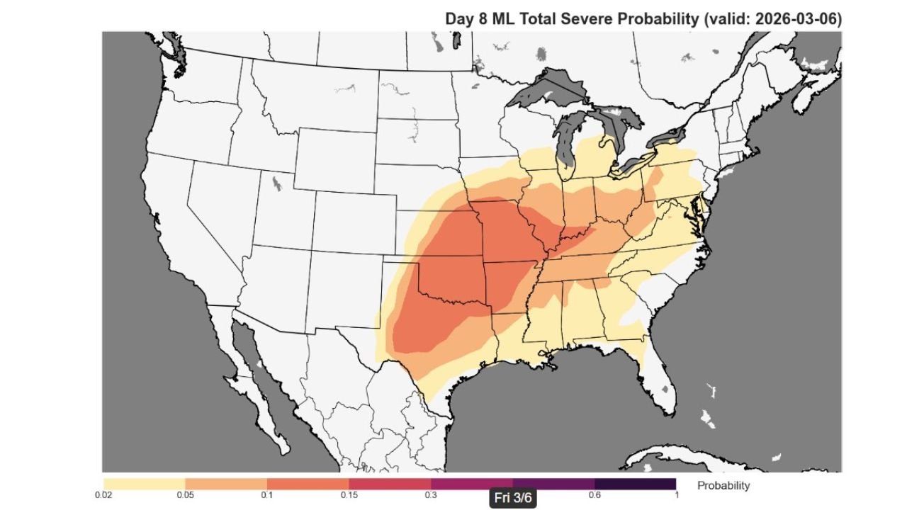
Machine Learning Guidance Flags Elevated Severe Risk
Extended-range severe probability maps valid around March 6–10 highlight a broad swath of elevated severe potential across:
- Central and eastern Oklahoma
- Much of Arkansas
- Western and central Missouri
- Western Tennessee
- Western Kentucky
- Southern Illinois
The probability shading expands northeast toward the Mid-Mississippi Valley, suggesting the severe threat is not confined strictly to the southern Plains.
This kind of spatial coverage at the Day 8–10 range is notable and signals confidence in a favorable environment for organized storms.
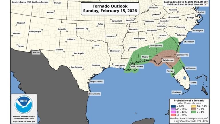
CIPS Severe Analogs Reinforce Tornado Potential
Analog guidance focusing on historical severe events also flags:
- Arkansas
- Missouri
- Tennessee
- Kentucky
as areas with meaningful signals for significant severe weather markers.
Clusters of analog-based tornado probabilities appear across:
- Central Arkansas
- Southern and eastern Missouri
- Western Tennessee
- Western Kentucky
While analogs do not guarantee outcomes, they indicate atmospheric similarities to past severe setups.
Illinois and the Midwest in the Crosshairs
For Illinois, especially southern and central portions of the state, this pattern bears watching closely.
Repeated storm systems tracking northeast could place:
- Southern Illinois
- The St. Louis metro region
- Portions of western and central Illinois
near the northern edge of the higher instability axis.
Even if Chicago sits on the cooler side of individual systems, the overall pattern supports:
- Increased thunderstorm frequency
- Strong frontal passages
- Potential severe windows depending on timing
A Very Active Pattern, Not a One-Day Event
The key takeaway is duration.
Rather than a single isolated severe weather day, guidance suggests:
- Multiple frontal boundaries
- Several storm rounds
- Sustained Gulf moisture return
- Elevated shear profiles across the Plains and Midwest
This type of multi-day setup often produces at least a few impactful severe episodes somewhere within the corridor.
Heartland Cold Front Parade Begins
The broader message from long-range charts is clear:
An active, possibly very active, pattern is setting up across the Heartland and Midwest, driven by:
- Persistent Gulf moisture
- Strong jet stream dynamics
- Repeated cold front intrusions
As we move deeper into early March, the atmosphere appears primed for frequent storm development from Texas through Illinois.
Stay with ChicagoMusicGuide.com for continued updates as this evolving severe weather pattern comes into sharper focus.