Washington DC Weather Whiplash Record 86° Heat, Tornado Warnings, Then 50-Degree Plunge Toward Snow in 24 Hours
WASHINGTON, DISTRICT OF COLUMBIA — The nation’s capital experienced a dramatic weather reversal Wednesday as temperatures surged to a record 85–86 degrees, triggering evening thunderstorms and tornado warnings, before forecasters warned of a plunge into the 30s by Thursday with the potential for wet snow mixing with cold rain. The projected 24-hour temperature change of 45 to 50 degrees represents one of the most striking weather swings of the season across the DC region and surrounding Mid-Atlantic states.
Meteorological data from the American weather model shows a sharp thermal gradient sweeping through Washington DC, Maryland, and Virginia, highlighting what experts describe as a textbook case of rapid frontal passage and cold air intrusion.
Record Heat and Severe Storms Strike Washington DC
Wednesday afternoon brought near-summer warmth to Washington DC, with temperatures peaking between 85 and 86 degrees, levels more typical of late spring or early summer. The unusually warm air mass fueled atmospheric instability, leading to the development of strong thunderstorms across parts of the region.
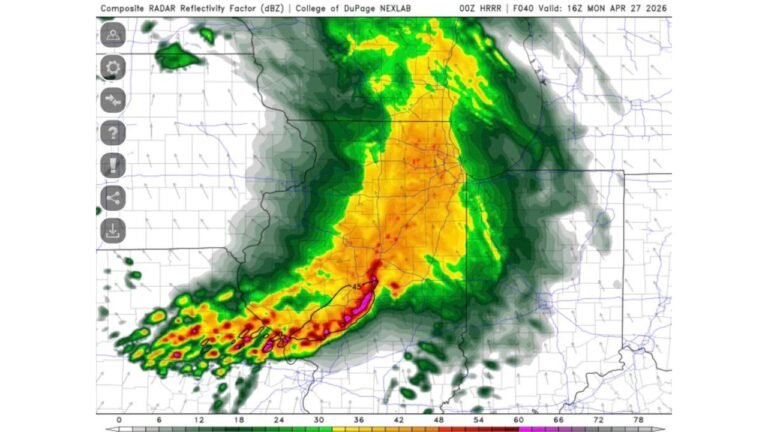
By evening, the unstable environment prompted multiple tornado warnings in and around the DC metropolitan area. Residents reported heavy rain, gusty winds, and lightning as the line of storms pushed through. The severe weather threat marked a sharp contrast to the tranquil spring-like conditions earlier in the day.
The combination of record-breaking warmth and rapid storm development underscores how volatile transitional seasons can be in the Mid-Atlantic. When warm, moisture-rich air collides with an advancing cold front, the result can be explosive thunderstorm activity.
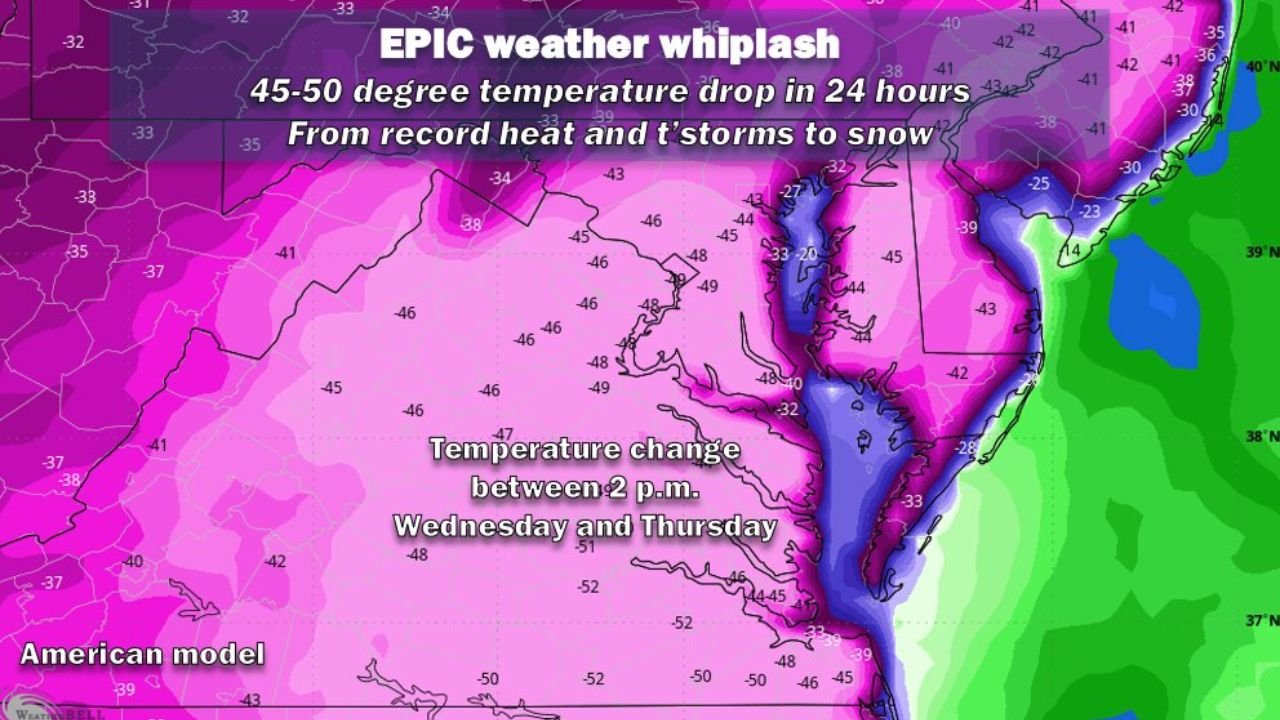
A 45–50 Degree Temperature Crash in Just 24 Hours
According to forecast model projections, temperatures between 2 p.m. Wednesday and 2 p.m. Thursday are expected to fall by as much as 45 to 50 degrees across large portions of the DC region.
Color-shaded model data illustrates widespread drops of 46, 48, and even 50 degrees stretching from Washington DC southward through parts of Virginia and west into areas of Maryland. Such a steep decline in a single 24-hour period is rare and often associated with powerful cold fronts tied to dynamic storm systems.
By Thursday morning, readings that were once in the mid-80s are forecast to settle into the low to mid-30s, representing a dramatic shift from record warmth to near-winter chill in less than a day. Meteorologists often refer to this phenomenon as “weather whiplash,” a rapid oscillation between extremes driven by strong jet stream dynamics.
From Tornado Threat to Wet Snow Possibility
As colder air pours into the region, forecasters indicate that precipitation lingering behind the departing storm system could transition into a mix of cold rain and wet snow, particularly during the colder overnight and early morning hours.
While significant accumulation is not expected in central Washington DC, the visual impact of flakes mixing into rain after near-record heat will emphasize the extraordinary nature of the shift. Areas north and west of the city, especially higher elevations in Maryland and western Virginia, could see brief periods of slushy precipitation.
Such transitions from severe thunderstorm conditions to wintry precipitation within 24 hours highlight the volatility of March weather patterns across the Mid-Atlantic. The region’s proximity to both coastal moisture and continental cold air masses makes it especially susceptible to these dramatic swings.
Three Seasons in a Single Day Across the Mid-Atlantic
The unfolding situation across Washington DC, Maryland, and Virginia serves as a vivid reminder of how quickly weather conditions can pivot during seasonal transitions. Residents experienced what felt like early summer heat, followed by severe storm conditions, and then an abrupt return to winter-like cold.
Meteorologists note that strong upper-level troughs diving southward behind powerful storm systems can usher in Arctic air masses at remarkable speed. When that cold air undercuts lingering moisture, precipitation types can change rapidly — sometimes within hours.
For commuters and event planners in the DC area, the rapid drop means preparing for sharply colder conditions, slick roads in isolated areas, and significantly different travel conditions compared to just 24 hours prior.
As Washington DC and the surrounding Mid-Atlantic continue to adjust to this dramatic weather shift, it stands as one of the clearest examples this season of how extreme temperature contrasts can develop in a short window.
For continued updates on severe weather patterns, regional climate shifts, and impactful storm systems affecting communities across the United States, visit ChicagoMusicGuide.com.