Washington, D.C., Baltimore, Annapolis, and Northern Virginia Under Level 2 Severe Risk Monday as Damaging Wind Threat Builds After Historic Temperature Crash
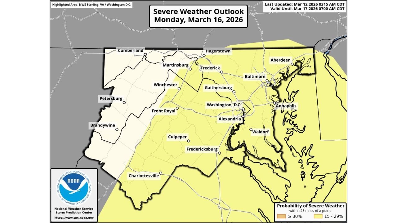
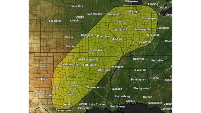
WASHINGTON, D.C. — Just days after a historic temperature plunge stunned the Mid-Atlantic, another round of volatile weather is already lining up. The Storm Prediction Center has issued a Level 2 out of 5 (Slight Risk) for severe thunderstorms on Monday, March 16, 2026, covering the Washington, D.C. and Baltimore region, including much of Northern Virginia and central Maryland.
The primary threat at this time appears to be damaging straight-line winds, though isolated severe storms cannot be ruled out as a strong cold front sweeps through the region.
Areas Included in the Level 2 Risk
The highlighted severe weather outlook spans a broad corridor that includes:
- Washington, D.C.
- Baltimore, Maryland
- Annapolis
- Frederick
- Gaithersburg
- Alexandria, Virginia
- Waldorf
- Fredericksburg
- Culpeper
- Charlottesville
- Hagerstown
- Portions of the Shenandoah Valley, including Winchester and Front Royal
The risk zone also extends toward the Chesapeake Bay and surrounding communities.
Damaging Winds Main Concern
Forecast discussions indicate that strong upper-level dynamics combined with a fast-moving cold front could support a line of thunderstorms capable of producing:
- Wind gusts exceeding 50–60 mph
- Isolated tree damage
- Scattered power outages
While instability may not be extreme, the strength of the upper-level system and frontal forcing may compensate enough to organize storms into a potentially impactful line.
Tornado Risk Appears Lower — But Not Zero
At this stage, the tornado threat appears secondary compared to wind damage. However, embedded rotation within a fast-moving line of storms cannot be entirely ruled out, particularly during peak heating hours Monday afternoon into early evening.
Residents across the DC/Baltimore metro should remain alert for possible warnings.
Rapid Pattern Shift After Historic Drop
This potential severe setup follows immediately after one of the most dramatic 24-hour temperature crashes on record for Washington, D.C., highlighting the extreme volatility of the current weather pattern.
A strong push of colder air behind Monday’s front could once again produce sharp temperature swings after storms exit the area.
Timing and Preparedness
Storms are most likely Monday afternoon through evening as the cold front advances eastward across:
- Northern Virginia
- The DC metro
- Central Maryland
Residents are encouraged to:
- Monitor forecast updates
- Secure loose outdoor items
- Ensure weather alerts are enabled on mobile devices
After an already historic stretch of weather in the Mid-Atlantic, Monday’s setup adds another chapter to a highly active March pattern.
For continuing updates on major weather events across the country, stay with ChicagoMusicGuide.com.