Severe Storm Risk Expands from Texas and Arkansas Sunday to Georgia, the Carolinas and Virginia Monday as SPC Highlights Multi-Day Tornado and Damaging Wind Threat
DALLAS, TEXAS — The Storm Prediction Center has officially introduced organized severe weather risks for both Sunday and Monday, signaling a potentially active two-day stretch from the Southern Plains into the Southeast and Mid-Atlantic.
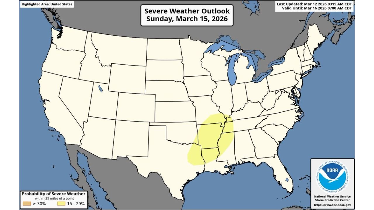
Forecast outlooks show highlighted severe risk areas on Sunday, March 15, centered over parts of Texas, Louisiana, Arkansas, Mississippi, and western Tennessee — followed by a shift eastward on Monday, March 16, into Georgia, South Carolina, North Carolina, and Virginia.
Forecasters note that storms capable of all hazards — including damaging winds, large hail, and tornadoes — appear possible on both days.
Sunday: Southern Plains into the Mid-South
Sunday’s highlighted zone stretches from east Texas through Louisiana, Arkansas, northern Mississippi, and into western Tennessee.
Cities within or near the risk area include:
- Dallas
- Shreveport
- Little Rock
- Jackson
- Memphis
This setup suggests a strengthening storm system emerging from the Southern Plains and interacting with increasing Gulf moisture. As instability builds and wind shear strengthens, thunderstorms could organize into supercells or clusters capable of producing:
- Tornadoes
- Damaging straight-line winds
- Large hail
The placement of the Sunday risk area aligns with a corridor often vulnerable during early spring severe weather events.
Monday: Threat Shifts East into the Southeast and Mid-Atlantic
By Monday, the severe threat is forecast to expand eastward into:
- Georgia
- South Carolina
- North Carolina
- Eastern Virginia
- Portions of eastern Tennessee
Major population centers potentially impacted include:
- Atlanta
- Charlotte
- Columbia
- Raleigh
- Richmond
The outlook highlights a broad swath along the Southeast coastline and into parts of the Mid-Atlantic. As the main storm system progresses eastward, strong wind fields aloft are expected to overspread the region, supporting organized thunderstorm development.
With Gulf moisture firmly in place ahead of the advancing front, storms could once again be capable of producing damaging winds and isolated tornadoes.
Multi-Day Setup Raises Concern
What makes this scenario noteworthy is the multi-day nature of the threat. Rather than a brief, localized event, the setup involves:
- A strengthening low-pressure system
- Expanding wind energy aloft
- Increasing moisture return from the Gulf
- Eastward progression of favorable dynamics
This pattern supports severe potential first across the Southern Plains and Mid-South, then shifting into the Southeast and Mid-Atlantic as the system moves east.
All Hazards Possible
Forecasters emphasize that severe storms on both Sunday and Monday may be capable of all hazards, meaning:
- Tornadoes
- Large hail
- Widespread damaging wind gusts
Details regarding storm mode — whether more discrete supercells or organized lines — will determine the exact magnitude and type of impacts in each region.
What Residents Should Do
Residents across Texas, Arkansas, Louisiana, Mississippi, Tennessee, Georgia, the Carolinas, and Virginia should:
- Monitor forecast updates closely
- Ensure weather alerts are enabled
- Review severe weather safety plans
Forecast refinements will continue over the coming days, but the introduction of Day 4 and Day 5 severe risks signals increasing confidence in a potentially active stretch of weather.
For continued coverage of significant weather developments across the country, stay with ChicagoMusicGuide.com.