Another Severe Weather Threat Is Emerging for the Southeast Later Next Week as Strong Upper-Level Flow and Deep Gulf Moisture Point Toward Friday May 1
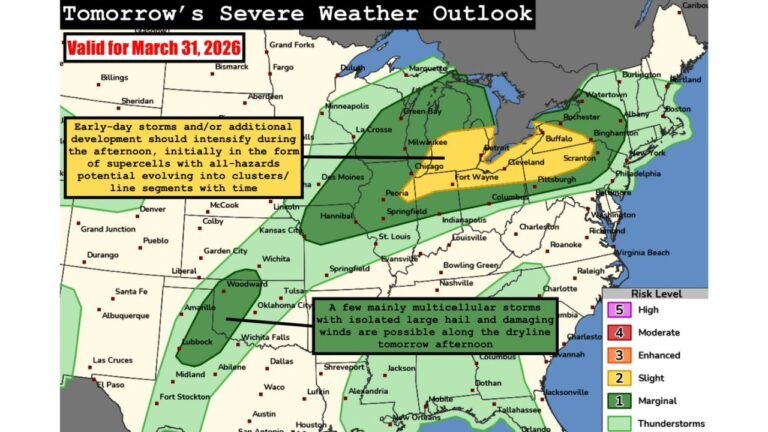
ATLANTA, GA — The severe weather pattern affecting the southern United States through late April is not finished when Monday’s event wraps up. Extended range atmospheric data is already flagging another potential severe weather setup for the Southeast later next week — with the current signal pointing toward Friday, May 1, 2026 as the date to watch.
The setup is still far enough out that details carry significant uncertainty. But two key atmospheric ingredients visible in the latest ensemble data — stronger upper-level flow and a robust moisture return from the Gulf — are the building blocks of a serious severe weather environment, and their presence this far in advance is worth tracking closely.
What the Data Is Showing for May 1
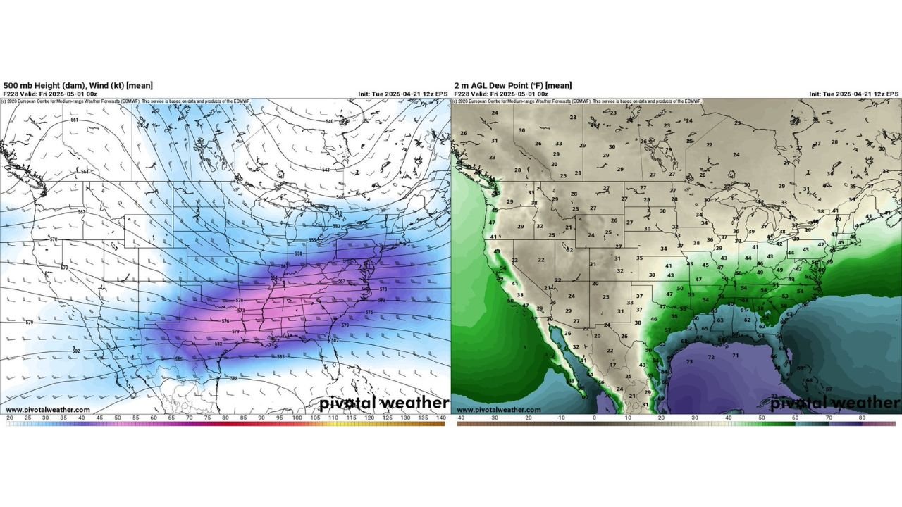
The upper-level wind and height pattern valid for Friday, May 1 shows a powerful jet stream digging southward into the central and eastern United States, with the strongest upper-level winds — depicted in deep purple and blue tones — concentrated across the Tennessee Valley, Deep South, and Southeast corridor. At approximately 18,000 feet above the surface, wind speeds across Alabama, Georgia, Tennessee, Mississippi, and the Carolinas are modeled at 90 to 120 knots or greater — an exceptionally strong upper-level flow for early May that would provide the atmospheric ventilation severe thunderstorms need to grow tall, rotate aggressively, and sustain themselves over long distances.
Strong upper-level flow of this magnitude is one of the most reliable precursors to organized severe weather across Dixie Alley and the Southeast. When the jet stream dips this far south this aggressively in late April and early May, forecasters take notice immediately.
The Moisture Picture
The dewpoint map valid for the same Friday, May 1 timeframe shows deep Gulf moisture already surging northward well ahead of the approaching system. Surface dewpoints across Texas, Louisiana, Mississippi, Alabama, Georgia, and Florida are modeled in the 54 to 65 degree range — with values climbing to 65 to 73 degrees across the Gulf Coast from Houston through New Orleans and into Mobile.
Dewpoints in the mid to upper 60s across the Deep South in early May represent a substantial moisture return. This level of atmospheric moisture — measuring the actual water vapor content of the low-level air — is what fuels explosive thunderstorm development. When combined with the strong upper-level flow shown in the wind pattern, the two ingredients together create the kind of atmospheric environment that severe weather forecasters classify as a high-ceiling setup.
The moisture boundary — the line where dewpoints transition from dry values in the 30s and 40s across the northern Plains and Midwest to the rich 50s and 60s across the mid-South and Southeast — is positioned across Missouri, Kentucky, Tennessee, and Virginia on the May 1 map, placing the Southeast squarely in the deep moisture zone.
Upper-Level Flow and Moisture Summary for May 1
| Parameter | Value | Region | Significance |
|---|---|---|---|
| 500mb Jet Speed | 90 to 120+ knots | Tennessee Valley, Deep South | Exceptional upper support for severe storms |
| Surface Dewpoints | 54 to 65°F | Alabama, Georgia, Mississippi, Tennessee | Deep moisture for storm fuel |
| Gulf Coast Dewpoints | 65 to 73°F | Houston, New Orleans, Mobile | Extreme low-level moisture |
| Moisture Boundary | Transitional zone | Missouri, Kentucky, Tennessee | Severe weather focus area |
Where the Threat Could Develop
Based on the combination of strong upper-level flow and deep Gulf moisture visible in the May 1 data, current analysis indicates the Southeast is the most likely target for a potential severe weather event later next week. The corridor from Alabama and Mississippi northward through Tennessee, Georgia, and into Kentucky and Virginia sits at the intersection of the strongest jet stream energy and the deepest moisture return.
Alabama in particular — already facing Monday’s severe weather risk — could see a second round of organized storm potential by Friday if the pattern evolves as current data suggests. Mississippi, Tennessee, Georgia, and the Carolinas are also in the watch zone for the May 1 timeframe.
The MJO Phase 2 signal — a large-scale tropical atmospheric wave pattern that influences weather across the United States — is identified in current analysis as a contributing factor enhancing the overall severe weather potential across the Southeast during this period. MJO Phase 2 historically favors stronger upper-level flow and increased moisture return across the Gulf States during late April and early May.
Forecast Confidence
Confidence: Low. This is a 10-day extended range signal, and the specific details of storm timing, exact geographic placement, and intensity will change considerably as May 1 approaches. What carries meaningful confidence at this range is the directional signal — the upper-level pattern and moisture return both support the possibility of another organized severe weather event across the Southeast later next week. The Alabama, Mississippi, Tennessee, and Georgia corridor should be treated as the preliminary watch zone, with forecasts expected to sharpen significantly by Wednesday and Thursday as the event comes into short-range model focus.
More extended severe weather pattern coverage is always on the horizon. Stay informed at ChicagoMusicGuide.com — your source for Southeast storm tracking and long-range severe weather outlooks across Alabama, Georgia, Tennessee, and the entire United States.