Milwaukee and Chicago Stay Cool Through Midweek Before Southwest Winds Return Heat and Storms by Thursday
MILWAUKEE, WI — A significant weather pattern change is developing for the Great Lakes region this week. The ridge of high pressure that has been keeping Milwaukee, Chicago, and surrounding communities dry is breaking down, and by Thursday, June 4, 2026, two major changes arrive simultaneously — warmth returns and storm chances increase.
Cool and Quiet Through Wednesday Near the Lake
Cooler lake-influenced temperatures will persist across the Milwaukee and Chicago shoreline communities through midweek. The high pressure ridge keeps storm chances minimal through Wednesday, giving residents a brief dry stretch before the pattern flips.
Thursday Brings Southwest Winds and Returning Heat
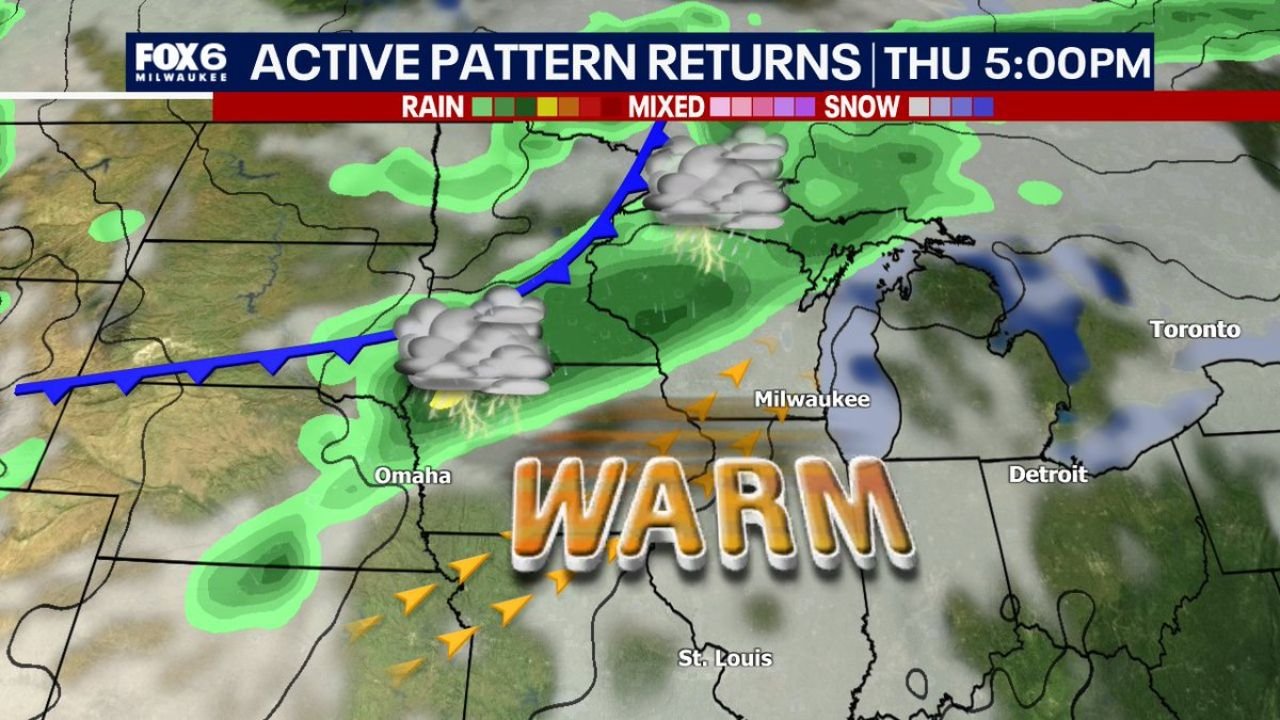
The key change arrives Thursday when winds shift out of the southwest. That wind shift is the atmospheric mechanism that breaks the lake influence and drives warmer air back into the region. Forecast radar valid for Thursday at 5:00 PM shows a cold front approaching from the west with a line of showers and thunderstorms pushing toward Wisconsin and Illinois from the Omaha and St. Louis corridor. Southwest winds ahead of that front will push temperatures back into the 80s Fahrenheit across the entire region before storms arrive.
Storm Chances Increase Thursday Night Through the Weekend
Thunderstorm chances begin rising late Thursday night and continue increasing through the weekend as the active pattern becomes established. Current analysis indicates this is not a one-day storm event. The pattern shift opens the door to multiple rounds of storm activity through the first weekend of June across Wisconsin, Illinois, Michigan, and Indiana.
Pattern Change Timeline
| Period | Conditions | Key Feature |
|---|---|---|
| Monday through Wednesday | Cool, dry, lake influence | High pressure holding |
| Thursday afternoon | Warming fast, 80s returning | Southwest wind shift |
| Thursday night | Storm chances increasing | Cold front approaching |
| Friday through weekend | Active storm pattern | Multiple storm rounds possible |
Confidence in the pattern change arriving Thursday is HIGH. Confidence in thunderstorm chances Thursday night through the weekend is MODERATE to HIGH. Specific severe weather details for the weekend will sharpen through midweek.
More weather coverage is always on the horizon. Stay informed at ChicagoMusicGuide.com — your source for Great Lakes pattern forecasts and breaking weather coverage across Wisconsin, Illinois, and the entire United States.