Explosive 1053 mb Arctic High Over North Dakota Set to Drive Dangerous Cold Across the U.S. Next Week
NORTH DAKOTA — A Rare 1053 mb Arctic High Is Forming, Signaling a Major Temperature Collapse Next Week
Meteorologists are sounding alarms as new model runs show a massive 1053 mb arctic high-pressure system building over North Dakota, setting the stage for one of the most intense cold blasts of the winter season.
This potent high — fueled by a deep pool of Canadian arctic air — is expected to spill southward and eastward late next week, driving temperatures to 20–35°F below normal across large parts of the United States.
Forecasters describe the setup as “wild,” noting unusually strong Pacific energy interacting with dense Canadian air, creating a perfect gateway for an arctic outbreak.
Dynamic Tropopause Maps Show a Direct Surge of Polar Air Into the Northern Plains
The latest dynamic tropopause temperature maps illustrate a dramatic drop in upper-atmospheric temperatures centered over North Dakota and the northern Plains.
A deep purple lobe — representing the coldest tropospheric air — forms directly over the Dakotas before plunging into the central U.S.
Meteorologists note that this structure is a classic signature of a major December arctic intrusion, especially when paired with a surface pressure dome exceeding 1050 mb.
Temperature Anomalies Show North Dakota Up to 30–35°F Below Normal
GFS temperature anomaly projections for Friday, December 12 highlight a severe cold pool anchored in North Dakota:
- North Dakota: 25–35°F below average
- South Dakota & Montana: 20–30°F below average
- Nebraska, Wyoming, Minnesota: 15–25°F below average
- Iowa, Missouri, Illinois: 10–20°F below average
These values would push many regions into dangerous wind chill conditions, especially during the nighttime and early morning hours.
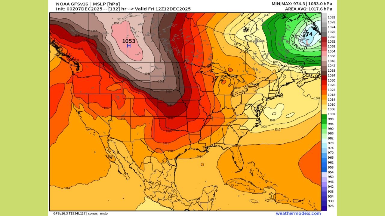
The 1053 mb High Over North Dakota Signals Extremely Dense Arctic Air
One of the most striking model outputs is the surface pressure chart showing a 1053 mb high-pressure center directly over North Dakota.
This level of pressure is exceptionally rare and indicates:
- Extremely dense, frigid air
- Rapid southward acceleration of the cold dome
- Strong pressure gradients capable of producing harsh winds & blowing snow
Such a setup is often seen in the early stages of historic winter cold snaps.
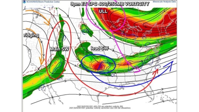
Pacific Jet Pattern Adding Fuel to the Outbreak
Meteorologists point to a highly volatile Pacific setup fueling the system:
- A strong jet carving deep troughs
- Energetic waves feeding cold transport
- Reinforcing shots of Canadian air feeding the North Dakota high
The combination strengthens the cold dome and accelerates its expansion.
What the U.S. Can Expect Next Week
If current model guidance holds, the upcoming pattern could bring:
- Severe cold across North Dakota beginning December 11–12
- Rapid temperature drops through the central Plains and Midwest
- Wind chills well below zero across the northern Plains
- Freezing temperatures pushing far into the South and Southeast
- Potential travel and event disruptions due to extreme cold and wind
Outdoor performances, winter festivals, and touring musicians should monitor forecasts closely.
More Data Expected as the Pattern Evolves
The meteorologist who posted the maps emphasized that this pattern is on track to strengthen further, with even colder ensemble trends possible as the week approaches.
Chicago Music Guide will continue tracking every model update as this North Dakota–anchored arctic high evolves and pushes toward the rest of the country.
How do you prepare for extreme winter cold during concerts or travel? Share your experiences at ChicagoMusicGuide.com!