Eastern U.S. Weather Pattern Shows No Signs of Slowing as Separate Storm Systems Continue Across Multiple States

CHICAGO — A broad look at long-range weather patterns across the United States shows a system that continues to favor fast-moving disturbances rather than the kind of slow, consolidated storm setup that typically brings widespread winter weather to states like Illinois, Indiana, Ohio, Pennsylvania, and much of the Northeast.
Recent upper-air charts reveal a striking pattern: the jet stream remains strong, flat, and unobstructed across the northern tier of the country. At the same time, the Atlantic remains wide open, with no signs of high-latitude blocking — a feature that would ordinarily help slow storms down and allow energy from different regions to merge.
Without that blocking, winter storms that might otherwise intensify or link together are instead traveling independently, leaving many states in a cycle of small northern disturbances and separate southern systems that fail to combine.
Why This Pattern Reduces the Chances for Widespread Snow Events
Across states such as New York, Pennsylvania, New Jersey, Massachusetts, Ohio, and Michigan, winter snow potential often depends on two ingredients:
- A slowed or buckled jet stream, allowing storm systems to deepen
- Energy from different branches of the atmosphere merging into one system
Right now, neither of those conditions is present.
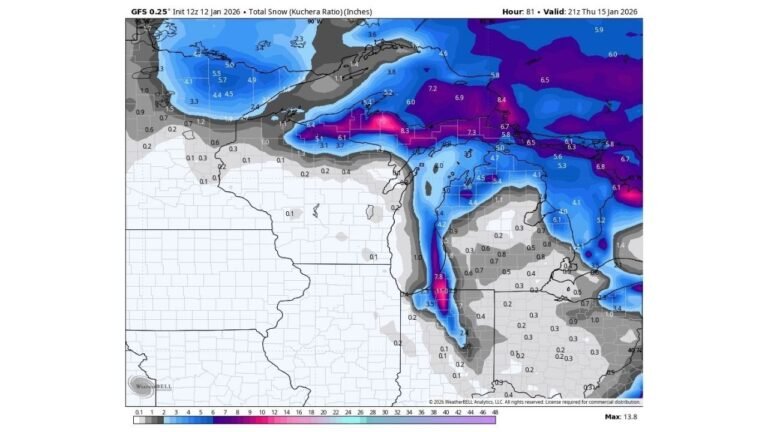
Upper-level maps show strong troughing locked over eastern Canada while the central and eastern United States remain under a fast west-to-east flow. This means disturbances drop through the Great Lakes and New England quickly, producing brief bursts of precipitation but no large-scale events.
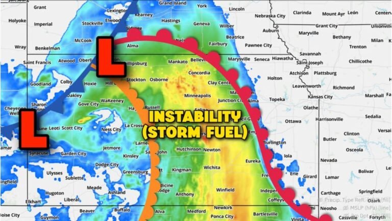
Meanwhile, impulses developing in the southern U.S. are also moving too fast to connect with northern energy. States like Tennessee, Kentucky, the Carolinas, and even Virginia continue to see isolated disturbances that never phase into major coastal storms.
The result: separate systems instead of one impactful winter event, limiting widespread snow opportunities, especially in the Northeast.
A Look at the Current Map: A Split Flow That Won’t Combine
The imagery provided highlights:
- A dominant trough over eastern Canada, pulling cold air south but not allowing it to anchor long enough for storm development
- A strong Pacific jet, pushing disturbances across the western and central United States at high speed
- A lack of blocking near Greenland, which would normally help “lock in” cold air and slow storms down
- Two separate energy branches, one northern and one southern, moving too quickly to merge
This is why storm systems in states stretching from Montana to Maine continue to appear disorganized — they’re simply not being given enough time or atmospheric support to intensify.
What This Means for the Coming Weeks Across the Midwest and Northeast
While temperatures may fluctuate and short cold snaps are still possible, the larger pattern is not favorable for sustained winter weather across many states.
Here’s what residents in key regions can expect:
Midwest (Illinois, Indiana, Wisconsin, Michigan, Ohio)
- Fast-moving disturbances
- Limited snowfall outside of lake-effect zones
- Brief cold periods interrupted by quick warm-ups
Northeast (New York, Pennsylvania, New Jersey, New England)
- Cold air will be present at times
- But without blocking, storms keep sliding through too quickly
- Snow chances remain scattered and limited
Mid-Atlantic (Maryland, Virginia, Delaware)
- Mostly mild spells with occasional weak systems
- No signs of a major coastal storm pattern yet
Until the northern and southern streams finally phase — something not supported by the current setup — this “separate system” pattern will persist.
Looking Ahead
The longer-range outlook suggests the eastern United States could stay in this active but non-snow-friendly pattern unless a major shift occurs in the upper atmosphere.
Experts typically look for signs of:
- High-latitude blocking
- Slowed jet stream
- Amplified ridges and troughs
None of these features are dominant right now.
As long as the jet keeps racing overhead, the Midwest and Northeast will continue dealing with frequent disturbances — but not the kind of large, slow-moving storms that define classic winter weather.
Stay Tuned with ChicagoMusicGuide.com
Weather patterns like this can change quickly, especially in December. Keep checking back with ChicagoMusicGuide.com for updated temperature outlooks, storm signals, and regional winter coverage.