Storm Track Shift Expected Late December as High Pressure Dominates the Central U.S. and Re-Routes Pacific Systems Across the North
UNITED STATES — A significant late-December pattern shift is taking shape, steering storms away from the central U.S. and toward northern states as a strong high-pressure ridge settles over the middle of the country.
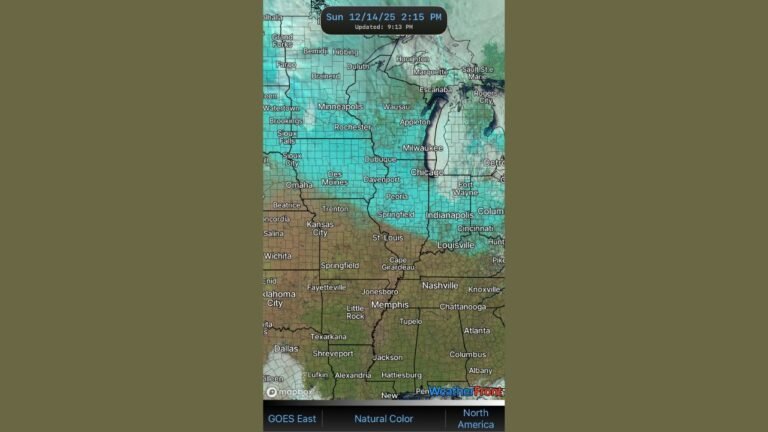
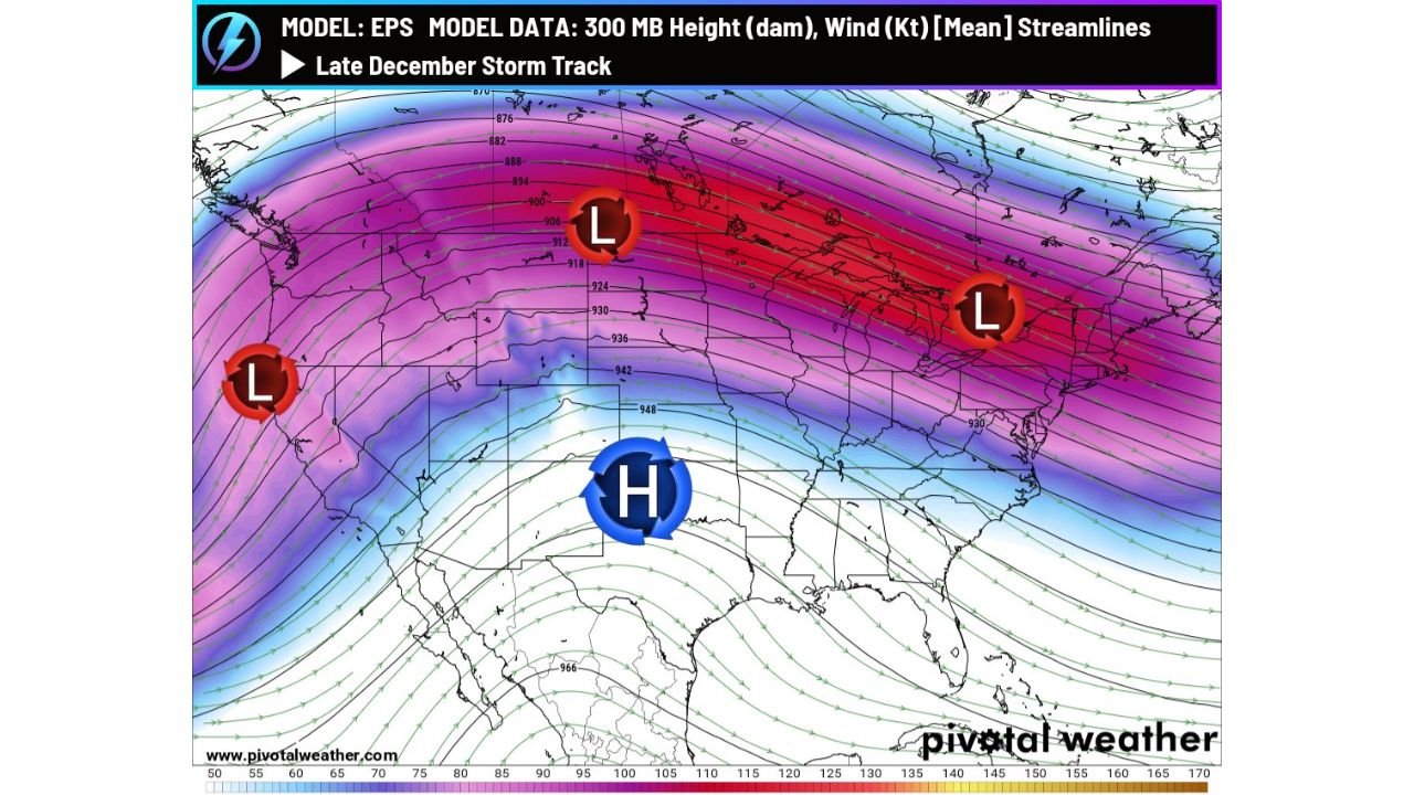
New model guidance highlights a notable transition as the final week of December approaches. Pacific systems that have been impacting the West Coast will continue to move inland, but instead of tracking toward the Southern Plains or Midwest, many will be diverted along the U.S.–Canada border due to a dominant ridge of high pressure building across the central states.
High Pressure Expands Across the Central U.S.
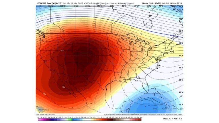
Recent EPS model data shows a widespread area of high pressure anchoring over the central portion of the country. This ridge acts as a barrier, forcing incoming Pacific energy to travel around it rather than through it.
Under this setup, most of the Central U.S. is expected to experience:
- Quiet weather conditions
- Above-average temperatures
- Limited storm activity
This calmer pattern may persist into early January if the ridge remains stable.
Storm Systems Shift North Into Colder, Stormier Air
While the central states trend warmer and quieter, the northern tier and the Northeast are positioned on the stormier side of the pattern. Storms riding the U.S.–Canada border may strengthen as they encounter colder air.
As a result, states in the Upper Midwest and Northeast could see:
- More frequent storm systems
- Increased wind energy aloft
- A mix of rain and wintry weather depending on surface temperatures
This contrasts sharply with the mild conditions expected farther south.
Pattern Could Hold Into Early January
Forecasters caution that while model confidence is strong in the short term, the duration of this pattern is still uncertain. If the ridge remains in place, warm and quiet conditions could linger through the first week or two of January. However, a shift in the Pacific jet or a breakdown of the ridge could reintroduce colder air deeper into the country later in the month.
For now, the dominant weather features include:
- A reinforced Pacific jet stream impacting the West Coast
- A strong ridge over the Central U.S.
- A more active storm corridor across the northern United States and Northeast
What This Means for Travelers and Residents
With holiday travel underway, this pattern has mixed implications:
- Central U.S. travelers may experience fewer weather-related disruptions.
- Northern states should anticipate changing conditions and possible storm impacts.
- West Coast states continue to monitor incoming Pacific systems tied to atmospheric river activity.
Staying updated with local forecasts will be important as the pattern evolves toward the end of December.
Stay Prepared with Chicago Music Guide Weather Updates
Weather patterns can shift quickly this time of year, especially with strong Pacific energy and evolving jet stream dynamics. Keep checking ChicagoMusicGuide.com for ongoing updates as we track late-December and early-January developments across the country.