Clipper System Brings Brief Snow Chance to New York, Massachusetts, Pennsylvania, New Jersey, and Connecticut on Tuesday
NEW YORK, N.Y. — A fast-moving Alberta Clipper system is expected to sweep across parts of the Northeast late Monday night into Tuesday morning, bringing a brief period of light accumulating snow to portions of New York, Pennsylvania, Massachusetts, Connecticut, and northern New Jersey, according to the latest forecast guidance and regional weather outlooks.
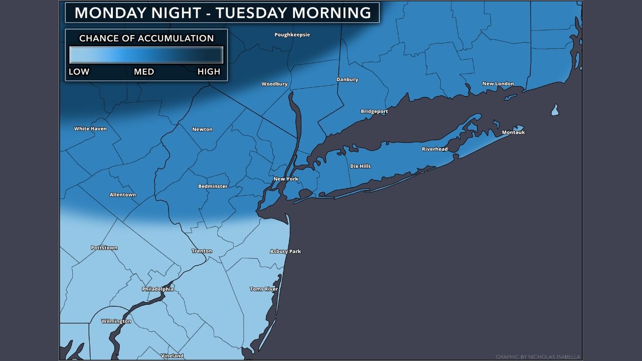
A Fast-Moving Clipper Targets the Northeast
Forecasters say the system will move quickly from west to east, limiting overall snowfall totals but still creating a narrow window for accumulation, especially north of the Interstate 95 corridor and across interior and elevated locations. Snow is expected to develop late Monday night and taper off by mid to late Tuesday morning in most areas.
“This is a classic quick-hitting clipper,” meteorologists note, meaning impacts will be short-lived but noticeable during the morning commute in some cities.
Areas Most Likely to See Snow
Based on the current forecast data and snowfall probability maps, the most favored areas for accumulation include:
- Upstate New York and the Hudson Valley
- Interior southern New England, including central and western Massachusetts
- Northern and central Pennsylvania
- Northern New Jersey and interior Connecticut
In these regions, a quick 1 to 2 inches of snow is possible, with locally higher totals in higher terrain. Coastal sections closer to Long Island, southern New Jersey, and southeastern New England may see lighter amounts or a mix with rain, reducing accumulation.
Timing and Travel Impacts
Snow is expected to begin late Monday night, with the most widespread activity occurring early Tuesday morning. While this is not expected to be a major winter storm, slick roads and reduced visibility are possible during the Tuesday morning commute, particularly where snow falls steadily for a few hours.
Transportation officials are urging drivers to allow extra time and use caution, especially on untreated secondary roads.
White Christmas Potential for Some
Because this system arrives just ahead of Christmas, areas that manage to pick up measurable snowfall could retain some snow cover into the holiday, depending on local temperatures. Northern locations that remain colder stand the best chance of holding onto snow through Christmas Day.
“Even a light snowfall can go a long way toward setting the holiday scene,” forecasters say, noting that this may be one of the better chances for fresh snow before Christmas in parts of the Northeast.
Forecast Confidence and What to Watch
Confidence is moderate, but meteorologists caution that small shifts in the storm track could still affect who sees snow versus rain. Because clippers move quickly, forecast models may continue to adjust snowfall placement up until the event begins.
Residents are encouraged to monitor local forecasts and updates overnight Monday into Tuesday as the system approaches.
While impacts are expected to remain limited, this quick burst of winter weather could provide a brief taste of snow and a festive boost for parts of the Northeast heading into the Christmas holiday.