Multi-Hazard Winter Storm Expected to Impact Illinois, Michigan, Ohio, and the Northeast With Blizzard Conditions, Freezing Rain, and Isolated Tornado Risk Sunday Into Monday
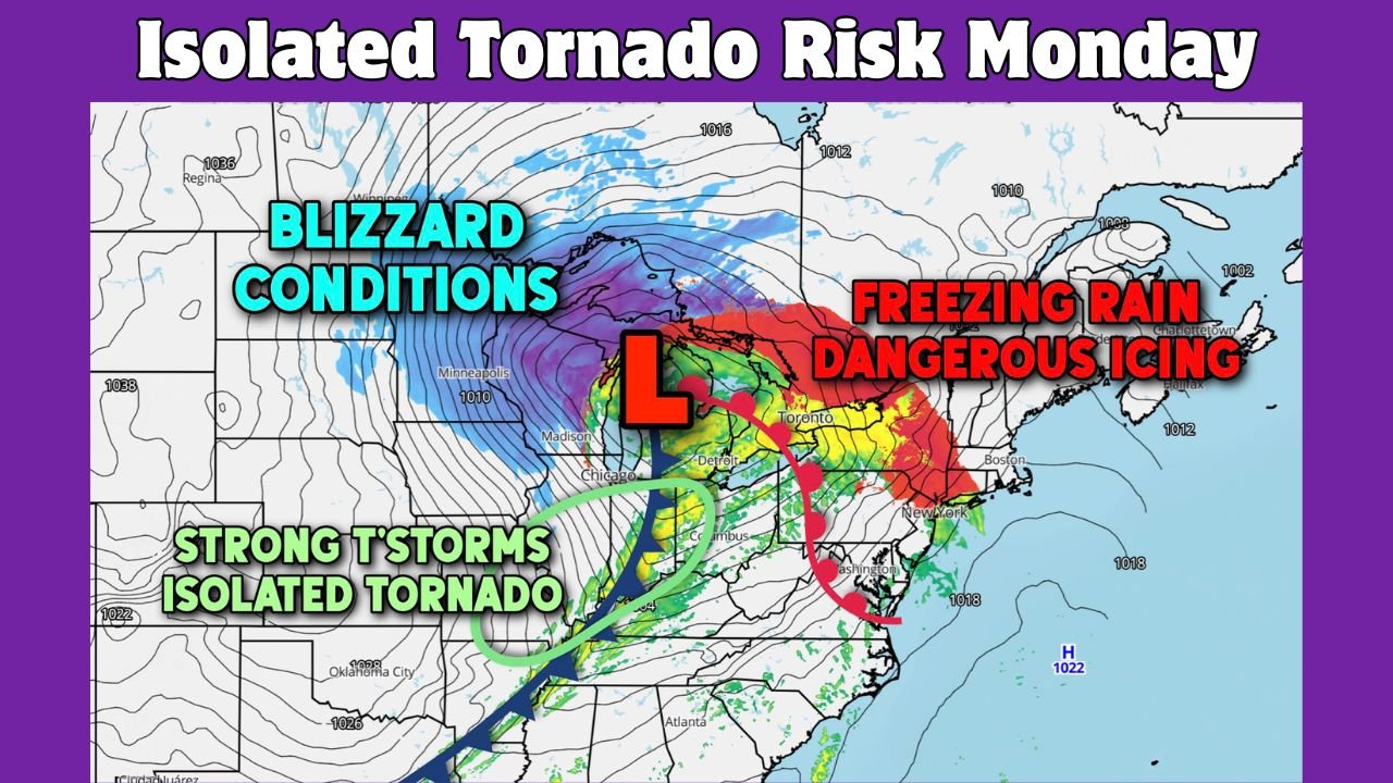
CHICAGO, ILLINOIS — A major, complex storm system is expected to unfold from Sunday into Monday, bringing a rare combination of weather hazards across the Midwest, Great Lakes, and Northeast. Forecast guidance shows the system rapidly intensifying as it moves northeast, producing blizzard conditions, dangerous freezing rain, damaging winds, and even isolated tornado activity in different parts of the storm’s footprint.
Meteorologists stress that this is a high-impact, multi-day event with sharply varying conditions depending on location, making preparedness especially critical.
Blizzard Conditions Target Upper Midwest and Great Lakes
The most severe winter impacts are expected across parts of the Upper Midwest and Great Lakes, particularly northern Wisconsin, Michigan’s Upper Peninsula, and areas downwind of Lakes Superior and Michigan. As the storm “bombs out” over the region, heavy snow combined with powerful winds will likely lead to prolonged blizzard conditions.
Snowfall totals may exceed 12 inches, with localized amounts approaching 2 feet in the hardest-hit areas. Wind gusts of 35–45 mph inland and 50–60 mph over the lakes will create whiteout visibility, deep snowdrifts, and potentially impassable roads for many hours.
Freezing Rain and Dangerous Icing Expand Eastward
East of the heavy snow zone, the storm will transition into a significant freezing rain event across parts of the Ohio Valley, interior Northeast, and New England. Forecast models show a classic overrunning setup, where warm air aloft rides over entrenched cold air at the surface.
This pattern favors freezing rain instead of snow, with ice accretion exceeding 0.25 inches in some locations and approaching 0.50 inches in the most vulnerable areas. Ice of this magnitude can snap tree limbs, down power lines, and trigger power outages, while making travel extremely hazardous or impossible.
Severe Thunderstorms and Isolated Tornado Risk to the South
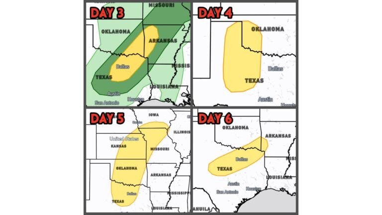
On the storm’s southern flank, warmer and more unstable air will support strong to severe thunderstorms across parts of the Midwest and Ohio Valley, including Illinois, Indiana, and Ohio. The primary threat will be damaging straight-line winds, but forecasters caution that a few isolated tornadoes are possible, particularly Sunday afternoon and evening.
This severe weather risk adds another layer of complexity to an already dangerous system, as some regions may experience thunderstorms just hours before temperatures crash and winter conditions develop.
Damaging Winds Widespread Across Multiple Regions
Strong winds will be a common factor across nearly all parts of this storm. Even outside of snow and ice zones, gusty winds may cause scattered power outages, downed branches, and difficult travel for high-profile vehicles. Wind-driven snow and ice will further amplify impacts in affected areas.
Why This Storm Is Especially Concerning
What makes this system notable is the simultaneous presence of multiple high-impact hazards — blizzards, ice storms, severe thunderstorms, and strong winds — occurring across a large portion of the eastern United States within a short timeframe. Small shifts in the storm’s track could significantly alter local impacts, increasing uncertainty for travelers and emergency planners.
What Residents Should Do
Officials urge residents across the affected regions to closely monitor forecasts, avoid unnecessary travel during peak conditions, and prepare for possible power outages. Completing errands, charging devices, and having emergency supplies ready before conditions worsen is strongly advised.
As this powerful storm system unfolds across the Midwest, Great Lakes, and Northeast, staying informed will be essential. For continued updates on winter storms, severe weather threats, and regional impacts, visit ChicagoMusicGuide.com for the latest forecasts and coverage.