
Illinois, Missouri, Arkansas, Kentucky, and Tennessee See Weakening Storm Line as Severe Threat Remains Very Low Thursday Evening
CHICAGO – A developing storm system sweeping across parts of the Midwest and Lower Mississippi Valley Thursday evening is failing to organize into a significant severe weather outbreak, with meteorologists noting very limited instability despite strong wind shear across the region.
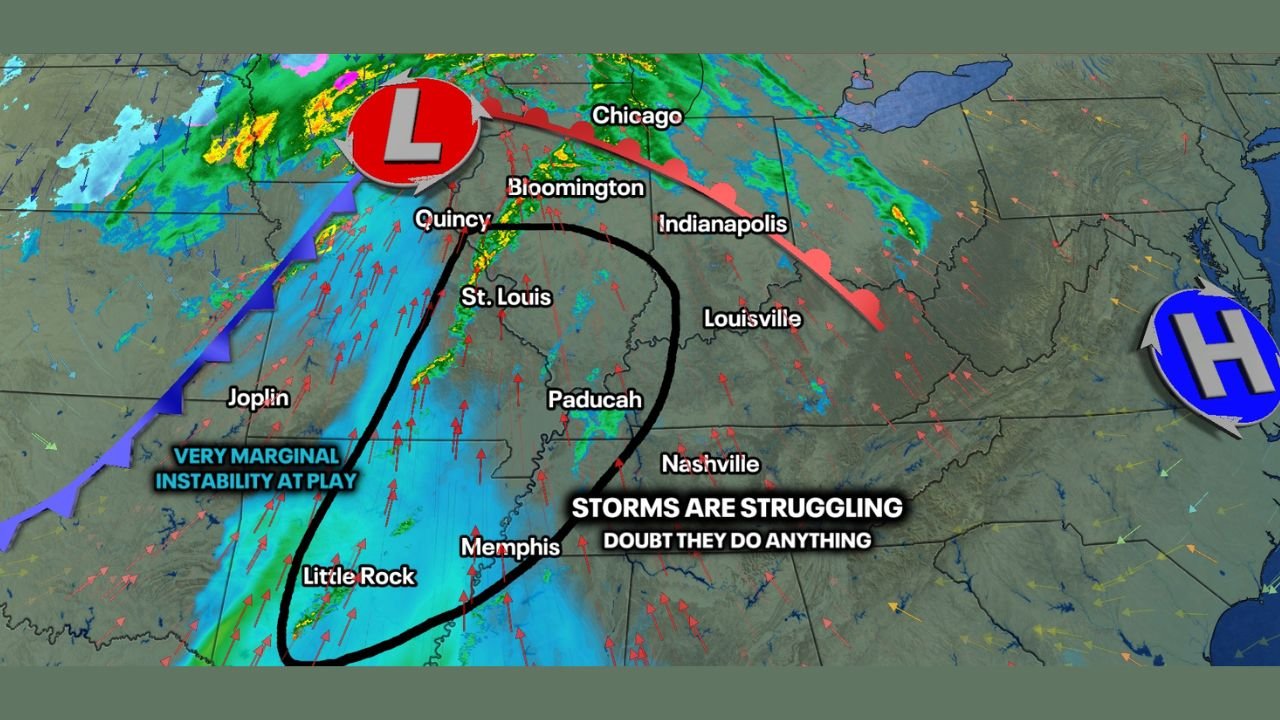
Radar imagery and atmospheric analysis show storms stretching from southeast Missouri through Arkansas and into western Tennessee and Kentucky, but experts say the environment is not supportive of widespread severe development. While heavy rain and gusty winds remain possible, the overall risk for damaging storms or tornadoes appears minimal.
Why Storms Are Struggling Despite Strong Winds Aloft
Forecast data indicates strong upper-level wind shear, a factor often associated with severe weather. However, the key missing ingredient Thursday evening is instability.
Storm updrafts are repeatedly being torn apart before they can mature, a result of very limited surface-based energy. Meteorologists describe the setup as one where storms attempt to form but cannot sustain themselves long enough to become severe.
This mismatch between wind energy and instability is the main reason confidence remains high that most storms will stay disorganized.
Areas Being Closely Monitored Tonight
The corridor receiving the most attention includes:
- Southeast Missouri
- Central and eastern Arkansas
- Western Tennessee
- Western Kentucky
Within this zone, a rogue tornado warning cannot be completely ruled out—particularly in southeast Missouri later Thursday evening—but forecasters stress that the odds remain very low.
Outside of this narrow area, the black-circled region shown in radar imagery is expected to see nothing more than scattered rain and weak thunderstorms.
What Residents Can Expect Through the Evening
Most locations will experience:
- Periods of moderate to heavy rain
- Occasional lightning
- Brief gusty winds near stronger cells
However, organized severe weather is not expected, and storms should gradually weaken as they move eastward overnight.
Forecasters emphasize that this system lacks the instability needed for widespread severe impacts, and the overall threat level remains low.
Bottom Line for the Midwest and Mid-South
Despite dramatic radar visuals and strong atmospheric winds, this is not shaping up to be a major severe weather event. Storms are struggling, and confidence continues to grow that significant damage or tornado activity will not materialize.
Residents should stay weather-aware, especially in southeast Missouri, but widespread concern is not warranted at this time.
Stay with ChicagoMusicGuide.com for continued weather updates, radar breakdowns, and clear explanations as conditions change. Have thoughts on tonight’s storm setup or noticed weather impacts in your area? Join the conversation with us at ChicagoMusicGuide.com.