
Light Snow Targets New York and Connecticut Late Monday Night, With Limited Impacts Extending Into New Jersey
CONNECTICUT — Forecast guidance continues to highlight a sneaky, weak northern-stream system moving through late Monday night into early Tuesday, with the best chance for measurable snow focused across parts of New York and Connecticut. While this is not a major winter storm, the timing just ahead of Christmas is enough to put a thin snow cover on the table for some areas.
Most Impacted Area: Interior and Southern New York
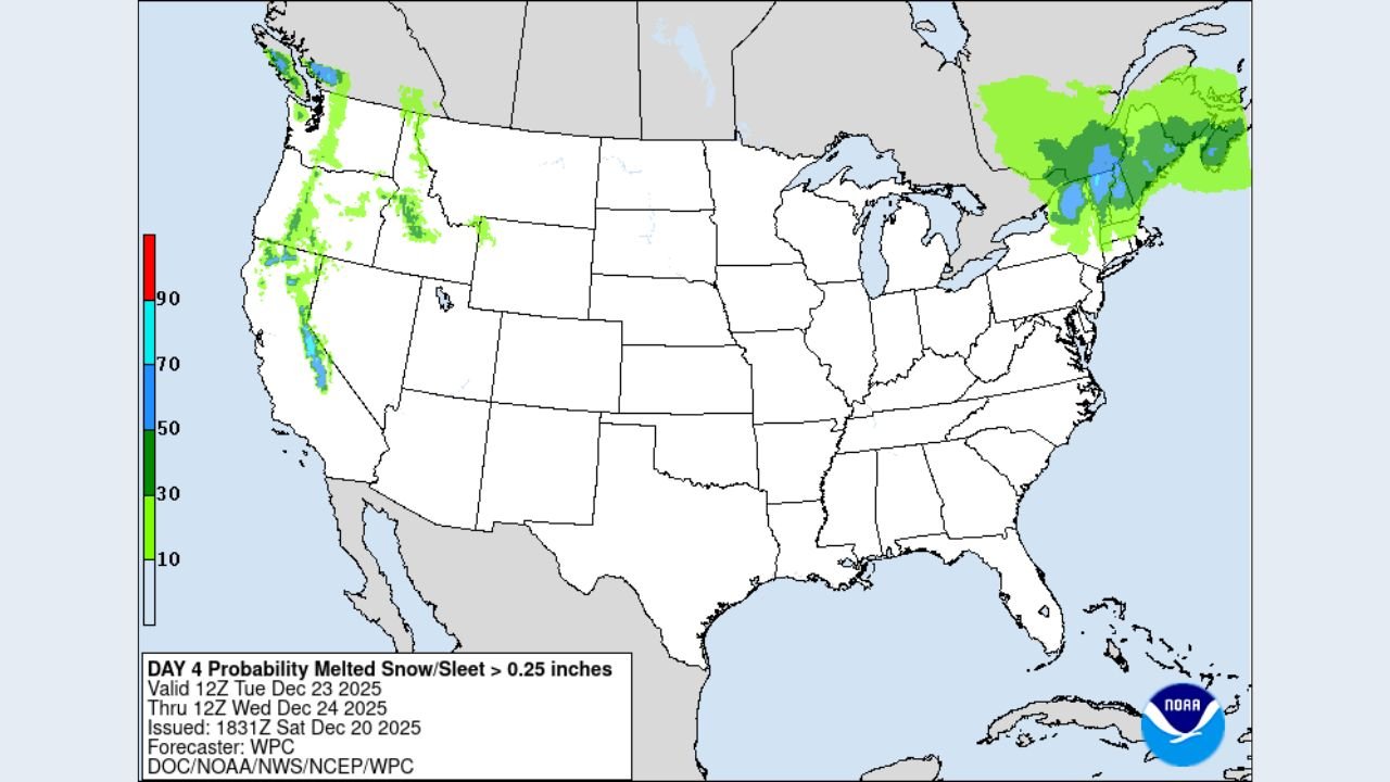
Based on the latest snowfall totals and probability maps, New York appears to be the most favored location for light accumulation. Interior sections — including parts of the Lower Hudson Valley, interior southern New York, and areas just north of New York City — sit under the highest probabilities for snow exceeding a light dusting.
Current projections suggest:
- Coatings to around 1–3 inches in the most favored interior zones
- Lower totals closer to the coast and within the immediate NYC metro
- Snow occurring mainly late Monday night into early Tuesday morning
The system is fast-moving, limiting totals, but cold enough aloft to support snow before tapering off shortly after daybreak.
Secondary Impact Area: Connecticut
Connecticut is the second-most impacted area, especially central and northern sections of the state. Forecast graphics show a solid signal for light accumulation, with probabilities supporting:
- A dusting to around 1–2 inches, mainly away from the immediate shoreline
- Slightly reduced snow potential closer to the coast due to marginal temperatures
Snowfall here is also expected to be brief, but enough to create slick travel during the early Tuesday commute in some locations.
Lower Impact Area: Northern New Jersey
While snow chances do extend into northern New Jersey, the signal is weaker and more conditional compared to New York and Connecticut. Most guidance suggests:
- Spotty coatings, mainly north and west of the immediate metro corridor
- Limited accumulation due to quicker mixing and marginal surface temperatures
Southern New Jersey appears unlikely to see meaningful snowfall from this system.
What This System Will — and Will Not — Do
This is not a high-impact snowstorm, and it is unlikely to produce widespread travel disruptions. However, it will:
- Reinforce colder air briefly
- Create localized slick spots where snow sticks
- Add to the White Christmas conversation for interior Northeast locations
The short duration and weak forcing are the main limiting factors.
Why Forecast Confidence Is Still Moderate
Meteorologists note that shallow northern-stream systems often fluctuate in last-minute model runs. Small shifts in track or temperature profiles can determine whether areas see nothing at all or a quick inch of snow. Confidence is highest in interior New York and Connecticut, where overlap between snow totals and probability guidance is strongest.
What to Watch Next
- Overnight temperature trends Monday
- Whether the snow band holds together as it moves east
- Early Tuesday morning road conditions in interior zones
While this system is modest, its timing makes it one worth watching.
Stay with ChicagoMusicGuide.com for continued weather updates as the holiday week unfolds, and let us know if you’re hoping for — or hoping to avoid — a touch of Christmas snow.