
Northern Illinois Could See Sneaky Friday Severe Storm Risk With Hail and Isolated Tornado Potential After Morning Storms
NORTHERN ILLINOIS — Forecasters are monitoring a potentially sneaky severe weather setup for Friday afternoon across northern Illinois, where leftover atmospheric boundaries from earlier storms could trigger isolated severe thunderstorms capable of producing large hail and even a brief tornado.
Weather models indicate that a morning round of storms moving through the Midwest could destabilize the atmosphere, setting the stage for additional development later in the day.
While the risk is not guaranteed, meteorologists say conditions could become favorable enough for scattered storms to intensify if the environment recovers behind the morning activity.
Morning Storms Could Set the Stage
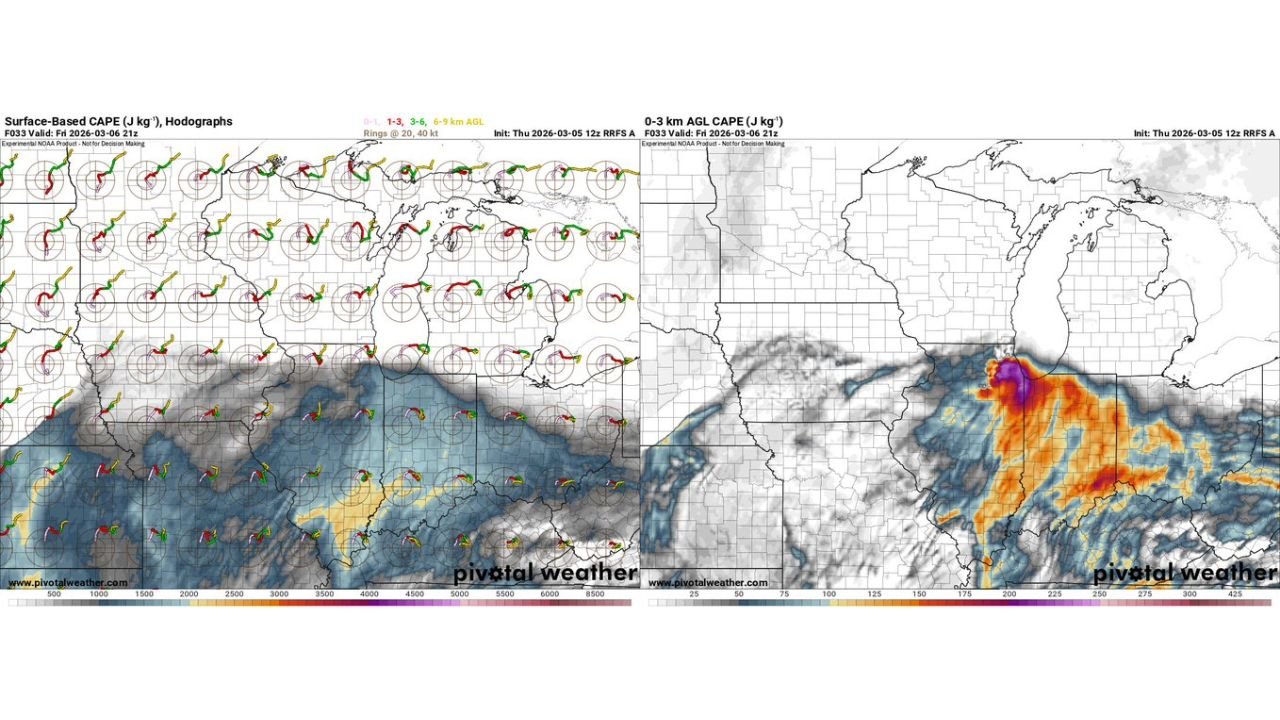
Forecast guidance shows a cluster of thunderstorms moving across parts of the Midwest Friday morning, potentially impacting areas across Wisconsin, northern Illinois, and surrounding regions.
These storms could leave behind outflow boundaries or pockets of unstable air, which often serve as triggers for new storm development later in the day.
If sunshine returns and temperatures warm behind the morning system, the atmosphere could quickly become unstable again.
Model Signals Suggest Afternoon Development
High-resolution weather models show increasing instability across northern Illinois Friday afternoon, particularly across areas near the Wisconsin border and the Chicago metropolitan region.
Storm simulations indicate scattered thunderstorm development during the mid-to-late afternoon hours, with some storms possibly becoming strong.
Forecast data also shows enhanced low-level instability and moisture, which can help storms rotate if the right conditions develop.
Hail the Primary Concern
The main threat with any storms that develop Friday appears to be large hail, as strengthening updrafts within thunderstorms could allow hailstones to grow quickly.
Some storms could produce hail capable of damaging vehicles, roofs, and windows, especially if storms intensify rapidly.
Lightning and brief heavy rainfall would also accompany stronger thunderstorms.
Isolated Tornado Cannot Be Ruled Out
While the tornado threat remains low overall, forecasters say an isolated tornado cannot be completely ruled out if storms interact with leftover boundaries from the morning storms.
These types of setups can occasionally produce brief spin-ups that develop quickly and with little warning.
Because of that possibility, meteorologists emphasize the importance of monitoring weather updates throughout the day.
Forecast Remains Conditional
Experts caution that the setup remains highly conditional, meaning storms may not develop at all if the atmosphere fails to recover following the morning activity.
However, if instability increases and storms manage to form, a few isolated severe thunderstorms could occur across northern Illinois Friday afternoon and evening.
Residents across the region are encouraged to remain weather aware and monitor updated forecasts as conditions evolve.
For continuing coverage of Midwest weather threats and severe storm developments, follow updates from ChicagoMusicGuide.com.