
Storm Signal Emerges for Tennessee, Kentucky, Virginia, and the Carolinas as ECMWF Highlights Potential Eastern U.S. System
UNITED STATES — A developing storm signal is beginning to show up on longer-range guidance for parts of the Eastern United States, with the ECMWF ensemble system highlighting a potential mid-February weather system centered over the Tennessee Valley, Kentucky, Virginia, and the Carolinas. While confidence is growing that some type of storm will develop, key details — especially cold air availability — remain unresolved.
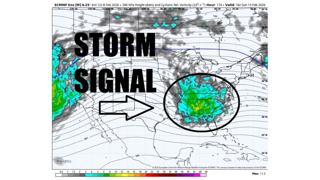
What the ECMWF Data Is Showing Right Now
The latest ECMWF ensemble graphics point to a broad upper-level disturbance tracking from the central U.S. toward the East late next weekend. At the 500-mb level, ensemble means show increasing cyclonic curvature and height falls across the Southeast and Mid-Atlantic, a classic signal that a storm may organize.
Importantly, this is not a locked forecast. Ensemble signals simply indicate where the atmosphere may favor storm development, not the final outcome at the surface.
Why Confidence Is Increasing — But Uncertainty Remains
Confidence is rising that a system will exist, but the thermal profile remains the biggest wildcard. Current signals suggest the storm could follow a climatologically favored track, which often brings rain to lower elevations while reserving wintry weather for colder air masses farther north or higher terrain.
At this range:
- The storm could be rain-dominant
- It could trend colder if Arctic air presses south
- Or it could become a mixed-precipitation event depending on timing
Right now, there is no clear indication that cold air will be firmly in place ahead of the system.
What This Means for Snow Potential
Some ensemble snowfall output does appear across interior sections of Kentucky, Virginia, and higher elevations of the Carolinas, but those signals follow a typical climatological footprint, not a high-confidence snowstorm scenario.
Meteorologists stress that EPS snow maps are signals, not predictions — useful for pattern recognition but not for final impacts.
Timing Window to Watch
The most likely timeframe for this potential system is late next weekend into early the following week. Over the coming days, forecasters will be watching:
- Whether cold air builds southward ahead of the storm
- How quickly the system intensifies
- The eventual surface track
Each of these factors will determine whether the event ends up being a rainstorm, a mixed event, or something colder.
Bottom Line
A legitimate storm signal is emerging for the Eastern U.S., centered on Tennessee, Kentucky, Virginia, and the Carolinas, but it is far too early to lock in snow or specific impacts. The setup warrants monitoring — especially for travelers and mountain communities — but confidence in wintry weather remains low for now.
As always with long-range pattern changes, clarity will come as the event moves into the short-range window later this week.
Stay tuned to ChicagoMusicGuide.com for continued updates as the forecast sharpens and confidence improves.