
Texas, Louisiana, Mississippi, and Arkansas Under Overnight Tornado Watch as Severe Storms Threaten the Lower Mississippi Valley Until Early Morning
TEXAS — A Tornado Watch (#2) is in effect across large portions of the Lower Mississippi Valley, impacting eastern Texas, northern and central Louisiana, western and southern Mississippi, and parts of southern Arkansas, as a powerful storm system continues to move through the region overnight.
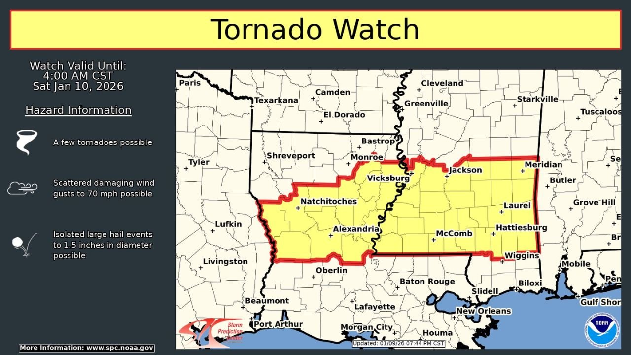
The Storm Prediction Center (SPC) says severe thunderstorms remain possible through 4:00 a.m. Central Time Saturday, with storms capable of producing tornadoes, damaging wind gusts up to 70 mph, and isolated large hail as the system advances eastward.
Areas Under the Tornado Watch
The highlighted risk zone includes several population centers and surrounding counties across multiple states:
- Texas: Eastern Texas near Lufkin, Livingston, Beaumont, and Port Arthur
- Louisiana: Shreveport, Natchitoches, Alexandria, extending south toward Oberlin
- Mississippi: Vicksburg, Jackson, McComb, Hattiesburg, and Wiggins
- Arkansas: Southern portions near the Texas–Louisiana border
The watch area stretches eastward from east Texas, across central Louisiana, and into western and southern Mississippi, following a corridor of strong instability and wind shear.
Primary Threats Overnight
The SPC outlines several hazards associated with this watch:
- A few tornadoes possible, especially within stronger storm cells
- Scattered damaging wind gusts up to 70 mph, capable of downing trees and power lines
- Isolated large hail, potentially reaching 1.5 inches in diameter
Storms are expected to be fast-moving, increasing the risk of sudden wind damage with limited warning time.
Why the Risk Is Elevated Tonight
This setup is being driven by a strong low-pressure system tracking through the region, pulling warm, moist Gulf air northward and interacting with an advancing cold front. The environment supports:
- Strong low-level wind shear
- Embedded rotating storms within larger rain bands
- Enhanced tornado potential near and east of the Mississippi River
While not every storm will be severe, any storm that becomes organized could quickly intensify, particularly during the overnight hours when visibility is low.
Timing and What Comes Next
- Now through early morning: Highest tornado and damaging wind risk
- After 4 a.m. CST: Storms gradually shift east, with the severe threat diminishing from west to east
Residents within the watch area are urged to remain weather-aware, keep alerts enabled overnight, and have a safe shelter plan ready in case warnings are issued.
Bottom Line
A multi-state severe weather threat is ongoing tonight across Texas, Louisiana, Mississippi, and Arkansas, with tornadoes and damaging winds possible until early Saturday morning. Even brief, isolated storms could pose serious hazards, making overnight preparedness critical.