Texas, Oklahoma, Arkansas, Missouri, Illinois, Tennessee, Kentucky, and East Coast States Face Massive January Winter Storm With 10–12+ Inches of Snow, 1,000-Mile Ice Swath, and Extreme Arctic Cold
UNITED STATES — A geographically massive January winter storm is expected to impact Texas, Oklahoma, Arkansas, Missouri, Illinois, Tennessee, Kentucky, and much of the eastern United States, with snow, ice, and extreme cold affecting areas east of the Rockies beginning Friday and lasting into early next week. Forecast data shows high-end winter impacts across a large portion of the country, making this an atypical, high-impact system capable of disrupting travel, utilities, and daily life for millions.
Half the U.S. Population at Risk as Storm Expands From Plains to East Coast
Forecast analysis indicates this system will be unusually large in geographic scope, with nearly half of the U.S. population expected to experience snow, ice, or extreme cold. High-impact winter weather is forecast to stretch from Oklahoma and Texas through the Midwest and Ohio Valley, all the way to the East Coast.
Meteorologists describe the atmosphere as exceptionally water-loaded, with more than two inches of liquid equivalent moisture available. Instead of falling as rain, much of this moisture is expected to fall as snow, sleet, and freezing rain, dramatically increasing impact potential.
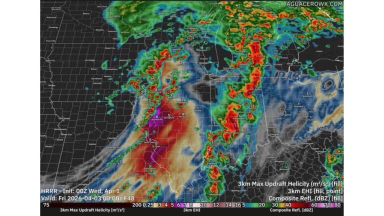
10–12+ Inch Snow Swath Forecast From the Plains to the Eastern Seaboard
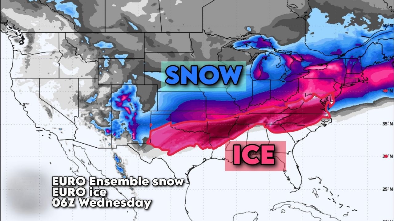
Model guidance shows a long, continuous corridor of heavy snow extending from the Central and Southern Plains through Missouri, Illinois, the Ohio Valley, and into the Northeast. Within this zone, a swath of 10 to 12+ inches of snowfall is increasingly likely.
This snow band is expected to affect:
- Missouri and Illinois
- Indiana and Ohio
- Pennsylvania and interior Northeast states
Heavy snowfall rates combined with strong cold advection could lead to rapid accumulation, severely reduced visibility, and widespread travel disruptions across major highways and transportation hubs.
1,000-Mile Ice Corridor Threatens Power and Infrastructure Damage
South of the primary snow band, forecast maps show a 1,000-mile-long strip of dangerous ice accretion extending from Texas through Arkansas, Tennessee, Kentucky, and into parts of the Mid-Atlantic.
In this zone, ice accumulations exceeding one inch are possible in localized areas, a level capable of:
- Knocking down trees and power lines
- Causing widespread power outages
- Making roads nearly impassable
Forecasters warn that vegetation damage and utility disruptions could be significant, especially where ice is followed by prolonged cold.
Snow and Ice Line Remains Uncertain as Models Continue to Shift
Despite increasing confidence in a very high-impact winter storm, forecast models continue to shift north and south, making it difficult to determine exactly where the snow-to-ice transition zone will set up.
This uncertainty means communities currently expecting snow could still see ice, while areas anticipating ice could shift into rain or heavy snow. Forecasters emphasize that no location should assume it is safe from impacts until the system fully enters the short-range forecast window.
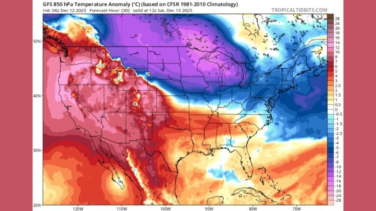
Extreme Arctic Cold to Follow and Prolong Impacts Into Early February
Behind the storm, Arctic air will surge south and east, bringing dangerously cold temperatures and wind chills across much of the country east of the Rockies. This cold will prolong snow and ice impacts, slow recovery efforts, and increase risks of hypothermia, frostbite, and infrastructure strain.
Forecast outlooks show the risk of hazardous cold continuing into late January and early February, particularly across the Midwest, Ohio Valley, Tennessee Valley, and parts of the Southeast.
Officials Urge Preparation for Prolonged and High-Impact Winter Conditions
Emergency officials and meteorologists urge residents across Texas, Oklahoma, Arkansas, Missouri, Illinois, Tennessee, Kentucky, and East Coast states to prepare for several days of dangerous winter conditions. Travel disruptions, power outages, and extended cold exposure are all possible as the storm unfolds.
Residents are advised to limit travel, prepare emergency supplies, and stay updated with forecast changes, especially as the exact snow and ice placement becomes clearer.
As this high-impact January winter storm approaches, preparation and awareness will be critical. For continued updates on snow totals, ice risks, Arctic cold, and regional impacts, visit ChicagoMusicGuide.com for the latest weather coverage and detailed storm analysis.