North Carolina and South Carolina Face Rare ‘Carolina Powder’ Snow as Strong Winter Storm Targets the Southeast
UNITED STATES — Confidence continues to increase that a significant winter storm will impact parts of the Southeast this weekend, with the highest risk focused on North Carolina and South Carolina, where unusually cold air could allow for rare, fluffy snow accumulations instead of the typical slushy or icy mix.
Forecast guidance shows a strengthening storm system developing along the Atlantic coastline while Arctic air remains firmly in place across the interior Southeast. This combination creates a narrow but dangerous window for impactful snowfall, especially across the Carolinas and portions of the southern Appalachians.
Why This Storm Is Different for the Carolinas
Unlike many winter systems in the Southeast that bring marginal temperatures and wet snow or freezing rain, this setup features deep cold air already established before moisture arrives.
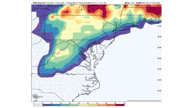
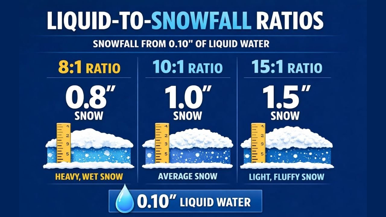
Snow-to-liquid ratios are expected to be closer to 15:1, meaning snowfall totals could increase rapidly even with limited moisture. In practical terms, 0.10 inches of liquid precipitation could produce up to 1.5 inches of snow, nearly double what is normally expected in this region.
This type of snowfall, often referred to as “Carolina Powder,” is rare and typically only occurs during strong Arctic outbreaks.
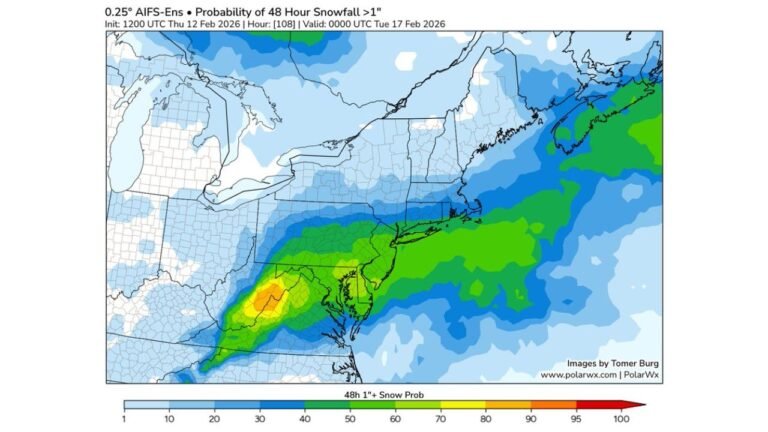
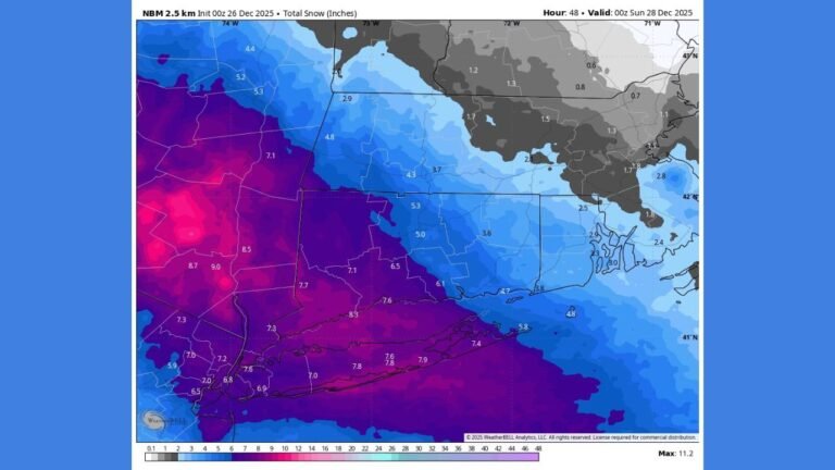
Snowfall Focus and Impact Areas
Current projections indicate the highest confidence for impactful snowfall across central and eastern North Carolina, extending into portions of South Carolina, particularly away from the immediate coast.
Weather Prediction Center data highlights:
- Moderate snowfall impacts likely across much of North Carolina
- Increasing confidence in travel disruptions due to dry, blowing snow
- Lower confidence farther north into Virginia and the Mid-Atlantic, where the storm track remains uncertain
While not everyone will see heavy accumulation, even lighter totals could create hazardous conditions due to cold surface temperatures.
Strong Winds and Coastal Concerns
As the storm rapidly intensifies offshore, strong winds are expected along the Southeast and Mid-Atlantic coastlines. Where snow and wind overlap, reduced visibility and blowing snow may lead to difficult travel conditions.
Along the North Carolina coastline, powerful onshore winds combined with high tides could also result in minor coastal flooding and rough marine conditions, especially late Saturday into Sunday.
Forecast Uncertainty Still Exists
Despite rising confidence, the exact westward extent of the storm remains uncertain. Small shifts in the storm track could significantly change snowfall totals, especially near the western edge of the snow shield.
Meteorologists are closely watching whether the system:
- Tracks farther offshore, limiting impacts
- Or shifts slightly west, expanding snowfall farther inland
This uncertainty is typical with rapidly intensifying coastal storms and will become clearer as the event approaches.
What to Expect Next
The most likely window for snow across the Carolinas runs late Friday night through Sunday, with the coldest temperatures arriving behind the storm. Some areas could see single-digit lows early Sunday morning, reinforcing the potential for powdery, fast-accumulating snow.
Residents across North Carolina and South Carolina should prepare for rapidly changing conditions, even if snowfall totals appear modest.
Stay with ChicagoMusicGuide.com as we continue tracking this developing winter storm, including snowfall updates, temperature trends, and any shifts in the storm’s path that could change impacts across the Southeast and East Coast.