Arctic Cold Wave and Coastal Snow Threat Grip New Jersey, Pennsylvania, Delaware, Maryland and North Carolina Through the Weekend
NORTH CAROLINA — A prolonged and dangerous winter pattern continues across the Mid-Atlantic and portions of the Southeast as arctic air, biting wind chills, light snow, and coastal flooding threats overlap through Saturday night and into Sunday. Forecast data from the National Weather Service and high-resolution models show the coldest temperatures of the ongoing cold wave arriving tonight into early Saturday, with conditions remaining below normal well into next week.
Coldest Temperatures of the Event Expected Tonight Into Saturday Morning
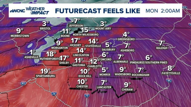
Temperature forecasts show single-digit and sub-zero lows across inland New Jersey and eastern Pennsylvania, with coastal areas remaining slightly warmer but still well below freezing.
Key overnight lows include:
- Northern & Central New Jersey: -5°F to 5°F
- Eastern Pennsylvania: -6°F to 4°F
- Delaware & Southern New Jersey: 7°F to 15°F
- Wind chills: -10°F to -20°F, especially away from the coast
The data confirms that this is likely the coldest night of the entire cold wave, with gradual but limited moderation beginning late Sunday.
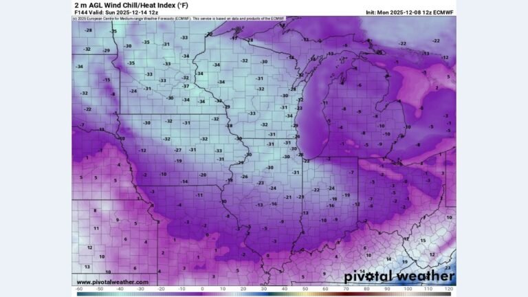
Dangerous Wind Chills Persist Even as Temperatures Slowly Recover
Although daytime temperatures inch upward next week, the forecast clearly shows below-normal temperatures continuing through at least mid-week. Several locations may struggle to reach freezing for days, particularly inland valleys and sheltered rural areas.
Wind chill maps highlight:
- Sub-zero apparent temperatures across Pennsylvania, New Jersey, and northern Maryland
- Persistent cold stress risks for anyone outdoors for extended periods
- Elevated concern for power outage impacts in exposed areas
Light Snow Expected Along the Coast Late Saturday Into Sunday
Snowfall guidance indicates a narrow but persistent coastal snow band, especially near the New Jersey and Delaware shoreline and parts of eastern Maryland.
Expected snowfall totals:
- Coastal New Jersey & Delaware: 1–3 inches
- Immediate shoreline: locally higher where bands linger
- Inland areas: generally under 1 inch or no accumulation
While totals are modest, cold pavement and gusty winds may still create hazardous travel conditions.
Widespread Minor Coastal Flooding Risk During Sunday Morning High Tide
Coastal flood outlooks show widespread minor flooding, particularly during the Sunday morning high tide cycle.
Most vulnerable locations include:
- Southern & Central New Jersey coastline
- Delaware Bay and Atlantic shoreline
- Lower Delaware coastal communities
The risk is driven by persistent onshore flow, not storm surge, meaning flooding could occur even without heavy precipitation.
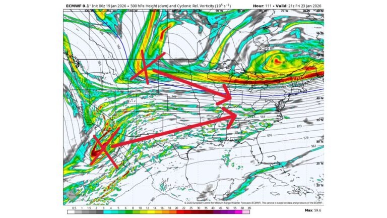
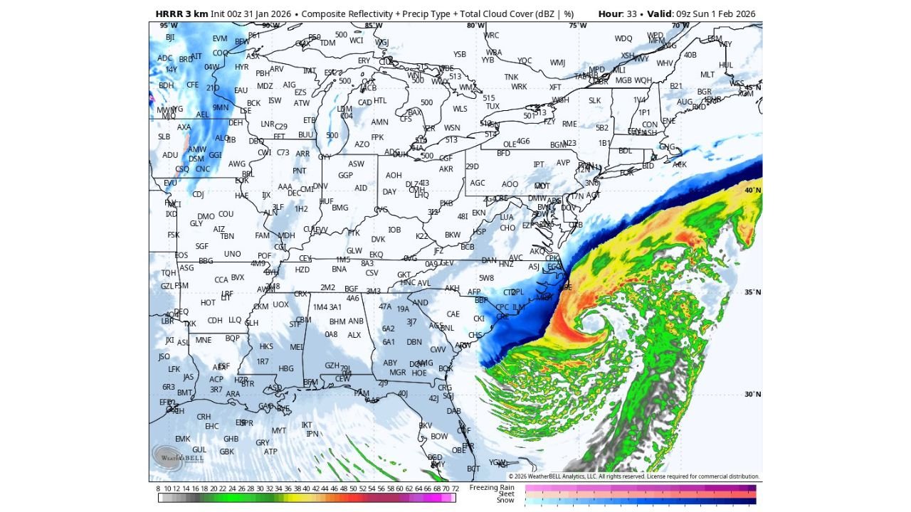
HRRR Model Signals Intensifying Coastal Low Near North Carolina
High-resolution HRRR data shows a well-defined offshore low pressure system near the Carolina coastline early Sunday, supporting continued snow production along the coast while colder air holds firm inland.
Key takeaways from the model:
- Strong cyclonic circulation offshore
- Enhanced snowfall bands near the coast
- Dryer air pushing north into the Mid-Atlantic later Sunday, limiting totals farther inland
This setup explains why snowfall remains coastally focused, while interior areas see more cold than snow.
What Happens After the Weekend
While temperatures will rise slightly next week, this is not a true warm-up. Forecast data shows:
- Continued below-normal highs
- Ongoing freeze concerns at night
- Gradual easing of wind chills, but lingering cold stress
The cold pattern remains entrenched, and winter hazards are far from over.
Stay with ChicagoMusicGuide.com for continued winter weather updates, model trends, and regional impact breakdowns as this prolonged cold pattern evolves.