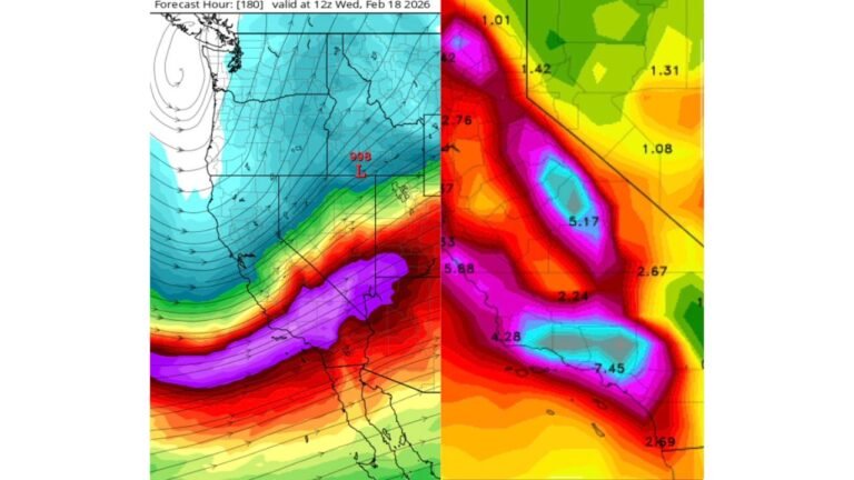
Colorado and New Mexico Storm Track Update as Low Pressure Near Elko, Nevada Pushes Mountain Snow and Front Range Showers Toward Denver and Cheyenne
COLORADO — A developing low-pressure system near Elko, Nevada is setting up a stormy stretch for parts of the Rockies as it tracks southeast into northern New Mexico and far southern Colorado Friday into Saturday, bringing widespread mountain precipitation and scattered showers along the Front Range.
Current radar imagery shows Colorado positioned beneath the jet stream, which is fueling precipitation across the mountains and western slope, while lighter, scattered showers extend into the northern Front Range, northeast plains, and Cheyenne Ridge. As the parent circulation shifts east and southeast, impacts are expected to expand.
Low Pressure Near Elko, Nevada Driving the Setup
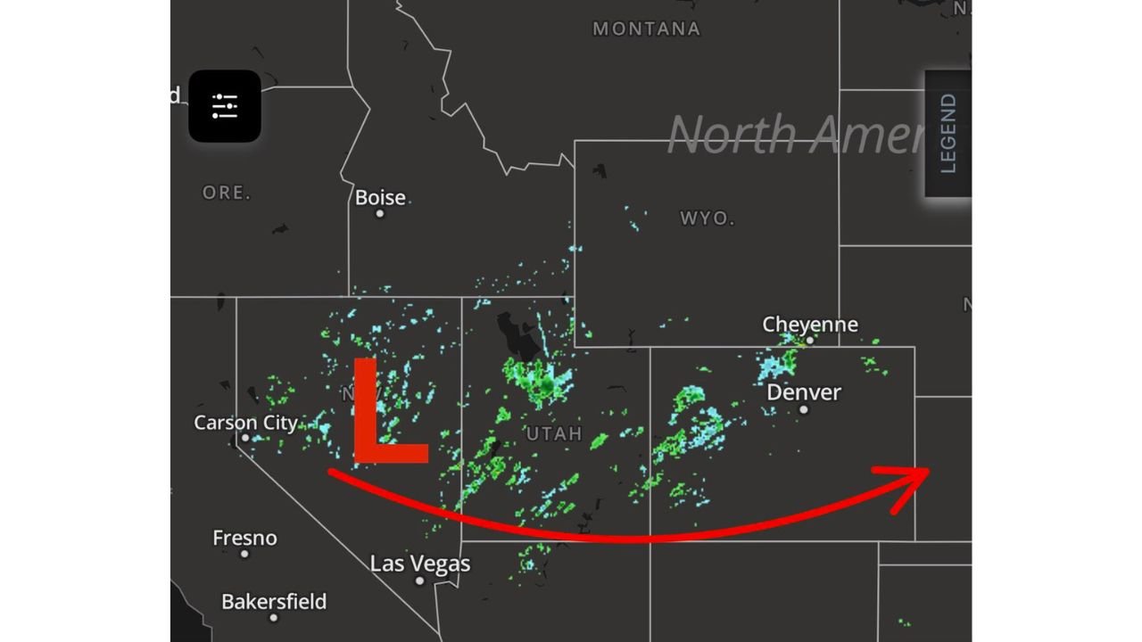
The center of the system is clearly identified near Elko, Nevada, with the storm circulation moving across the Great Basin. This track places Utah and western Colorado in the immediate zone of lift and moisture, supporting continued precipitation in higher elevations.
As the low moves into northern New Mexico and brushes southern Colorado, it will keep dynamic lift in place across the region. This trajectory favors ongoing snowfall in the higher terrain while allowing lower elevations to see periods of scattered rain showers.
Because the system is embedded within the broader jet stream pattern, it has enough upper-level support to sustain precipitation through at least Saturday, particularly in mountainous terrain.
Mountain Snow and Western Slope Impacts
With Colorado under the jet, orographic lift across the Rockies and western slope is generating the most consistent precipitation. Higher elevations will likely continue to see snow, while mid-elevation areas may experience a mix depending on temperatures.
Communities in the central and southern Colorado mountains should anticipate steady periods of snowfall through Friday night. Travel across higher passes could become impacted depending on accumulation rates and timing.
The western slope remains active as moisture rotates around the low, with radar already indicating scattered bands across western Colorado and eastern Utah.
Front Range and Plains: Scattered Showers Developing
Farther east, the system is sparking scattered showers across portions of the northern Front Range, including areas near Denver and Cheyenne. The Cheyenne Ridge and northeast plains are also seeing intermittent activity as upper-level forcing spreads eastward.
While precipitation in these areas appears more scattered compared to the mountains, timing will be key as the low approaches southern Colorado and northern New Mexico. Showers could become more organized depending on how the system evolves.
At this stage, impacts east of the mountains look more episodic rather than widespread, but conditions will remain unsettled into Saturday.
Storm Track Into Northern New Mexico and Southern Colorado
Forecast guidance indicates the system will slide southeast into northern New Mexico and far southern Colorado by Friday night into Saturday. This shift may focus additional precipitation across southern mountain ranges and adjacent lower elevations.
As the low translates eastward, wrap-around moisture could linger in portions of Colorado even after the primary energy shifts south. That could prolong light precipitation in some areas.
The overall setup suggests a classic Great Basin low tracking into the southern Rockies, with terrain playing a significant role in where precipitation is most persistent.
What Comes Next
This morning’s forecast update outlines the primary impacts for Friday into Saturday, with additional timing refinements expected in later briefings. The evolving jet structure and exact placement of the low center will determine how widespread precipitation becomes across eastern Colorado and northern New Mexico.
Residents in higher elevations should remain alert for changing travel conditions, while those along the Front Range should monitor for periods of showers.
Stay with ChicagoMusicGuide.com for continued weather updates, regional impact details, and developing forecasts as this western storm system progresses into the Rockies and Southwest.