Kansas City St Louis Peoria Chicago And Milwaukee Under Ongoing Tornado Outbreak With 19 Tornado Reports And Nearly 200 Hail Incidents As Severe Storms Continue Friday Night
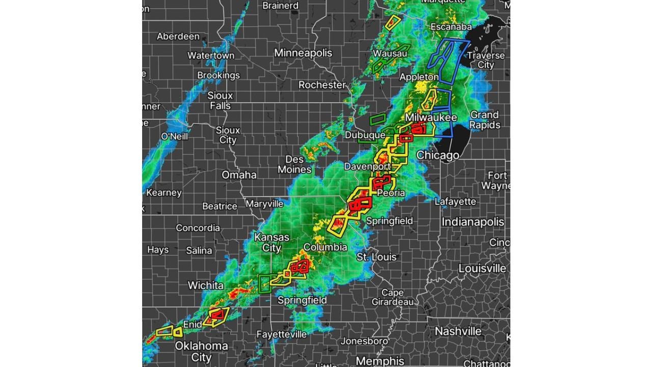
UNITED STATES — A dangerous severe weather outbreak is actively unfolding Friday evening across the central United States into the Midwest, with a line of intense thunderstorms producing multiple tornadoes, large hail, and damaging winds from Kansas City and St. Louis through Peoria and into Chicago and Milwaukee.
Tornado Reports Climb As Storm Line Intensifies Across Midwest
As of the latest update around 7:15 PM CST, the ongoing storm system has already produced at least 19 tornado reports and approximately 190 hail reports, signaling a high-end severe weather event in progress.
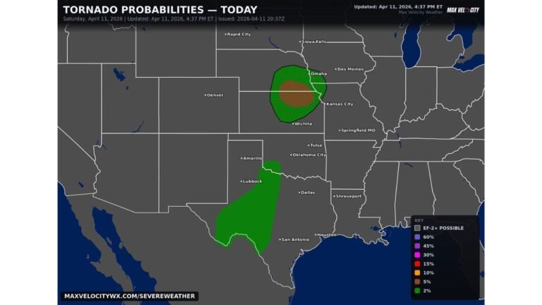
The most intense activity is concentrated along a southwest-to-northeast corridor, stretching from Oklahoma and Kansas through Missouri and Illinois into Wisconsin.
Cities currently in or near the most active storm zone include:
- Kansas City and Columbia in Missouri
- St. Louis and Springfield in Illinois
- Peoria and the Chicago metro area
- Milwaukee and surrounding parts of Wisconsin
Radar imagery shows numerous warnings embedded within a larger storm line, including tornado warnings and severe thunderstorm warnings, indicating continued storm intensification.
Chicago And Milwaukee Face Increasing Threat As Storms Move Northeast
As the storm system advances northeast, the threat is shifting toward Chicago and Milwaukee, where conditions remain favorable for severe thunderstorm development.
The primary risks for these cities include:
- Large hail capable of causing structural and vehicle damage
- Damaging straight-line winds exceeding severe limits
- Isolated tornadoes developing within storm cells or embedded within lines
Given the ongoing intensity of storms farther southwest, there is growing concern that impacts could remain significant as the system reaches the Great Lakes region.
Storm Reports Highlight Widespread Severe Impacts
Preliminary storm report data indicates a widespread distribution of severe weather incidents, including:
- Numerous hail reports, many potentially large in size
- Wind damage reports across multiple states
- Confirmed tornado activity in several locations
The clustering of reports from Missouri into Illinois and Wisconsin highlights the broad reach of this storm system, with impacts spanning hundreds of miles.
Even areas not directly hit by tornadoes are experiencing intense thunderstorms capable of producing damaging conditions.
Atmospheric Setup Continues To Support Severe Weather
The persistence of this severe weather event is being driven by a highly energized atmosphere, with strong instability and wind dynamics allowing storms to:
- Maintain intensity over long distances
- Produce repeated severe weather episodes along the same corridor
- Generate multiple hazards simultaneously, including hail, wind, and tornadoes
This type of setup allows storms to continue producing severe reports well into the evening hours, increasing the overall impact footprint.
Residents Urged To Stay Alert As Event Continues Overnight
With storms still ongoing and expected to continue tracking northeast, residents from Kansas City to Chicago and Milwaukee should remain alert for:
- Rapidly issued warnings and changing storm conditions
- Nighttime severe weather risks, which can be harder to detect
- Potential power outages and travel disruptions due to storm impacts
This is an evolving situation, and additional tornado and hail reports are likely as the event continues.
For the latest updates on severe weather alerts, storm tracking, and impacts across major Midwest cities, visit ChicagoMusicGuide.com and stay informed as this dangerous storm system continues to unfold.