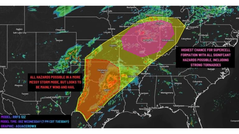
Monday Severe Weather Outlook Carries a 60% Severe Storm Probability Over Illinois and Indiana With a Possible Upgrade to Moderate Risk Still on the Table
CHICAGO, IL — The most dangerous severe weather setup of the entire multi-day outbreak may still be ahead. The Storm Prediction Center’s Day 3 probabilistic outlook, issued Saturday evening and valid for Monday, April 27 through Tuesday, April 28, 2026, places a 60% total severe weather probability zone directly over Illinois and Indiana — and forecasters have already stated openly that a categorical upgrade to a Moderate Risk, Level 4 of 5, was actively considered before being held pending additional model guidance.
That is not a routine forecast hedge. When the Storm Prediction Center publicly signals that an upgrade was on the table, it means the atmospheric data is already knocking on the door of a high-end severe weather day. The only thing holding back that upgrade right now is the unresolved question of how early-day convection on Monday morning will behave — the same wildcard that has complicated this entire multi-day pattern.
What the Day 3 Outlook Is Showing
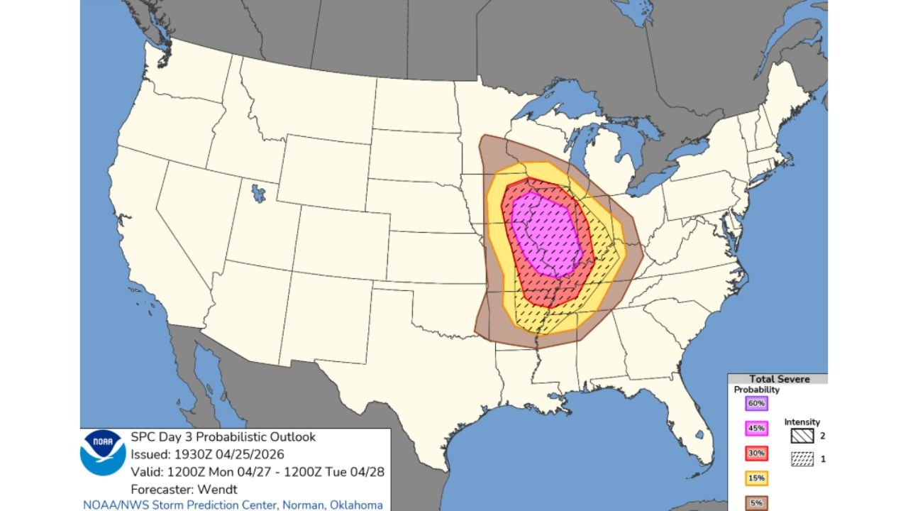
The probabilistic outlook map is striking in both its intensity and its geographic focus. The 60% severe weather probability zone — the highest contour shown on the map — is centered over a corridor spanning central Illinois through Indiana, placing millions of residents in the Midwest directly in the crosshairs of Monday’s severe weather potential.
Surrounding that magenta 60% core is a 45% probability zone that expands the threat footprint across a broader swath of the Midwest, followed by 30% and 15% contours extending outward through portions of Missouri, Kentucky, Tennessee, and adjacent states. The outermost 5% zone shown in tan covers an enormous area from the central Plains through the Ohio Valley, indicating the reach of the overall storm system.
The hatched overlay visible on the map indicates Intensity Level 2 severe weather potential — meaning significant severe weather events including large tornadoes, very large hail, and widespread damaging winds are possible, not just garden-variety severe storms.
The Moderate Risk Upgrade Question
Current analysis from the Storm Prediction Center states directly that a Level 4 Moderate Risk upgrade was considered for Monday but was withheld pending clarification on early-day convection. This is one of the most important forecasting nuances in this entire outbreak to understand.
The concern is identical to what was discussed for other days in this pattern. If morning thunderstorm activity fires across Illinois and consumes the available instability before afternoon, the severe weather environment gets disrupted. But if Monday morning stays relatively quiet and the atmosphere can hold its energy into the afternoon hours, the setup for a significant severe weather outbreak across the Chicago metropolitan area, central Illinois, and Indiana becomes very well-supported.
The Storm Prediction Center will reassess as Monday approaches and additional model runs come in. If morning convection looks more manageable in subsequent guidance, a Moderate Risk upgrade covering portions of Illinois and Indiana becomes highly probable.
What Monday’s Atmosphere Is Loaded With
The Day 3 outlook is supported by an atmospheric environment that forecasters describe as genuinely dangerous for the Midwest. A potent upper-level trough driving across the central United States will provide the large-scale forcing needed to initiate and sustain severe thunderstorm development. At the surface, a warm front lifting northward through Illinois will sharpen wind shear dramatically in the low levels of the atmosphere — the layer most critical for tornado development.
Instability values across Illinois and Indiana on Monday afternoon are expected to be substantial, with moisture streaming northward from the Gulf of Mexico feeding directly into the warm sector ahead of the approaching cold front. When these ingredients combine — strong upper-level support, a sharpening surface boundary, rich low-level moisture, and high instability — the result is an environment capable of producing violent, long-track tornadoes alongside very large hail and damaging straight-line winds.
Severe Probability Breakdown Table
| Probability Zone | Coverage Area | Threat Level |
|---|---|---|
| 60% (Magenta core) | Central Illinois, Indiana | Highest — Intensity Level 2 significant severe |
| 45% (Pink) | Broader Illinois, Indiana, adjacent states | Very high — all severe hazards |
| 30% (Red) | Missouri, Kentucky, western Ohio | High — tornadoes, hail, wind |
| 15% (Orange) | Tennessee, broader Ohio Valley | Moderate — organized severe possible |
| 5% (Tan outer) | Plains through Appalachians | General severe threat, monitoring warranted |
State-by-State Impact Outlook
Illinois — Highest risk state for Monday. The 60% and 45% probability zones are centered here. The Chicago metro, Springfield, Peoria, Champaign-Urbana, and Rockford corridors all sit within or adjacent to the highest-probability area. A Moderate Risk upgrade would make this one of the most significant severe weather days Illinois has seen this spring. All residents should finalize their severe weather plans before Monday morning.
Indiana — Sits directly within the 60% core zone alongside Illinois. Indianapolis, Terre Haute, Lafayette, and South Bend are all within the elevated threat corridor. Tornado, hail, and damaging wind threats are all in play for Monday afternoon and evening.
Missouri — The western and southern flanks of the 30% probability zone extend across Missouri. St. Louis and Kansas City areas will need to monitor developments closely as the storm system approaches from the west.
Kentucky — Falls within the 30% zone on the eastern and southern edges of the outlook. Louisville and Lexington should prepare for the possibility of severe storms during the Monday evening hours as the system moves east.
Tennessee — The 15% contour reaches into northern Tennessee. Severe thunderstorm potential increases through Monday night as storm complexes organize and push southeast.
Ohio — The eastern fringe of the outlook reaches into western Ohio. While not in the highest-probability corridor, severe weather is possible during the overnight hours Monday into Tuesday as storm systems continue tracking eastward.
Forecast Confidence
Confidence that Monday, April 27 produces a significant severe weather event across Illinois and Indiana is MODERATE to HIGH and rising. The overall pattern is well-established and consistent across multiple model runs. The primary source of uncertainty — early-day convection — is a legitimate concern that has complicated this entire multi-day pattern, but it does not eliminate the threat. It shifts the timing and intensity.
Confidence in a Moderate Risk upgrade before Monday arrives is MODERATE and will increase if subsequent model guidance shows a cleaner morning storm environment. Confidence in Intensity Level 2 significant severe weather — including tornadoes and very large hail — occurring somewhere within the 60% zone is HIGH.
Monday is a day to take seriously across the entire Midwest. The Storm Prediction Center does not signal a potential Moderate Risk upgrade lightly. Get your plan in place this weekend.
More severe weather coverage is always on the horizon. Stay informed at ChicagoMusicGuide.com — your source for outbreak tracking, Day 3 severe weather analysis, and breaking storm coverage across Illinois, Indiana, and the entire United States.