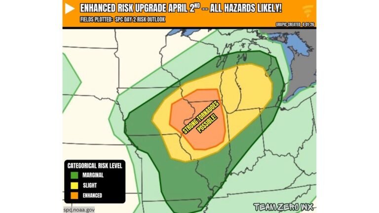
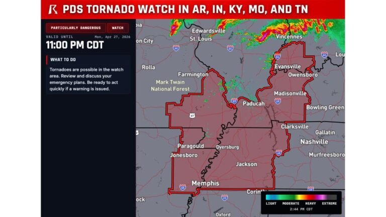
Strong and Long-Track Tornadoes Possible From 3pm to Midnight Monday Across Central Illinois, Saint Louis and Indiana as EF-3 Threat Looms
SPRINGFIELD, IL — The window is narrowing and the atmosphere is not bluffing. Current analysis issued Sunday evening identifies a focused corridor stretching from central Illinois through Saint Louis, Evansville, and into western Indiana as the highest-risk zone for significant, long-track tornadoes on Monday, April 27, 2026 — with the threat window running from 3:00 PM straight through midnight. Some of those tornadoes could be strong, reaching EF-3 intensity or higher on the Enhanced Fujita scale, meaning winds capable of exceeding 136 mph and causing severe structural destruction.
The critical factor that separates this from a routine severe weather day is the combination of atmospheric recovery after morning convection and the primed environment waiting on the other side of that recovery. If the afternoon storms can tap into what the atmosphere has been building all day, the result could be one of the most significant tornado outbreaks Illinois has seen in years.
The 3pm to Midnight Threat Window and Why It Matters
Most people think of tornado season as an afternoon event. Monday’s setup breaks that assumption entirely. Current analysis indicates the later round of storms developing Monday afternoon will have the greatest access to the unstable, shear-rich environment that supports organized supercell development and long-track tornadoes. The threat does not peak and fade by sunset. It continues building and persisting well into the overnight hours through midnight CDT.
This is what makes Monday’s setup particularly dangerous for Illinois and adjacent states. Nighttime tornadoes are significantly more deadly than daytime ones. Visibility is zero. Radar and warning apps become the only lifeline. Many residents are asleep. The combination of a strong tornado environment and a nighttime threat window demands that every household in the risk zone have a warning plan that works while they are sleeping.
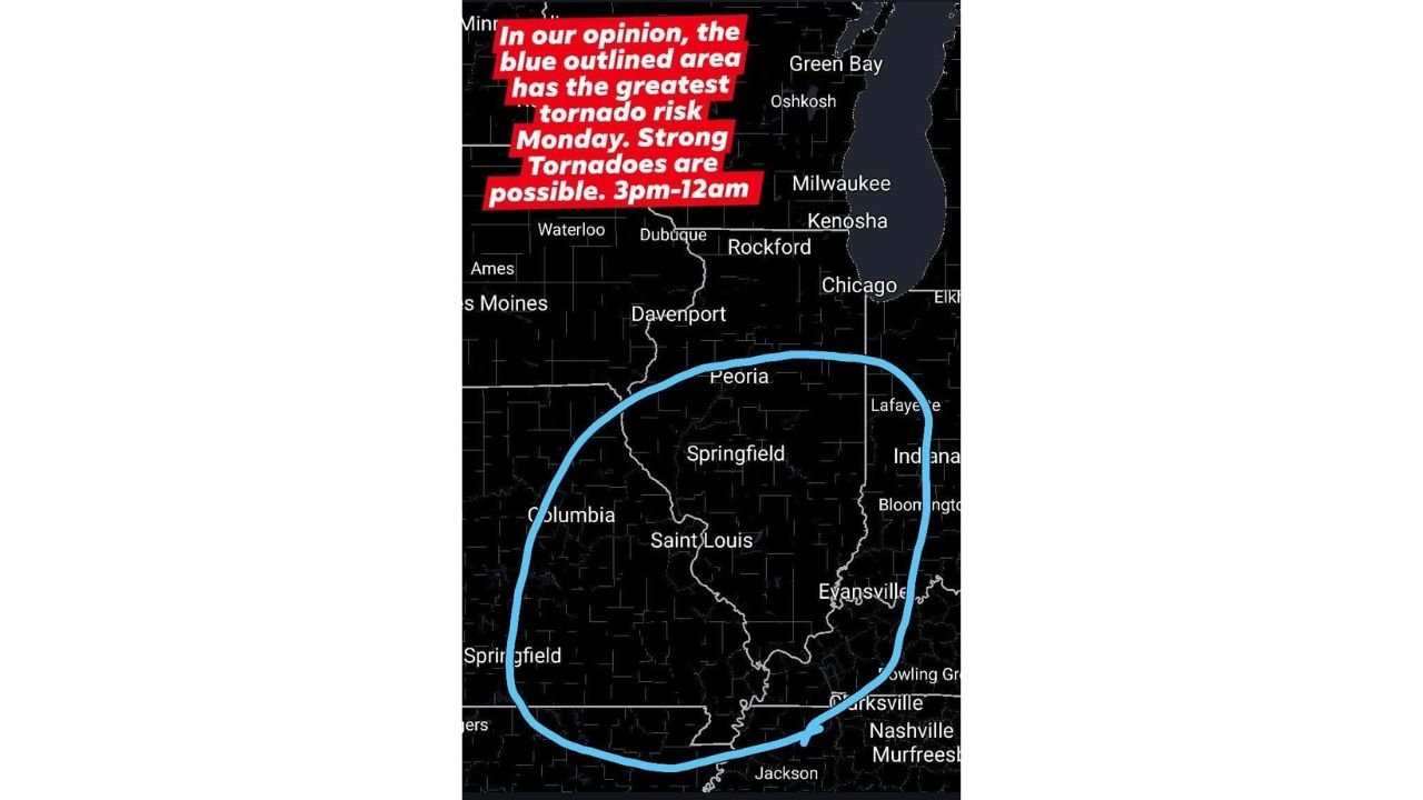
The Blue Zone — Where the Greatest Risk Lives
Current analysis clearly defines the highest tornado risk corridor for Monday as the region encompassing Peoria, Springfield, Saint Louis, Evansville, Lafayette, Bloomington, and extending south through western Tennessee toward Nashville and Jackson. This corridor sits at the intersection of the strongest atmospheric ingredients — the deepest moisture, the sharpest low-level wind shear, and the best overlap of instability and storm-scale rotation potential.
Within this zone, long-track tornadoes are the primary concern. A long-track tornado is one that stays on the ground for an extended distance — sometimes 10, 20, or even 50 or more miles — because the parent supercell sustains its rotation over time. The atmospheric profile supporting Monday’s storms is consistent with environments that produce exactly this type of tornado.
EF-3 or stronger tornadoes carry winds of 136 mph or greater. At that intensity, well-constructed frame homes suffer major damage, large trees are snapped or uprooted, and vehicles can be thrown significant distances. Underground shelter or an interior room on the lowest floor of a sturdy building is the only safe option when an EF-3 or stronger tornado is approaching.
Northern Illinois — A Separate and Murkier Forecast
The picture across northern Illinois — near and north of Interstate 80 — is considerably less certain. Current analysis indicates that whether the atmosphere can recover sufficiently after morning and early afternoon convection remains the central forecasting question for this part of the state. If recovery does occur, tornado potential would come online any time after 3:00 PM for communities including Rockford, Chicago, Kenosha, and the broader northern corridor.
If recovery is limited or does not materialize, the primary tornado threat for northern Illinois shifts to what forecasters call an embedded QLCS tornado scenario. A QLCS — which stands for Quasi-Linear Convective System, essentially a fast-moving squall line — can produce brief but intense tornadoes embedded within the line itself. These tornadoes are particularly dangerous because they form quickly, move fast, and often produce very short warning lead times. The main squall line threat for northern Illinois is expected during Monday evening.
City and Corridor Risk Summary
| Location | Tornado Risk Level | Threat Type | Timing |
|---|---|---|---|
| Peoria, IL | Highest | Long-track supercell tornadoes, EF-3 possible | 3pm to midnight |
| Springfield, IL | Highest | Long-track supercell tornadoes, EF-3 possible | 3pm to midnight |
| Saint Louis, MO | Highest | Long-track supercell tornadoes | 3pm to midnight |
| Evansville, IN | Highest | Long-track supercell tornadoes | Evening through midnight |
| Lafayette, IN | High | Supercell and QLCS tornadoes | Afternoon through evening |
| Bloomington, IN | High | Supercell tornadoes | Afternoon through evening |
| Chicago, IL | Uncertain | QLCS embedded tornadoes if recovery fails | Evening squall line |
| Rockford, IL | Uncertain | QLCS embedded tornadoes | Evening squall line |
| Nashville, TN | Moderate | Downstream supercell and line activity | Evening through overnight |
What EF-3 and Above Means for Residents
The Enhanced Fujita scale rates tornadoes from EF-0 at the weakest, with winds of 65 to 85 mph, up through EF-5 at the most violent, with winds exceeding 200 mph. An EF-3 rating begins at 136 mph — the level at which entire roofs are removed from well-built homes, exterior walls can collapse, and most trees in a path are destroyed. Current analysis places EF-3 or stronger tornadoes as possible within the highest-risk corridor on Monday. Mobile homes and vehicles offer zero protection from a tornado at this intensity. If a warning is issued, do not shelter in either.
Forecast Confidence
Confidence in a significant tornado event across the central Illinois, Saint Louis, and Indiana corridor from 3 PM through midnight Monday is HIGH. The atmospheric ingredients are in place and model data shows meaningful recovery of the storm environment after morning convection across the southern and central portions of the risk zone. Confidence in EF-3 or stronger tornado potential within the defined corridor is MODERATE to HIGH. Confidence for northern Illinois remains LOW to MODERATE and is highly dependent on how the morning convection evolves. The QLCS embedded tornado threat for the north is a moderate confidence scenario for Monday evening.
Do not go to sleep Monday night without a weather radio active or your phone alerts fully enabled. In a nighttime tornado event of this potential magnitude, those seconds of warning are everything.
More severe weather coverage is always on the horizon. Stay informed at ChicagoMusicGuide.com — your source for tornado outbreak tracking, overnight severe weather coverage, and breaking storm alerts across Illinois, Indiana, Missouri, and the entire United States.