New York and Connecticut Brace for Significant Snowfall as Winter Storm Brings 5–8 Inches Through Saturday Morning
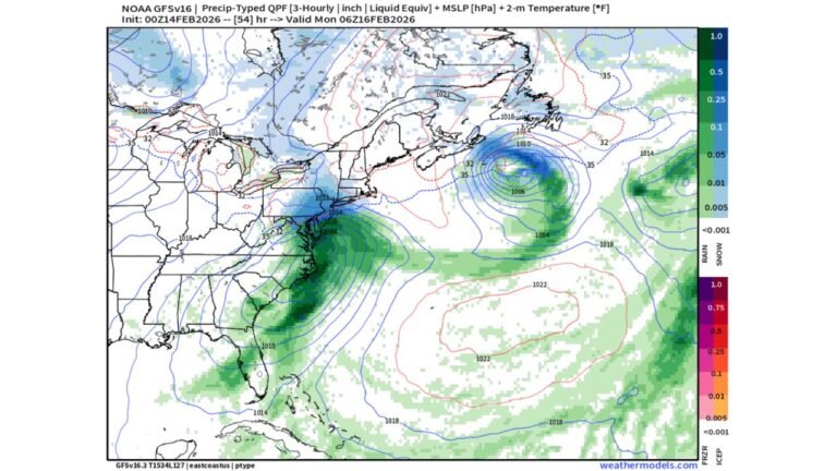
NEW YORK AND CONNECTICUT — A strengthening winter storm is moving into the region Friday night, bringing a period of steady to heavy snowfall across large portions of New York and Connecticut that is expected to continue into Saturday morning. Forecast data shows several areas, including parts of southern New York and central to northern Connecticut, could receive 5 to 8 inches of snow, with localized higher totals possible where snowfall rates intensify overnight.
Meteorologists indicate the storm will ramp up quickly after sunset as colder air locks in, allowing precipitation to fall almost entirely as snow across much of the region.
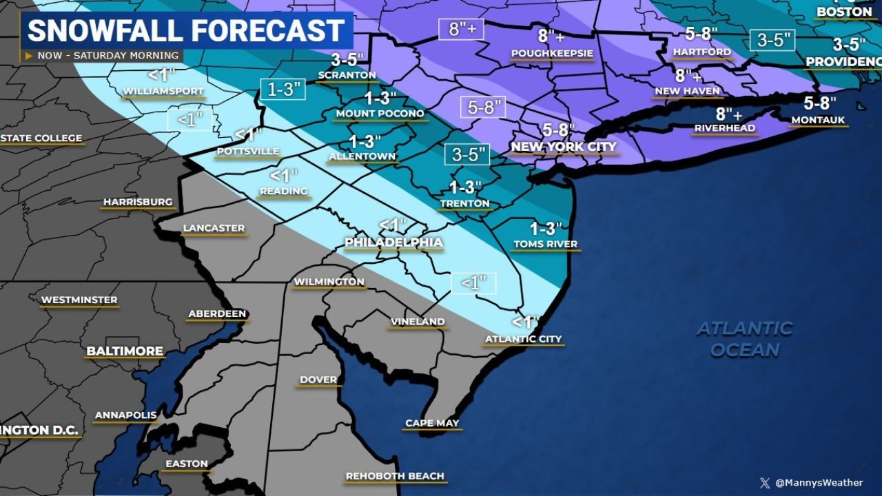
Snowfall Totals Vary by Location Across Both States
Forecast maps show a clear gradient in snowfall totals across New York and Connecticut:
- Southern and eastern New York, including areas north and east of New York City, are expected to see 5–8 inches, with some inland locations potentially exceeding that range.
- Central and northern Connecticut are also forecast to receive 5–8 inches, especially away from the immediate shoreline.
- New York City and nearby metro areas may see slightly lower totals overall, generally in the 3–5 inch range, depending on how quickly snowfall rates increase overnight.
- Coastal sections in both states could experience slightly reduced accumulations due to marginal surface temperatures.
The highest snowfall rates are expected late Friday night into early Saturday morning, when snowfall may fall at 1 to 2 inches per hour in the most intense bands.
Timing: When the Heaviest Snow Is Expected
Snow is forecast to overspread much of New York and Connecticut Friday evening, becoming heavier overnight as the storm strengthens.
- Friday evening: Snow develops and becomes steady across most areas.
- Overnight: Periods of heavy snow possible, especially inland.
- Early Saturday morning: Snow tapers from west to east, though slick conditions may linger even after precipitation ends.
By late Saturday morning, most locations should see improving conditions, but untreated roads and sidewalks may remain hazardous.
Travel Impacts Likely Overnight and Early Saturday
The combination of accumulating snow and reduced visibility is expected to create hazardous travel conditions, particularly overnight and during early morning hours on Saturday.
Drivers should prepare for:
- Snow-covered roads
- Reduced visibility during heavier snowfall
- Slower travel times on major highways and local roads
Air and rail travel across parts of New York and Connecticut could also experience delays if snowfall rates intensify as forecast.
What Residents Should Prepare For
Officials recommend residents take precautions ahead of the storm, especially those planning to travel late Friday night or early Saturday:
- Avoid unnecessary overnight travel if possible
- Allow extra time for Saturday morning commutes
- Prepare for snow-covered sidewalks and driveways
- Monitor local weather updates for any changes to snowfall totals or timing
Temperatures are expected to remain cold enough overnight to allow snow to accumulate efficiently, particularly away from coastal areas.
Looking Ahead After the Storm
Once the snow exits Saturday morning, colder air will remain in place across New York and Connecticut, which may slow melting through the weekend. Any snow that falls overnight is likely to stick around for at least part of Saturday, especially in shaded and untreated areas.
Residents are encouraged to stay alert to local forecasts as small shifts in the storm track could still influence final snowfall totals.
Stay with ChicagoMusicGuide.com for continued regional weather updates, storm impacts, and forecast changes as this winter system moves through New York and Connecticut.