Midwest High-Impact Storm Expected to Trigger Blizzard Conditions in Minnesota and Michigan While Severe Storms Threaten Illinois and Indiana
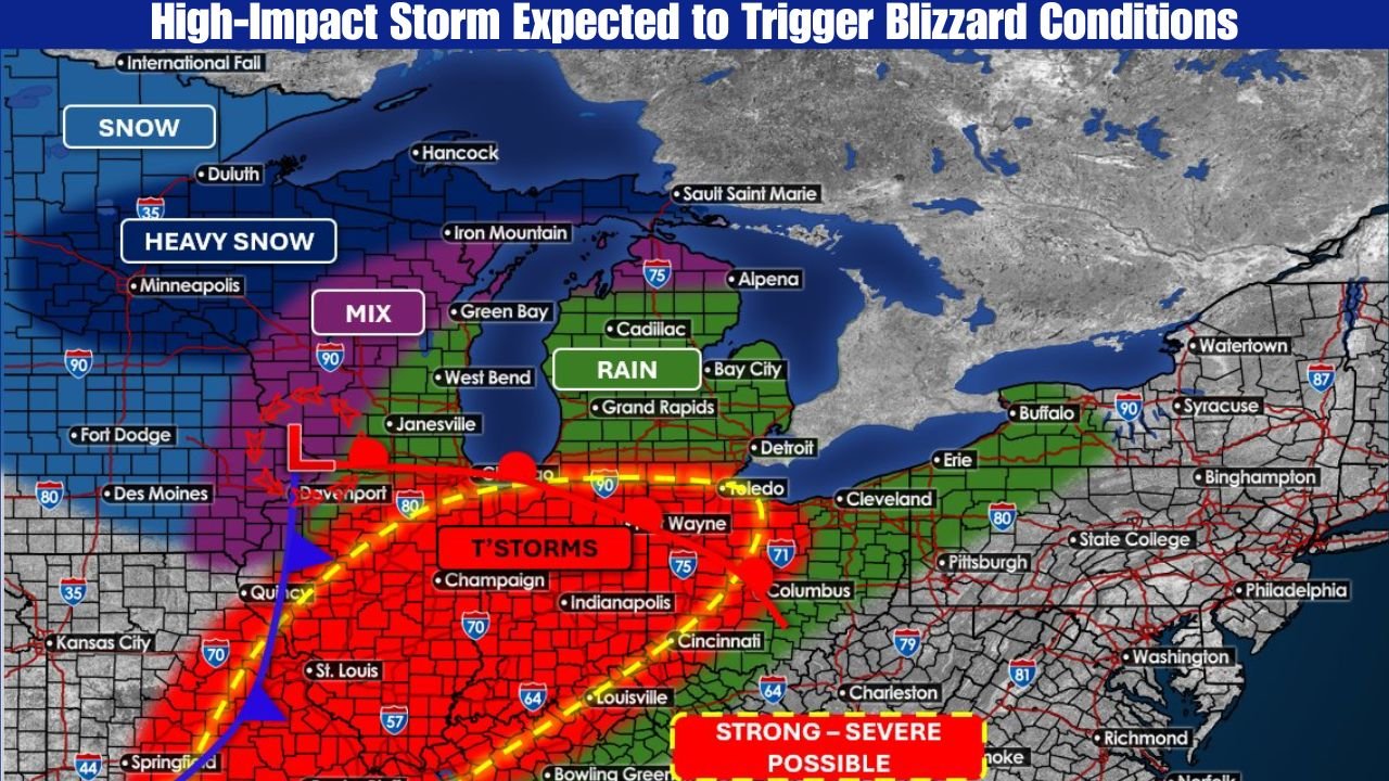
ILLINOIS — A powerful and complex storm system is expected to sweep across the Midwest from Sunday into Monday, bringing multiple dangerous weather hazards across the region. Forecast data shows a sharp divide in impacts, with blizzard conditions and heavy snow north of the storm track, while strong to severe thunderstorms develop to the south ahead of a fast-moving cold front.
Meteorologists warn that this system will feature rapid weather changes, strong winds, and dangerous travel conditions across several states in a short period of time.
Blizzard Conditions Expected Across Minnesota and Michigan’s Upper Peninsula
North of the storm’s low-pressure center, conditions will deteriorate rapidly as rain and wintry mix transition to heavy snow. Forecast guidance indicates a wide swath of accumulating snow, with wind gusts between 45 and 55 mph producing blowing and drifting snow.
Blizzard conditions are considered likely across parts of Minnesota and Michigan’s Upper Peninsula, where visibility may drop to near zero at times. Even areas receiving lower snowfall totals could experience life-threatening travel conditions due to the extreme winds.
Snowfall rates may increase quickly Sunday evening, and dangerous conditions are expected to persist overnight into Monday.
Heavy Snow and Wintry Mix Near the Transition Zone
Closer to the storm’s center, a transition zone will develop where snow, sleet, and rain mix before colder air pushes precipitation fully into snow. This zone will include parts of Wisconsin and northern Illinois, where snowfall accumulations and brief icing could impact road conditions.
Forecasters emphasize that snowfall amounts alone do not capture the storm’s full impact, as strong winds and falling temperatures will significantly worsen travel conditions.
Severe Thunderstorms Possible Across Illinois, Indiana, and Ohio Valley
South of the storm system, warmer air will fuel widespread thunderstorms ahead of the cold front. Forecast models highlight eastern Missouri, Illinois, Indiana, Kentucky, and western Ohio as areas most at risk.
Some storms may become strong to severe, capable of producing damaging wind gusts and a few isolated tornadoes. The threat will be highest Sunday afternoon and evening before the front sweeps eastward.
Residents in these areas are urged to remain weather-aware, especially as storms may develop quickly.
Temperature Whiplash Adds to Travel and Safety Concerns
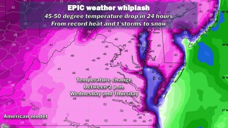
One of the defining features of this system will be dramatic temperature swings. Portions of the Ohio Valley could see Sunday highs in the 60s, followed by Monday highs plunging into the 20s as Arctic air pours in behind the front.
This rapid cooldown increases the risk of flash freezing, particularly where rain falls ahead of the front and temperatures drop quickly overnight.
Officials Urge Caution as Conditions Change Rapidly
Emergency managers across the Midwest stress that this storm’s danger lies in its multi-hazard nature, with blizzard conditions, severe storms, and rapid temperature drops occurring within the same system.
Travel may become hazardous or impossible in some areas, especially where snow and high winds overlap. Drivers are advised to avoid unnecessary travel, monitor local alerts, and prepare for rapidly changing conditions.
As this high-impact storm unfolds, staying informed will be critical. For continued updates on Midwest winter storms, severe weather threats, and travel impacts, visit ChicagoMusicGuide.com for the latest weather coverage and alerts.