
California, Nevada, Utah, and Colorado Enter Long-Awaited Winter Pattern Shift With Snow and Colder Weather Expanding This Week
UNITED STATES — A long-overdue winter pattern change is now taking shape across the Western United States, setting the stage for more frequent wintry weather beginning this week and continuing into the second half of February. Forecast data points to a breakdown of the recent warm, high-pressure pattern, allowing cooler temperatures, increasing winds, and multiple storm systems to impact California, Nevada, Utah, Colorado, and the broader Intermountain West.
This transition marks a meaningful shift toward more seasonable — and eventually colder — conditions, especially in mountain regions.
Warm Start Gives Way to a Transitional Setup
Through Monday, much of the West will continue to experience relatively mild conditions, with temperatures running around 10 degrees above average in many lower elevations. This warm stretch, however, is temporary.
By Monday night into Tuesday, high pressure weakens and shifts east as low pressure begins digging south off the California coast. This change allows cloud cover and onshore winds to increase, signaling the beginning of a broader atmospheric realignment.
First System Arrives Tuesday Night Into Wednesday
A closed low-pressure system is expected to move inland late Tuesday, bringing rain and snow showers Tuesday night into Wednesday across California and parts of the Southwest. While this initial storm appears relatively weak, it plays an important role in opening the door for stronger systems behind it.
Snow levels are forecast to:
- Start near 7,000 feet Tuesday
- Fall to around 5,500 feet by Wednesday
Above 6,000 feet, there is potential for one to two inches of snow, particularly in Southern California mountain communities. Rainfall totals across most of Southern California are expected to remain under a quarter inch, limiting flood concerns for this first event.
Clearer Conditions Briefly Return Thursday
Behind the midweek system, conditions improve on Thursday, offering a short break before the next phase of the pattern develops. This pause is typical during larger-scale pattern transitions and should not be mistaken for a return to prolonged dry weather.
Stronger Storm Signal Builds for Next Weekend and Beyond
Forecast guidance and national outlooks indicate that additional storms are likely to enter the West next weekend into early next week, with much stronger systems possible. These storms may bring:
- Significant mountain snow
- Lower snow levels
- More widespread precipitation
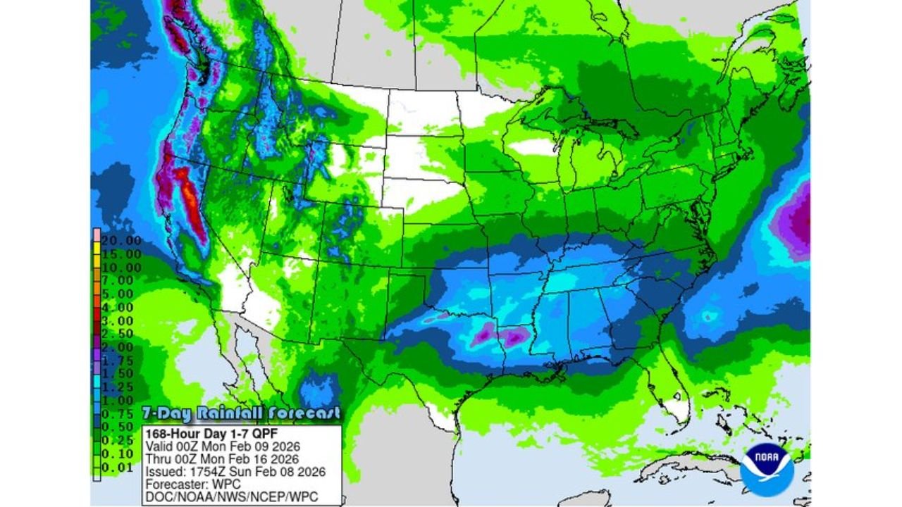
The Climate Prediction Center’s 6–10 day outlook supports this idea, showing below-normal temperatures pushing into the West, while precipitation probabilities increase across California, the Great Basin, and the Rockies.
Heavy Snow Risk Expands Across Western States
The Days 8–14 hazards outlook highlights heavy snow potential across:
- California mountain ranges
- Nevada and Utah
- Colorado and Wyoming
This aligns with earlier snowfall projections showing substantial snowpack growth in western mountain ranges as February progresses. The Rockies, in particular, appear poised to exit this pattern with an impressive seasonal snow base.
Impacts for Travel and Mountain Areas
While this pattern is welcome for snowpack and water supply, it will also bring travel challenges, especially in higher terrain. Drivers heading into mountain regions should prepare for:
- Winter driving conditions
- Rapidly changing weather
- Possible chain controls
- Snow-covered roads during storm periods
Even though the strongest storms are still several days away, preparation is key.
A Defining Shift for the Rest of Winter
This developing setup represents one of the most important pattern changes of the season for the Western U.S. After weeks of inconsistent winter weather, the atmosphere is finally shifting toward a more active, colder, and snow-friendly regime.
As February continues, this pattern could define snow totals, ski conditions, and water outlooks well into spring. For continued Western U.S. weather updates, winter storm tracking, and mountain forecasts, visit ChicagoMusicGuide.com.