
Lake-Effect Snow Band Could Stretch From Ohio and Kentucky Into Virginia Sunday, But Confidence Remains Low
UNITED STATES — Weather models are flagging a highly uncertain and unusually long lake-effect snow band that could develop Sunday, potentially stretching from parts of Ohio and Kentucky down into Virginia, including the Tri-Cities region. Meteorologists stress that confidence is very low and that the setup could easily shift north, weaken, or miss affected areas altogether.
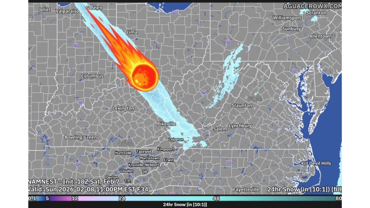
What the Models Are Showing Right Now
Several short-range and mesoscale simulations hint at a narrow corridor of lake-effect snow originating off the Great Lakes and extending southeast through the Ohio Valley, brushing eastern Kentucky before possibly reaching southwest Virginia. If the band materializes and holds together, localized accumulations of 0.5 to 1 inch are possible beneath the narrow plume.
That said, the signal is inconsistent. Some model runs keep the snow band well north of Kentucky and Virginia, while others dissipate it before it reaches the Appalachians. This kind of setup—long, skinny, and highly sensitive to wind direction—often changes dramatically run to run.
Why Confidence Is So Low
Lake-effect snow bands are notoriously fickle, and this scenario adds extra uncertainty:
- Wind direction and speed must line up almost perfectly to keep the band intact over hundreds of miles.
- Terrain interference across eastern Kentucky and southwest Virginia can disrupt the plume.
- Dry air intrusions could erode snowfall before it reaches Virginia counties.
- Small shifts could redirect snow north toward Ohio or east toward central Virginia, bypassing the Tri-Cities entirely.
Forecasters describe this as a “watch-and-wait” setup rather than something to lock in plans around.
Areas That Could See a Brief Impact
If the snow band survives its southeast journey, brief light snow could affect:
- Northern and central Ohio
- Eastern Kentucky, including higher elevations
- Southwest Virginia, including parts of the Tri-Cities region
Any impacts would likely be short-lived and highly localized, with many nearby towns seeing little to nothing at all.
Bottom Line for Sunday
This is not a widespread winter storm. Instead, it’s a low-probability, high-uncertainty lake-effect scenario that could surprise a few spots with a quick coating of snow—or completely miss the region. Forecasters will be watching upcoming model runs closely to see whether a clearer trend emerges.
For now, residents in Ohio, Kentucky, and Virginia should stay aware but avoid overreacting until confidence improves.
Stay tuned to ChicagoMusicGuide.com for continued winter weather updates, and let us know—did you see lake-effect snow make an unusually long run in your area this season?