Mississippi, Alabama, and Georgia Face Morning Tornado Threat as SPC Warns of Strong Storms Through Midday
UNITED STATES — A dangerous line of severe thunderstorms is moving across parts of the Deep South early Friday, prompting the Storm Prediction Center to warn of a continued risk for additional tornadoes and damaging wind gusts across Mississippi, Alabama, and western Georgia through the morning hours.
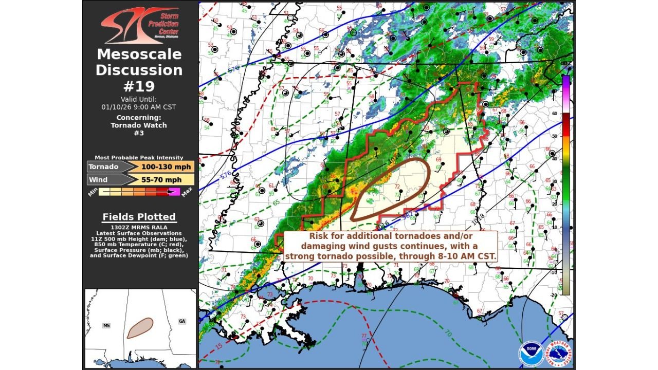
According to SPC Mesoscale Discussion #19, the threat remains elevated as a powerful storm system pushes east, with forecasters noting that a strong tornado is still possible through roughly 8–10 a.m. CST in the most affected areas.
Where the Highest Risk Is Right Now
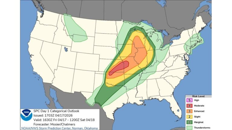
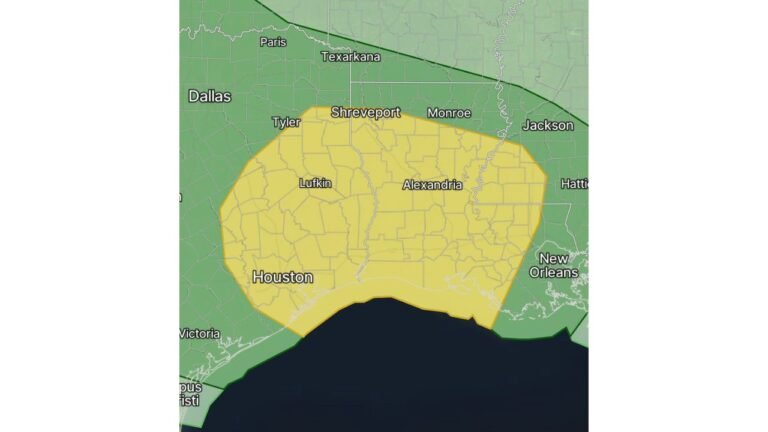
The most concerning zone stretches from central Mississippi into western and central Alabama, with storms advancing toward western Georgia as the morning progresses.
Based on radar and atmospheric analysis, the corridor includes:
- Central and eastern Mississippi
- Much of Alabama
- Western Georgia, especially areas west of Atlanta
Within this zone, storms are embedded in a fast-moving squall line capable of producing brief but intense tornadoes and damaging straight-line winds.
Why This System Is Especially Dangerous
Forecasters highlight a combination of factors making this setup hazardous despite the early hour:
- Strong wind shear supporting rotating storms
- Unstable warm air feeding into the system from the Gulf
- A rapidly moving line of storms, limiting warning lead time
The SPC specifically notes that wind gusts between 55 and 70 mph are possible, and any tornadoes that develop could be strong, not just brief spin-ups.
Timing and Movement of the Storm Line
The severe threat is time-sensitive and moving quickly east.
- Mississippi: Ongoing early morning
- Alabama: Peak threat during the morning commute
- Georgia: Increasing risk late morning into early afternoon
Even as storms weaken later in the day, isolated severe weather may persist as the line exits the region.
What Residents Should Do
Because this system is moving fast, forecasters stress that warnings may come with little notice.
Residents in the affected states should:
- Keep weather alerts enabled on phones
- Know where to take shelter before warnings are issued
- Avoid travel during active warnings, especially during heavy rain and wind
Tornadoes forming within lines of storms can be rain-wrapped and hard to see, increasing danger.
Why Confidence Remains High This Morning
Unlike long-range outlooks, this SPC discussion is based on real-time radar, surface observations, and upper-air data, giving forecasters high confidence that severe weather is ongoing and not just theoretical.
The wording from SPC emphasizes that the threat is continuing, not ending, as storms push eastward.
As conditions evolve, updates and warnings may change rapidly across Mississippi, Alabama, and Georgia.
For continued weather updates and regional coverage, stay connected with ChicagoMusicGuide.com and share what conditions look like where you are.