
Mississippi, Alabama, Tennessee, Arkansas, and Illinois Face Multi-Day Severe Storm Threat as Wind, Tornado, and Late-Season Snow Risks Emerge
UNITED STATES — A complex and high-impact storm system is taking shape across the central and southern United States, with severe thunderstorms expected Thursday night into Friday, followed by a potential transition to snow across parts of the Midwest and Great Lakes region as colder air wraps in behind the system.
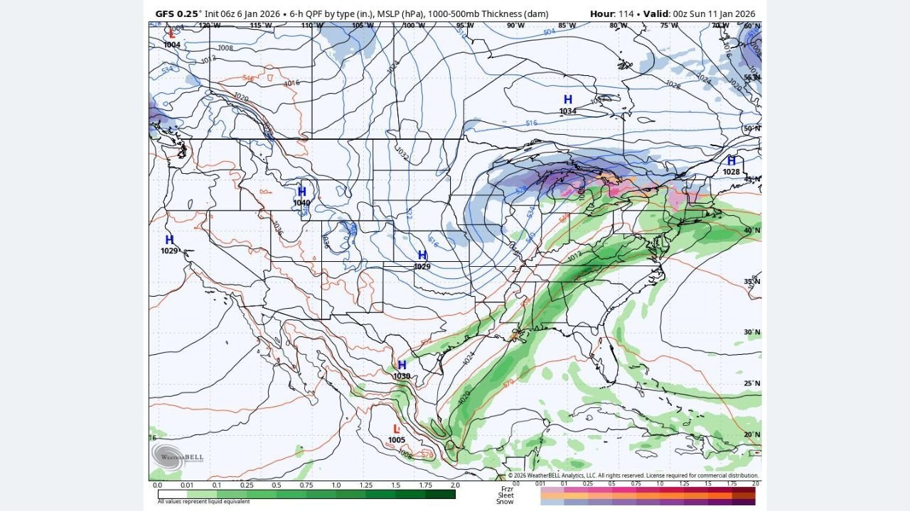
Forecast guidance shows two distinct phases to this event: an initial severe weather setup across the Lower Mississippi Valley and Deep South, and a secondary cold-side precipitation threat farther north heading into the weekend.
Thursday Night: Limited Instability but Dangerous Wind Shear from Arkansas to the ArkLaTex
Model data indicates that Thursday’s environment will feature strong wind shear but marginal instability, particularly across Arkansas, northern Louisiana, eastern Texas, and southern Missouri.
While the strongest atmospheric dynamics are displaced slightly north of the best instability, some overlap is expected Thursday evening into the overnight hours, allowing for scattered thunderstorms to develop. However, without a strong forcing mechanism in the most unstable air, storm coverage and intensity may remain limited.
Even so, forecasters caution that any storm that manages to mature could briefly become severe, with isolated damaging wind gusts or a brief tornado not completely ruled out due to intense low-level wind shear.
Friday: Higher Confidence Severe Weather from Mississippi to Alabama and Tennessee
Confidence increases significantly on Friday, when a powerful upper-level disturbance ejects eastward, tightening the surface low and accelerating the cold front across the South.
Forecast models consistently show a broken line evolving into a fast-moving squall line stretching from southern Tennessee through Mississippi and into Louisiana, eventually pushing toward Alabama and the central Gulf Coast by Friday evening.
The primary threats include:
- Widespread damaging wind gusts exceeding 60 mph
- Embedded tornadoes (EF0–EF2 possible)
- Heavy rainfall within the line
The most concerning corridor currently includes central and northern Mississippi, far western Alabama, southern Tennessee, and parts of eastern Arkansas, where storm-relative helicity values are highest and low-level wind fields favor rotation within the line.
Discrete supercells are expected to be limited, but mesovortices within the squall line could produce quick spin-up tornadoes, especially during the evening and overnight hours.
Illinois and Missouri: Storms Struggle Initially but Wind Threat Still Exists
Across Missouri and southwest Illinois, Thursday storms are expected to struggle to intensify due to limited instability, despite very strong shear. This may keep tornado potential lower early on.
However, strong gradient winds and fast storm motion still raise concern for localized damaging gusts, particularly with any organized convective elements that can briefly tap into momentum aloft.
Cold Air Wrap-Around May Turn Rain to Snow in the Midwest and Great Lakes
Behind the departing storm, colder air is forecast to wrap into the system late Friday into Saturday, allowing some back-side precipitation to change from rain to snow across parts of the Upper Midwest and Great Lakes.
Several model solutions indicate:
- Snow potential across northern Illinois, Michigan, Wisconsin, and northern Indiana
- Localized snowfall totals possibly approaching 6–8 inches
- High sensitivity to temperature trends, meaning totals could shift significantly with small changes in thermal profiles
This late-season snow threat remains highly dependent on how quickly cold air arrives, and confidence in exact accumulation amounts remains moderate at best.
What to Watch Closely Over the Next 48 Hours
Key factors that will determine final impacts include:
- Exact placement of the strongest instability axis
- Timing of the squall line relative to peak wind shear
- Overnight storm evolution Friday into early Saturday
- Temperature trends on the back side of the system
With multiple hazards spanning severe storms, damaging winds, tornadoes, heavy rain, and snow, residents across the affected states should remain weather-aware through the end of the week.
If you’re tracking how this evolving storm pattern could impact live events, concerts, or travel plans across the Midwest and South, stay connected with ChicagoMusicGuide.com for continued weather updates tied to real-world conditions and regional impacts.