
Tennessee, Mississippi, Alabama, and Louisiana Face Developing Severe Storm Threat Friday as Squall Line Strengthens
CHICAGO – A developing storm system is drawing close attention across Tennessee, Mississippi, Alabama, and Louisiana, where forecast data shows a potential squall line of strong to severe thunderstorms taking shape late Friday, January 9, extending from Middle Tennessee southward toward New Orleans. While uncertainty remains, multiple signals suggest parts of the Mid-South and lower Ohio Valley could see damaging winds, isolated tornadoes, and intense downpours if the system evolves as expected.
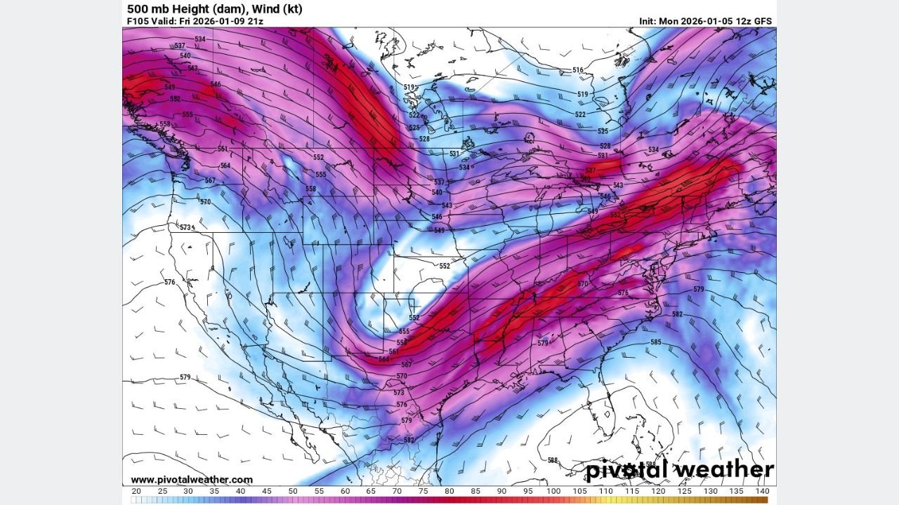
What the Forecast Data Is Showing Right Now
Current medium-range guidance indicates a deep upper-level trough pushing eastward into the central U.S., helping organize a long line of thunderstorms along a cold front. Forecast maps show this line stretching from central Tennessee through Mississippi and Alabama, eventually reaching southeast Louisiana, including the New Orleans metro area.
At this stage, the strongest storms appear most likely south of Tennessee, where low-level moisture and surface instability are expected to be higher. Northern areas may see storms weaken more quickly due to cooler air and limited instability.
Key Uncertainties Still in Play
Forecast confidence is being limited by two major factors:
- Timing and speed of the upper-level trough
- How much warm, humid air returns ahead of the system
If the trough moves too slowly, instability may remain limited, reducing tornado potential and keeping the threat mainly to strong winds and isolated hail. However, a faster-moving trough would allow better moisture return and stronger low-level winds, increasing the risk of brief tornadoes embedded within the squall line.
Meteorologists emphasize that even subtle changes in timing could significantly shift where the strongest storms develop.
Where the Highest Severe Risk May Develop
Based on current projections, the highest severe threat Friday evening appears to favor:
- Southern Mississippi
- Central and southern Alabama
- Southeastern Louisiana
These areas are closer to deeper Gulf moisture and may see stronger storms capable of producing damaging wind gusts over 60 mph, along with quick spin-up tornadoes within the line.
Further north into Tennessee, storms may still be strong but are expected to weaken as instability decreases.
What This Means for Travel and Outdoor Plans
The squall line is expected to be fast-moving, meaning impacts could arrive quickly with little warning. Travelers and residents across the affected states should be prepared for:
- Sudden heavy rain reducing visibility
- Dangerous crosswinds on highways
- Power outages caused by downed trees and lines
- Rapid changes in weather conditions during the evening hours
Because this system is expected to arrive during evening and overnight hours, staying weather-aware will be especially important.
Why Forecasts May Still Change
Medium-range predictability remains below average, meaning confidence will improve as higher-resolution data becomes available later in the week. Forecasters caution that model-based severe probabilities should be viewed as guidance, not guarantees, especially this far out.
Updates from the National Weather Service and local meteorologists will be critical in refining the threat area over the next several days.
What to Watch for Next
As Friday approaches, key signals to monitor include:
- Strengthening low-level winds from the Gulf
- Rising dew points across the Deep South
- Faster eastward movement of the upper-level trough
Any of these could raise the overall severe weather risk, particularly across Mississippi, Alabama, and Louisiana.
If you’re planning travel, concerts, or outdoor events across the South this weekend, now is the time to stay alert and prepared. We’ll continue tracking how this system evolves — share your thoughts or local conditions, and follow ChicagoMusicGuide.com for ongoing weather updates that could impact travel and events across the country.