
Valentine’s Day Weekend Turns Tricky as Narrow Snow Bands Target Eastern Massachusetts and Rhode Island
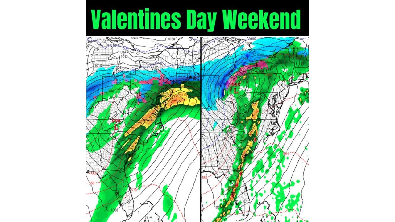
UNITED STATES — A deceptively complex winter setup is unfolding for the Northeast this weekend, with forecasters watching a narrow but potentially impactful snow event that could catch parts of New England off guard. While most locations are looking at a relatively modest snowfall, a few very tight, heavy snow bands may end up making all the difference for select communities—especially in eastern Massachusetts and Rhode Island.
A Light Snow for Most — But Not Everyone
At first glance, this looks like a routine light snow event. Current guidance supports a general 1–3 inches of snowfall across Southern New England, including much of interior Massachusetts, Connecticut, and nearby areas. For many towns, that may be the final total.
However, this is not a uniform system.
Meteorological models continue to highlight the risk of a 15–20 mile wide band of heavier snowfall, where totals could jump significantly higher in a short period of time. If you happen to sit directly beneath this band, snowfall amounts could easily reach 3–5 inches, with isolated pockets pushing 5–8 inches.
Eastern Massachusetts and Rhode Island: Prime Targets
Right now, eastern Massachusetts and Rhode Island appear to have the best chance of being impacted by these heavier snow bands.
Model disagreements remain, which is typical in setups like this:
- One solution places the inverted trough and strongest banding over Rhode Island
- Another shifts it slightly north into eastern Massachusetts, including coastal and near-coastal areas
This small shift—sometimes no more than 20 miles—will determine who sees a plowable snowfall and who does not.
Additional attention is also being paid to eastern coastal Massachusetts, where localized enhancement could further boost totals if banding locks in.
Why This Setup Is So Tricky
This event is being driven by a subtle but powerful feature known as an inverted trough, which can focus lift into very narrow corridors. These setups often produce sharp snowfall gradients, where one town may receive a coating while the next gets several inches.
What makes this weekend especially sneaky is the high snow-to-liquid ratios. That means it won’t take much moisture to produce noticeable accumulations. Even with relatively low overall precipitation, snow can pile up quickly under the right band.
In short: you don’t need a big storm to get big totals in spots.
Upstate New York, NYC, and the Jersey Shore Also Watching Closely
Beyond New England, attention is also on:
- Upstate New York
- New York City
- Parts of Pennsylvania
- The New Jersey shoreline
These areas could see accumulating snowfall as well, though totals will vary widely depending on how bands evolve and where they set up.
While not everyone will see significant snow, localized plowable accumulations are very much on the table for some communities.
Bigger Picture: A Winter of Extremes
This weekend’s setup fits into a larger winter pattern that has favored the Eastern United States, where snowfall has been frequent and, at times, impressive.
Meanwhile, much of the Western U.S. has struggled. Several mountain regions that normally receive 200–300 inches of snow per season have seen less than 60 inches so far. That stark contrast raises concerns heading into 2026, with enhanced drought and wildfire risks expected across parts of the West if trends continue.
Bottom Line
- Most of Southern New England: 1–3 inches
- Narrow heavy band: 3–5 inches, isolated 5–8 inches
- Highest risk areas: Eastern Massachusetts and Rhode Island
- Forecast confidence: Moderate, but placement still uncertain
This is the kind of forecast where small details matter. A slight shift in the band could change outcomes dramatically from one town to the next.
Keep checking updates, especially if you’re in eastern Massachusetts or Rhode Island — this one may end up being more fun (or frustrating) than it first appears.
For continued Northeast weather updates, storm breakdowns, and pattern shifts, follow along with ChicagoMusicGuide.com and stay weather-aware this weekend.