Northern Illinois Storm Alert: Chicago, Rockford and Aurora Could See Two Rounds of Thunderstorms Friday With Wind, Hail and Overnight Severe Risk
NORTHERN ILLINOIS — Forecasters are warning that multiple rounds of thunderstorms could move across northern Illinois on Friday, March 6, bringing periods of heavy rain, lightning, and a low-end severe weather risk to cities including Chicago, Rockford, Aurora, DeKalb, and surrounding communities.
Meteorologists say the evolving storm pattern may deliver two main waves of storms throughout the day and overnight, with the second round potentially carrying the greater severe weather potential.
First Round of Storms Expected Late Morning and Afternoon
The first wave of thunderstorms is expected to move through late Friday morning into the early afternoon, mainly affecting north-central and northwest Illinois.
During this period, storms are expected to produce:
- Heavy rainfall
- Frequent thunder and lightning
- Isolated gusty winds
- Possible pockets of large hail
While the severe threat during this first round appears limited, meteorologists note that localized strong wind gusts and hail cannot be ruled out, especially in areas where storms briefly intensify.
Stronger Storm Complex Could Arrive Friday Night
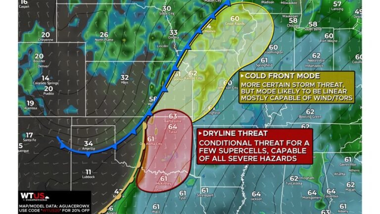
A second and potentially more active wave of thunderstorms is forecast to develop across the central Plains during the evening before moving east into Illinois.
These storms could begin arriving in northern Illinois after roughly 7–8 PM, with the most widespread activity expected between 9 PM and 3 AM Friday night into early Saturday morning.
Forecast models suggest that storms may gradually weaken as they move east, but environmental conditions could still allow a few stronger storms to develop across the region.
Potential hazards from this nighttime storm line include:
- Damaging wind gusts
- Large hail
- A very low-end tornado threat associated with QLCS-style storms
QLCS storms, or quasi-linear convective systems, are fast-moving storm lines capable of producing brief spin-ups that can lead to quick tornadoes.
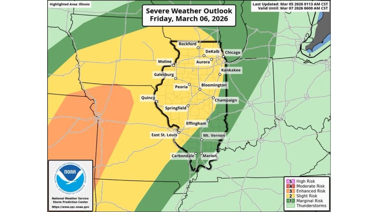
Strongest Severe Weather Risk West of Illinois
Storm prediction maps show the highest severe weather risk located west of Illinois, across parts of Missouri, Iowa, and the central Plains, where stronger instability is expected.
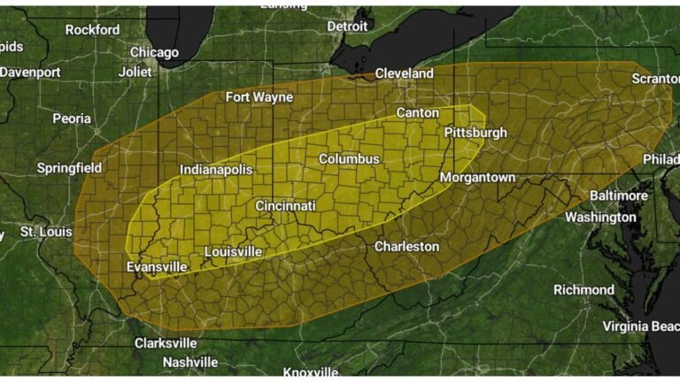
However, northern Illinois remains within a broader severe weather zone, meaning that storms moving into the region Friday night could still retain enough strength to produce isolated severe conditions.
Cities including Peoria, Springfield, Galesburg, Moline, and Quincy may see storms earlier in the evening before activity pushes farther northeast toward the Chicago metro area.
Flood Risk Expected to Remain Low
Despite the potential for multiple rounds of rain, forecasters say flooding is unlikely to become a major issue, largely because storms are expected to move quickly across the region.
The fast-moving nature of the system should limit how long heavy rain remains over any one location.
Residents Should Monitor Weather Updates Friday
Because thunderstorms may develop at different times throughout the day and evening, meteorologists recommend that residents across northern Illinois remain alert for changing conditions.
Anyone with plans Friday night should ensure they have reliable ways to receive severe weather alerts, particularly if stronger storms approach overnight.
Additional forecast updates are expected as meteorologists refine the timing and intensity of the storm system.
For continuing coverage of major weather developments across the United States, follow updates on ChicagoMusicGuide.com.