
Illinois, Indiana, Ohio, Pennsylvania, and West Virginia Set for Heavy Snow as Clipper System Spreads 4–10 Inch Totals Across Multiple States
CENTRAL AND EASTERN UNITED STATES — A fast-moving clipper system is delivering a wide swath of heavy snow from the Midwest into the Ohio Valley and will continue pushing east into Pennsylvania, West Virginia, and parts of the interior Northeast through tonight. Forecast models remain firmly aligned on a concentrated corridor of accumulating snow stretching from central Illinois to western Pennsylvania, with the system intensifying again as it crosses the Appalachians.
Forecasters note that while some speculation suggested the storm could shift south toward Kentucky, current upper-air patterns strongly favor a northern track. Only far northern Kentucky near the Cincinnati metro area may see modest accumulation, with the heaviest totals focused farther north.
Heaviest Snowfall Targets Illinois, Indiana, and Ohio
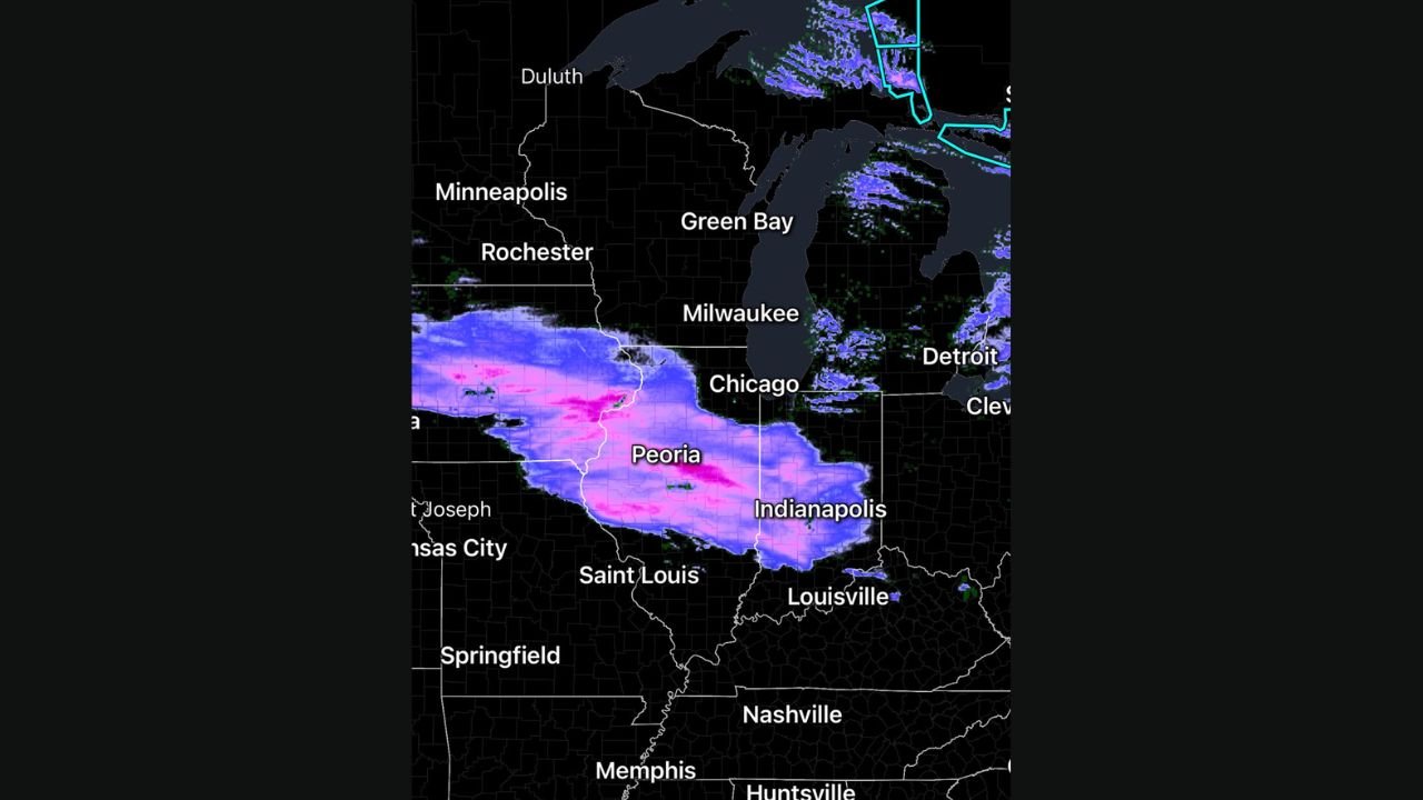
Consistent model trends highlight a focused band of snow across central Illinois, central Indiana, and western Ohio. Cities including Peoria, Bloomington, Indianapolis, Fort Wayne, Dayton, and Columbus are positioned within a zone projected to receive 4–7 inches, with locally higher amounts nearing 8 inches where mesoscale bands develop.
Snowfall is already expanding eastward based on radar trends, with a well-defined axis of moderate to heavy snow stretching from eastern Iowa into Illinois and onward into Indiana and Ohio. Travel conditions across this corridor will deteriorate rapidly through the afternoon and evening.
System Strengthens Into Pennsylvania and West Virginia
As the clipper continues east, snowfall will intensify again over higher terrain and favored lift areas. Western and central Pennsylvania, along with northern West Virginia, are on track for 6–10 inches, especially in places like Pittsburgh, State College, Morgantown, and nearby Appalachian foothill regions.
This enhancement is expected as the system interacts with cold air pooling behind the clipper and added elevation-driven lift along the mountains.
Interior Northeast to See Additional Accumulation
Once the storm clears the Appalachians, it will regenerate enough lift to bring a final round of respectable snow to parts of interior New York and the Northeast corridor. While totals will taper compared to the Ohio Valley, several regions remain favored for impactful snowfall.
Travel Impacts Expected Across a Wide Area
With widespread accumulation occurring from Illinois to the Northeast, motorists should prepare for:
- Snow-covered and slick roads
- Rapidly reduced visibility in heavier bands
- Slower highway travel and possible delays
- Hazardous conditions during the core evening and overnight periods
Behind the storm, a surge of Arctic air will sweep in, dropping temperatures sharply by Sunday morning and increasing the risk of icy conditions.
Stay tuned to ChicagoMusicGuide.com for ongoing winter weather updates, travel advisories, and regional alerts that can help you plan safely through the storm.