Major January Winter Storm Delivers Heavy Snow, 1–3+ Inches of Sleet, and Damaging Ice From Texas and Oklahoma to the Mid-Atlantic as Bitter Cold Locks In Impacts Through Monday

UNITED STATES — A major January winter storm continues to unfold across a massive portion of the country, bringing heavy snow, widespread sleet accumulations of 1 to 3+ inches, and dangerous freezing rain from the Southern Plains through the Mississippi Valley and into the Mid-Atlantic, according to the Weather Prediction Center (WPC). The storm is already producing crippling travel conditions, power outages, and infrastructure damage, with bitter Arctic cold expected to lock in impacts through Monday and into early next week.
National Weather Service radar imagery shows a broad swath of wintry precipitation stretching from Texas and Oklahoma northeastward into the Ohio Valley and Mid-Atlantic, while surface observations confirm temperatures in the single digits and teens across much of the storm’s northern and central zones.
Heavy Snow Expands From the Southern Plains to the Mid-Atlantic
On the northern side of the storm system, heavy snow continues to fall from the Southern Rockies and central Plains through the Ohio Valley and into parts of the Mid-Atlantic and Northeast. The Weather Prediction Center reports widespread snowfall totals exceeding 6 inches, with localized amounts topping 12 inches in several regions.
Preliminary storm-total snowfall reports highlight significant accumulations across multiple states. Colorado has recorded totals as high as 23 inches near Crested Butte, while New Mexico mountain locations have seen snowfall exceeding 10 inches. Across the central Plains, Kansas and Oklahoma are reporting widespread 5 to 8 inches, while parts of Arkansas, Tennessee, and Missouri continue to see steady accumulations that are rapidly deteriorating road conditions.
As colder air presses southward, snowfall rates have intensified in some areas, particularly where banding has developed. Officials warn that snow-covered roads and reduced visibility may persist for several days, especially in regions where temperatures remain below freezing.
Widespread Sleet and Ice Create High-End Impact Zone South of the Snow Line
South of the primary snow axis, the storm’s most dangerous impacts are unfolding in a broad stripe of sleet and freezing rain extending from central Texas through Louisiana, Mississippi, Alabama, Tennessee, and into the Carolinas.
Sleet accumulations of 1 to 3+ inches are being reported across parts of Texas, Louisiana, Mississippi, Arkansas, and Oklahoma, with some locations exceeding 2 inches of compacted sleet. These conditions are creating extremely hazardous driving conditions, with roads becoming impassable even where snowfall totals are lower.
Even more concerning, freezing rain ice accretion is building across portions of the Southern Plains, Lower Mississippi Valley, Tennessee Valley, Southeast, and southern Appalachians. Preliminary ice measurements show 0.25 to 0.75 inches of ice, with locally higher totals possible. The Weather Prediction Center warns that ice accumulations exceeding one-half inch are capable of producing long-duration power outages, widespread tree damage, and structural stress on power infrastructure.
Travel Disruptions, Power Outages, and Infrastructure Damage Worsen
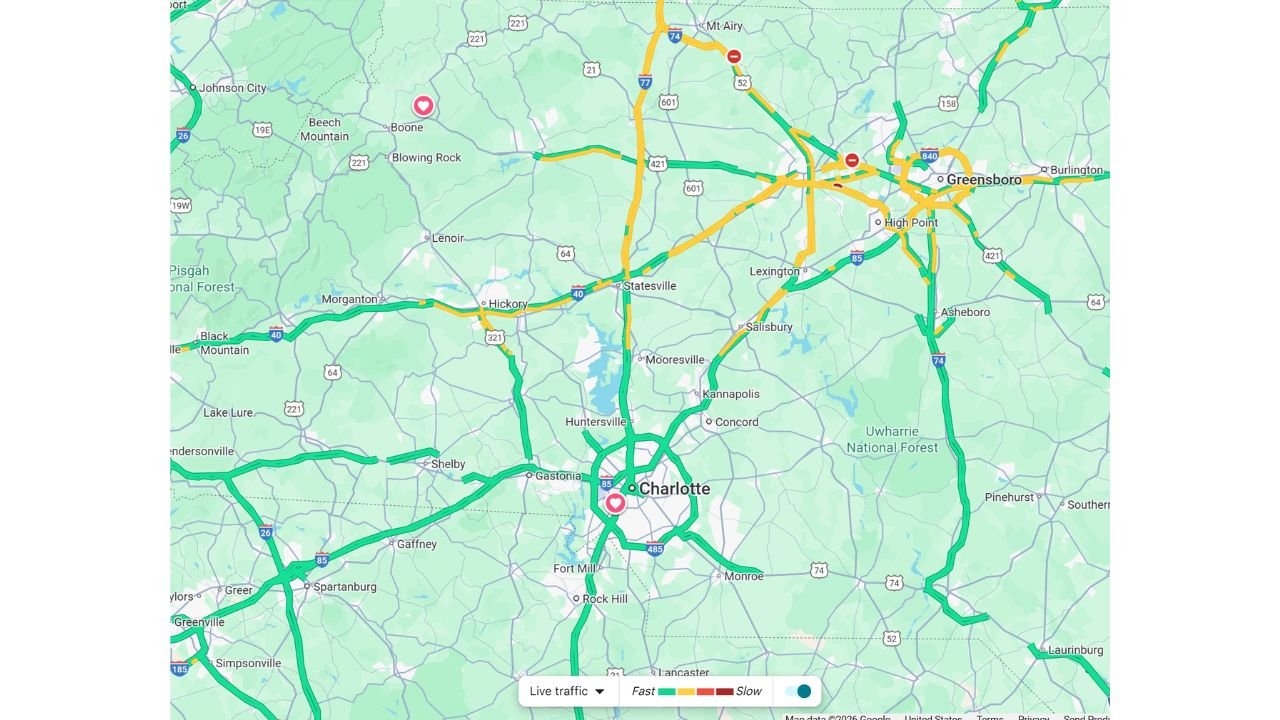
As sleet and freezing rain continue, travel disruptions are becoming widespread and prolonged. Traffic data and emergency management reports indicate rapidly worsening road conditions, particularly from north to south corridors where freezing drizzle is spreading.
Interstates, bridges, and elevated roadways are especially vulnerable, and officials urge residents to avoid non-essential travel. In several regions, emergency services are already reporting delayed response times due to impassable roads.
Power utilities across the Southern Plains and Lower Mississippi Valley are preparing for major outage scenarios, especially in areas where ice accretion approaches or exceeds 0.50 inches. WPC forecasters caution that some communities may face power disruptions lasting several days, especially where ice damage coincides with extreme cold.
Bitter Arctic Cold Extends and Intensifies Storm Impacts
Behind the storm system, Arctic air is pouring southward, pushing temperatures well below seasonal averages. Observations show single-digit and sub-zero temperatures across parts of the Plains, Midwest, and interior Northeast, with lighter winds allowing cold air to settle efficiently.
This cold will slow recovery efforts, prevent melting, and keep roads icy and hazardous even after precipitation tapers off. Cleanup operations may be delayed into early next week, as crews contend with frozen infrastructure, downed power lines, and continued safety risks.
What to Expect Next and Safety Messaging
The Weather Prediction Center warns that this winter storm is far from over, with wintry precipitation expected to continue shifting eastward into the Mid-Atlantic and Northeast through Monday. Additional updates and storm summaries will be issued as the event evolves.
Residents across impacted regions are urged to:
- Avoid unnecessary travel
- Prepare for extended power outages
- Keep emergency supplies and backup heat sources ready
- Check on vulnerable neighbors and pets
This storm is shaping up to be one of the most impactful winter weather events of the season, with snow, sleet, ice, and extreme cold combining to create long-lasting hazards across a large portion of the United States.
For continued coverage of this major winter storm, including updated snowfall totals, ice reports, and regional impacts, visit ChicagoMusicGuide.com for the latest weather updates and analysis.
