Pennsylvania and New York Face Rising Snow and Ice Threat as Late-Week Winter Storm Targets the Northeast

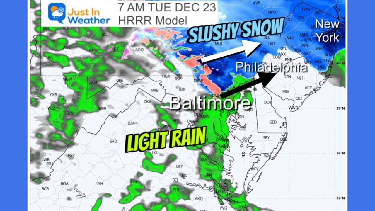
PENNSYLVANIA & NEW YORK — Forecast data released over the past 24 hours shows a developing winter weather system with its strongest impacts focused across Pennsylvania, New York, and parts of New England, where probabilities for snow and ice are increasing heading into Friday and early Saturday. While this system is not expected to be extreme, temperature placement and timing could still create meaningful travel disruptions in multiple regions.
Pennsylvania: Ice Risk Southwest, Snow Favored Northeast
Pennsylvania sits at the center of this forecast, but impacts vary sharply by region.
- Southwestern Pennsylvania shows the highest likelihood of freezing rain, with probability maps indicating roughly 40–55% odds of ice accretion. Temperatures near freezing raise concerns for slick roads, particularly during overnight and early-morning hours.
- Central Pennsylvania falls into a mixed zone, where precipitation may shift between rain, slush, and snow. Roadways are expected to remain mostly wet, but brief slushy accumulation is possible.
- Northeastern Pennsylvania stands out as the most snow-favored area, with 70–85% probabilities of snowfall. Colder surface temperatures here increase the chance that snow will accumulate more efficiently than farther south.
This sharp gradient makes Pennsylvania one of the most complex states in the forecast.
New York: Higher Confidence for Accumulating Snow
Conditions become more clearly winter-driven farther north.
- Upstate New York and areas north and west of New York City are forecast to remain below freezing for much of the event, favoring snow over rain.
- Probability data shows widespread 70%+ chances of snow, with 1–3 inches likely near and north of the metro region.
- Colder air locked in across interior sections increases the risk for snow-covered roads, especially outside urban heat islands.
These factors place New York among the most impacted states overall.
New England: Snow Totals Increase North and West
Into New England, the pattern remains consistent.
- Interior sections show the strongest signal for accumulation, while coastal zones may experience some mixing.
- Snow totals generally range from 1 to 3 inches, with localized higher amounts possible where temperatures stay firmly below freezing.
- Even modest snowfall could lead to travel slowdowns due to timing and road temperatures.
Travel Impacts Likely Along Major Corridors
Although snowfall totals are not extreme, timing and surface temperatures elevate risk.
- Slushy or icy conditions may develop along major highways, including portions of the I-95 and interior interstate corridors.
- Areas north and west of large cities are most vulnerable to slick conditions, particularly during heavier bursts of precipitation.
Drivers should remain cautious, especially during overnight and early-morning travel windows.
Forecast Still Subject to Change
Meteorologists stress that small shifts in temperature or storm track could significantly alter outcomes, especially in transition zones. Continued updates are expected as the system approaches.
For the latest winter weather developments and regional updates, stay connected with ChicagoMusicGuide.com.
