
Snow Finally Melts in Washington, D.C., Baltimore and Dulles After Rare 18–22 Day Streak of Measurable Snow on the Ground
WASHINGTON, D.C. — After more than three weeks of persistent winter conditions, the final patches of measurable snow have officially melted across the D.C. metro region, marking the end of one of the area’s longest snow-on-the-ground streaks in decades.
According to regional airport climate data, this winter stretch was not just notable — it was historically significant.
DCA, BWI, and IAD End Rare Multi-Week Snow Streak
The last holdout was Dulles International Airport (IAD), which officially ended its measurable snow-on-the-ground streak this afternoon. Here’s how the numbers stack up:
- Reagan National (DCA): 18 consecutive days with measurable snow — most since 2000
- Baltimore/Washington (BWI): 21 consecutive days — most since 2000
- Dulles (IAD): 22 consecutive days — most since 2010
For Washington, D.C., this was especially unusual. Since official record-keeping began in 1893, the city has only seen a streak this long — or longer — 15 times in its entire recorded history.
That puts this recent event firmly in the “rare anomaly” category.
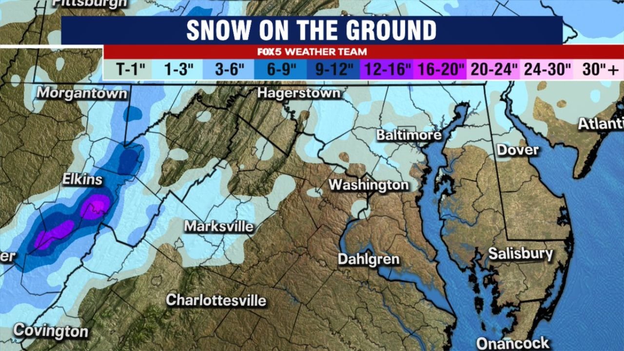
What the Snow Map Showed
At the height of the snowpack, much of the D.C. metro and surrounding areas — including Baltimore, Washington, Hagerstown, and parts of northern Virginia — held between a trace and several inches of snow on the ground.
Higher elevations to the west — near Elkins, West Virginia and surrounding Appalachian terrain — maintained deeper snowpack totals, with some isolated areas holding well over a foot before gradual melting began.
Over time, daytime temperatures and sun angle steadily chipped away at the snow-ice pack that had lingered since the major storm more than three weeks ago.
Why This Stretch Was So Unusual
The Mid-Atlantic typically sees snow events that melt within several days, especially in urban corridors like Washington and Baltimore where temperatures often rebound quickly.
But this pattern featured:
- Repeated cold air reinforcement
- Limited strong warmups
- Persistent below-normal temperatures
That allowed snow cover to remain intact far longer than usual.
For Dulles in particular, maintaining measurable snow on the ground for 22 consecutive days is something that hasn’t happened in over a decade.
What Happens Next?
With the snowpack finally gone across the region’s major reporting sites, attention now shifts to longer-range patterns.
Late February often brings transitional weather to the Mid-Atlantic — swings between brief warmups and lingering winter shots remain possible. But as of now, the historic snow streak is officially over.
And given how rare a stretch like this is, it may be years before Washington sees another run quite like it.
Stay with ChicagoMusicGuide.com for continuing updates on significant national weather trends and pattern shifts across the U.S.