West Texas, Western Oklahoma and Southwest Kansas Under Slight Risk Thursday as Dryline Sparks Supercells With Hail and Isolated Tornado Potential
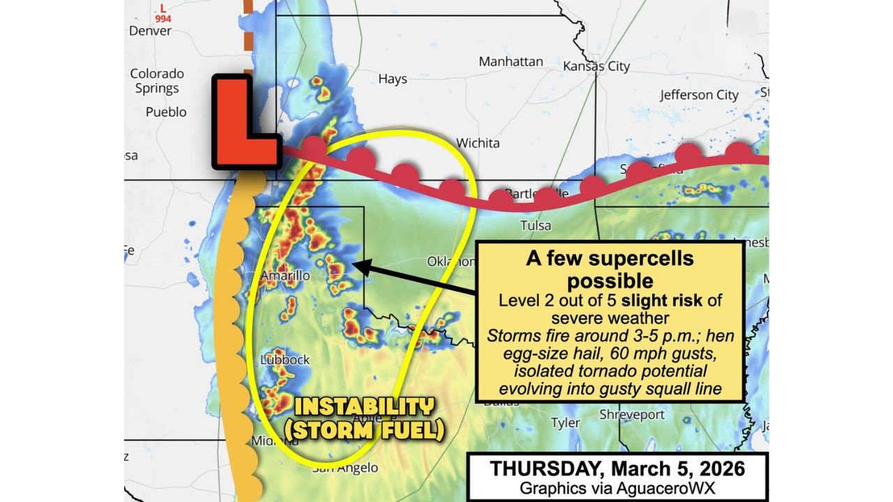
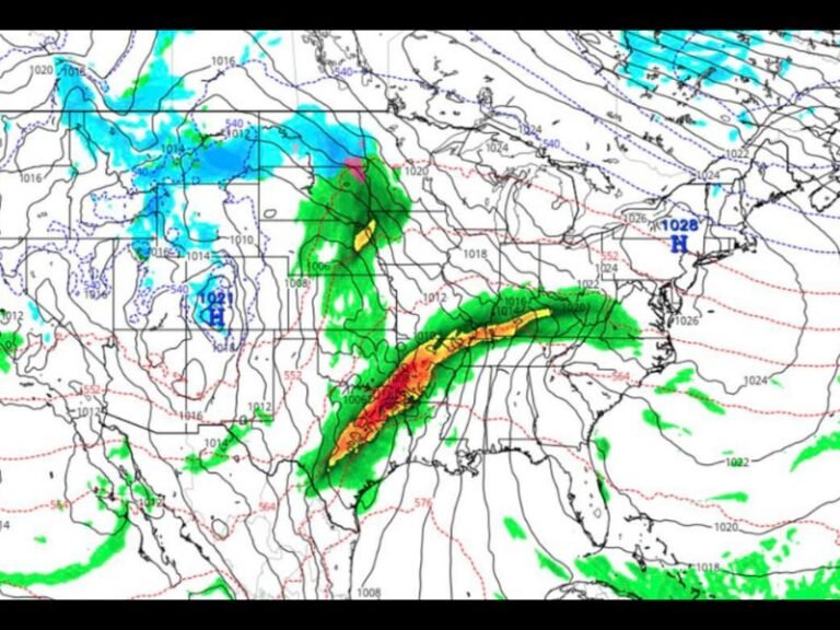
UNITED STATES — A developing dryline setup across the southern Plains will bring a Level 2 out of 5 Slight Risk for severe weather on Thursday, March 5, focusing on West Texas, western Oklahoma, and adjacent southwest Kansas.
Forecasters indicate that a few supercells could develop during the late afternoon and early evening hours, bringing the potential for large hail, damaging winds, and a low-end tornado risk before storms consolidate into a squall line later in the night.
Cities Included in the Slight Risk Zone
The Level 2 risk area includes:
- Elk City and Lawton, Oklahoma
- Tulsa and Bartlesville, Oklahoma (near the northern edge)
- Amarillo, Shamrock, Childress, Canadian, Lubbock, and Guthrie, Texas
- Liberal, Kansas
Storms are expected to initiate roughly between 3 p.m. and 5 p.m. along the dryline, which represents the boundary separating dry desert air from moist Gulf air surging northward.
Initial Supercells Could Pack a Punch
Early storms may take on supercell characteristics, meaning rotating thunderstorms capable of producing:
- Hail up to hen-egg size
- Wind gusts exceeding 60 mph
- An isolated tornado
However, forecasters emphasize that tornado potential appears limited.
Why the Tornado Threat Is Not Higher
While ingredients for rotation will be present, strong southerly winds a mile above the surface may hinder long-lived isolated supercells.
Instead of drifting east into richer instability and remaining discrete, storms are expected to:
- Track along the dryline like “train cars”
- Merge after 2–3 hours
- Transition into clusters or a messy squall line
As this evolution occurs, the tornado threat diminishes, while the damaging wind threat increases.
By around 9 p.m., much of the region could be dealing primarily with gusty squall lines rather than isolated rotating storms.
Atmospheric Setup: Instability Meets a Dryline
Warm surface temperatures and increasing low-level moisture will provide storm fuel across West Texas and western Oklahoma.
The dryline extending northward toward southwest Kansas serves as the primary trigger. Meanwhile, a low-pressure system positioned to the northwest enhances lift and upper-level support.
The instability axis is most concentrated across:
- Amarillo and the Texas Panhandle
- Western Oklahoma near Oklahoma City
- Southwest Kansas near Liberal
What This Means for the Southern Plains
Although the severe setup is not expected to produce widespread high-end tornado activity, residents should still prepare for:
- Rapid storm intensification in the late afternoon
- Localized hail damage
- Brief tornado spin-ups
- Strong wind gusts capable of downing tree limbs and power lines
Storm coverage may not be extensive, but any supercell that forms could briefly become strong before merging into a line.
Bottom Line
Thursday’s severe weather threat centers on West Texas, western Oklahoma, and southwest Kansas, where a dryline may spark a few supercells capable of hail, 60+ mph winds, and an isolated tornado.
Storms are expected to evolve into clusters by evening, shifting the primary hazard toward damaging straight-line winds.
ChicagoMusicGuide.com will continue tracking severe weather developments across the Plains and Midwest as this multi-day storm pattern unfolds.