Kansas City To Wichita Tulsa And Oklahoma City Face Level 4 Severe Storm Risk Tonight With 60 To 80 MPH Winds And Tornado Threat Developing
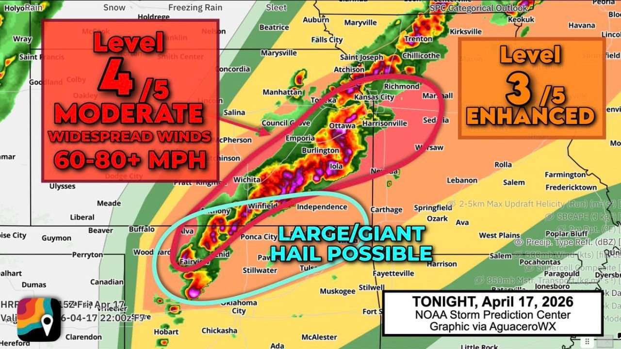
UNITED STATES — A dangerous Level 4 out of 5 severe weather risk has been issued for areas including Kansas City, Wichita, Tulsa, and Oklahoma City, with storms expected to intensify tonight into a powerful squall line capable of producing widespread 60 to 80+ mph wind gusts, along with embedded tornado potential.
Kansas City At Center Of Upgraded Moderate Risk Zone
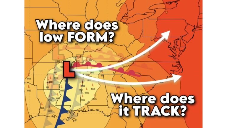
The most concerning conditions are centered near Kansas City and surrounding parts of Missouri and eastern Kansas, where the risk level has been upgraded to Level 4 (Moderate Risk)—a significant indicator of widespread severe weather potential.
Storms are expected to organize quickly this evening and evolve into a fast-moving squall line, capable of producing:
- Widespread damaging winds between 60 and 80+ mph
- Power outages and structural damage in stronger wind cores
- Brief, embedded tornadoes within the line of storms
Cities such as Kansas City, Topeka, Lawrence, and nearby communities are directly in the path of this highest risk zone.
Initial Supercells Bring Giant Hail Threat Across Oklahoma And Southern Kansas
Before storms merge into a solid line, discrete supercells are expected to develop across northern Oklahoma and southern Kansas, impacting areas like Enid, Ponca City, Stillwater, and Wichita.
These early storms pose a different but equally dangerous threat, including:
- Very large to giant hail, potentially exceeding golf ball size
- Rotating storms capable of producing a couple of tornadoes
- Localized but intense damage before storms merge
This phase is critical because supercells have more time to rotate, increasing the risk for significant hail and isolated tornado activity.
Storms Transition Into Widespread Wind Event By Evening
As the evening progresses, these individual storms are expected to merge into a squall line, extending from Oklahoma through Kansas into Missouri.
Once this transition occurs, the primary threat will shift toward:
- Widespread damaging straight-line winds
- Rapid storm movement reducing warning times
- Embedded tornado spin-ups within the line
Cities including Tulsa, Wichita, Kansas City, and Columbia could see impacts in a relatively short time window as the line pushes eastward.
Why This Setup Is Particularly Dangerous
This event stands out due to the combination of multiple severe weather hazards occurring in sequence:
- Initial supercells with giant hail and tornado potential
- Transition into a high-impact wind-producing squall line
- Large geographic coverage increasing the number of affected areas
Additionally, the high wind speeds expected (60–80+ mph) could lead to damage similar to weak tornadoes, especially in exposed areas.
What Residents Should Do Across Impacted Cities
From Oklahoma City and Tulsa to Wichita and Kansas City, residents should prepare for a rapidly evolving severe weather event tonight.
Key safety actions include:
- Stay alert for severe thunderstorm and tornado warnings
- Have multiple ways to receive alerts, especially overnight
- Secure outdoor objects ahead of strong winds
- Be ready to take shelter quickly if warnings are issued
Given the potential for fast-moving storms and limited reaction time, preparedness will be critical across the region.
This is a high-end severe weather setup that could produce significant impacts across multiple states in just a few hours, especially in and around Kansas City and the surrounding Midwest corridor.
For continued updates on severe storms, live tracking, and regional weather alerts, visit ChicagoMusicGuide.com and stay informed as this dangerous weather situation unfolds.