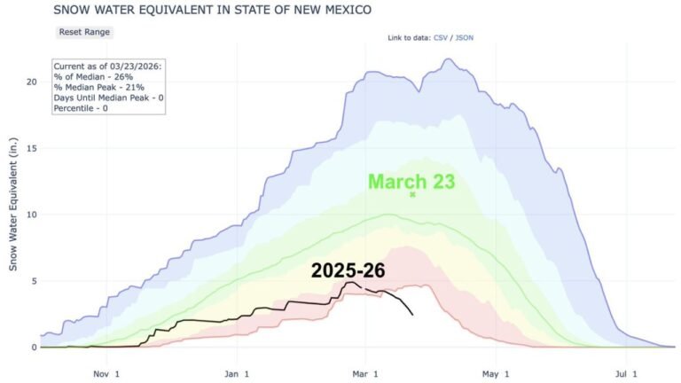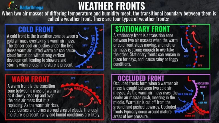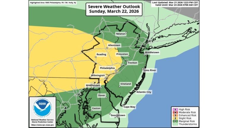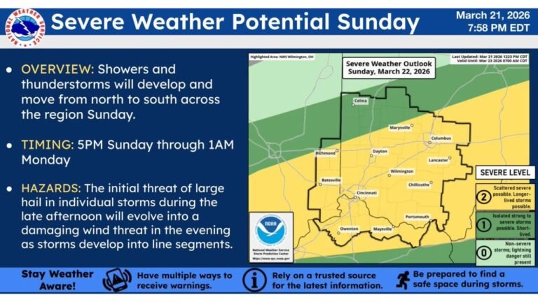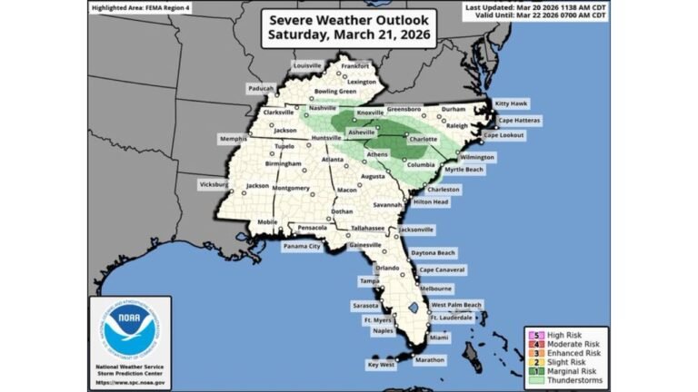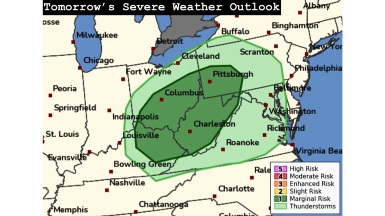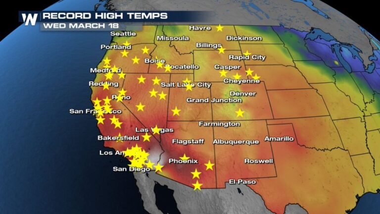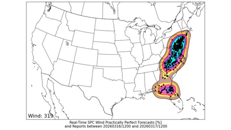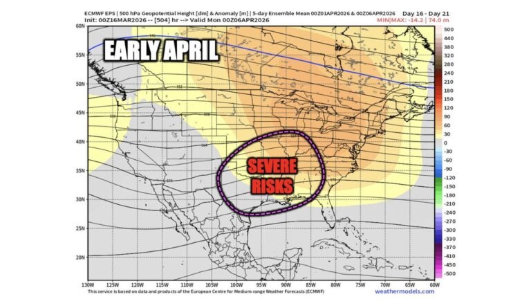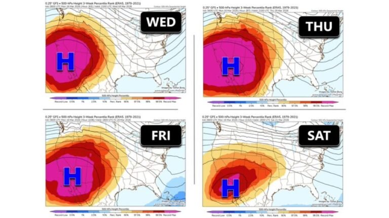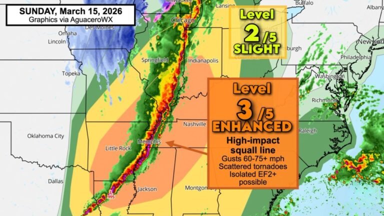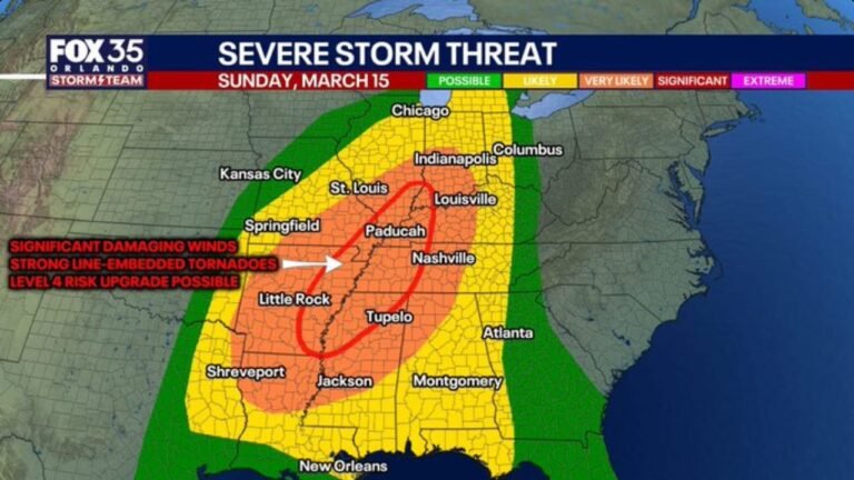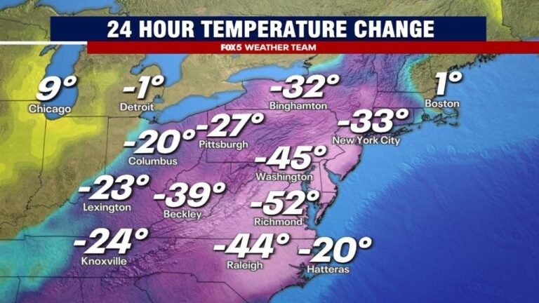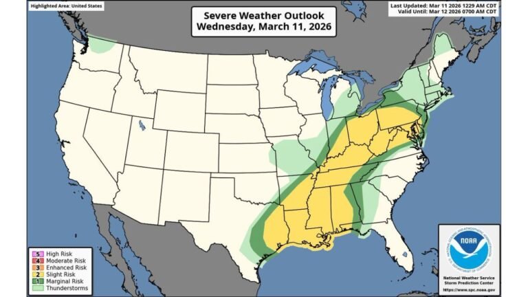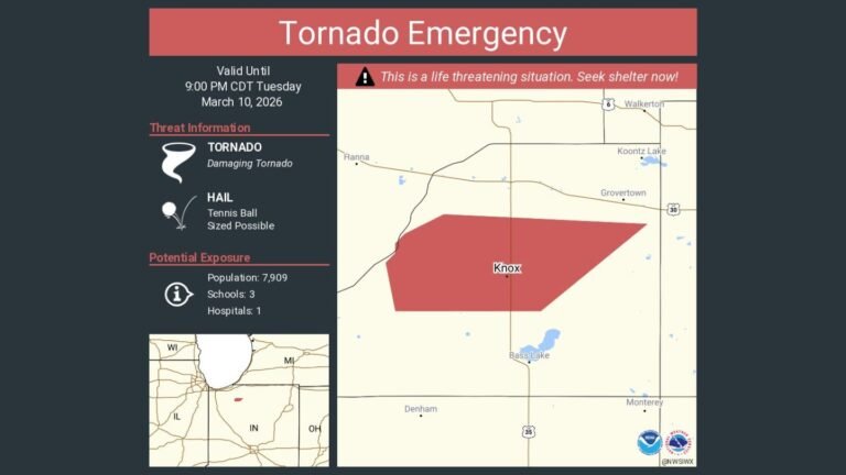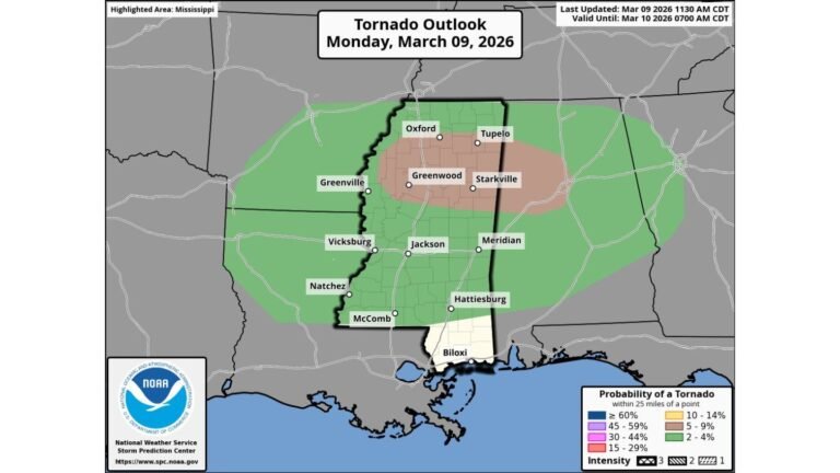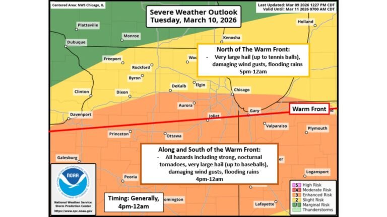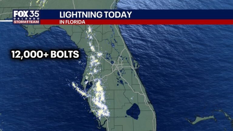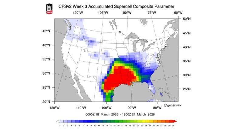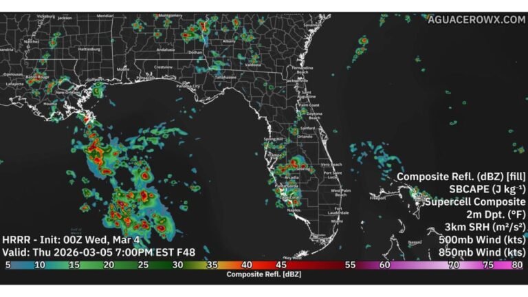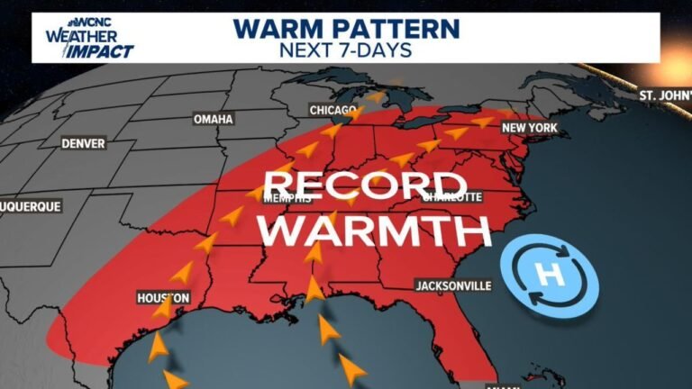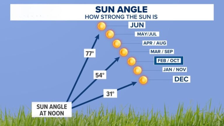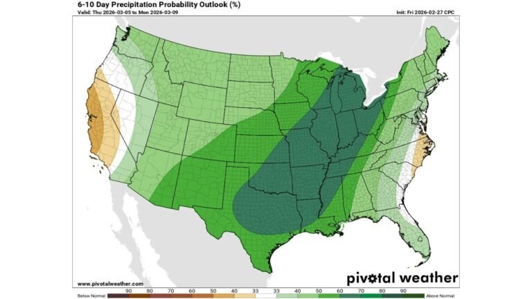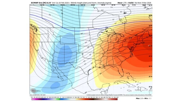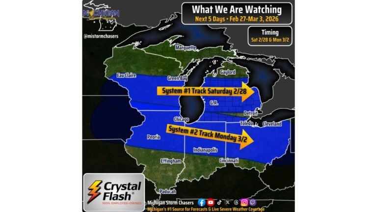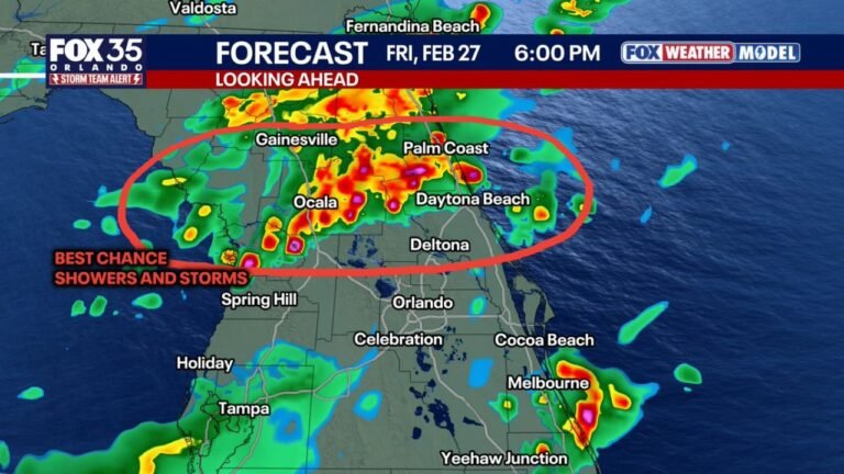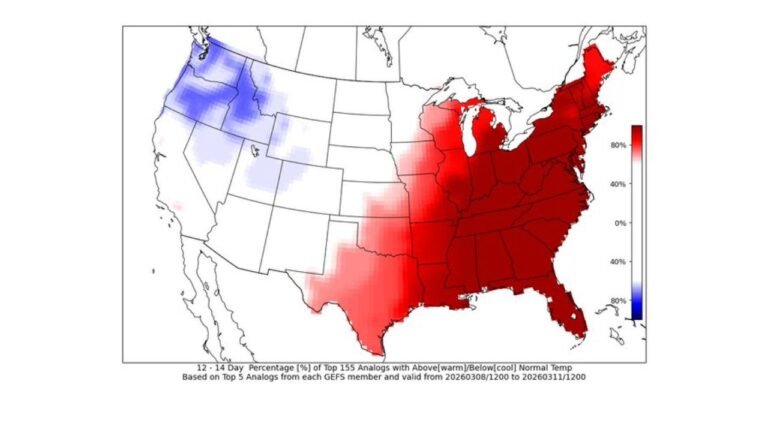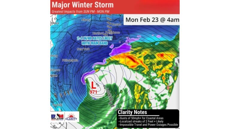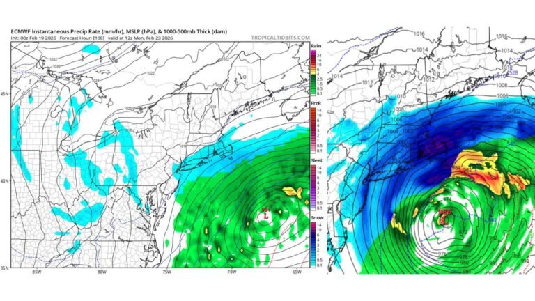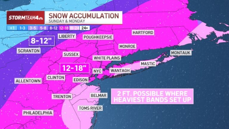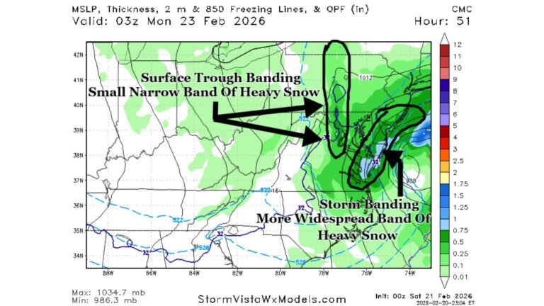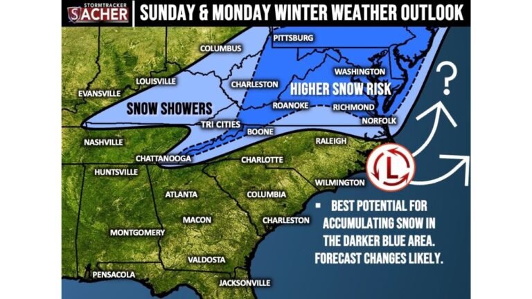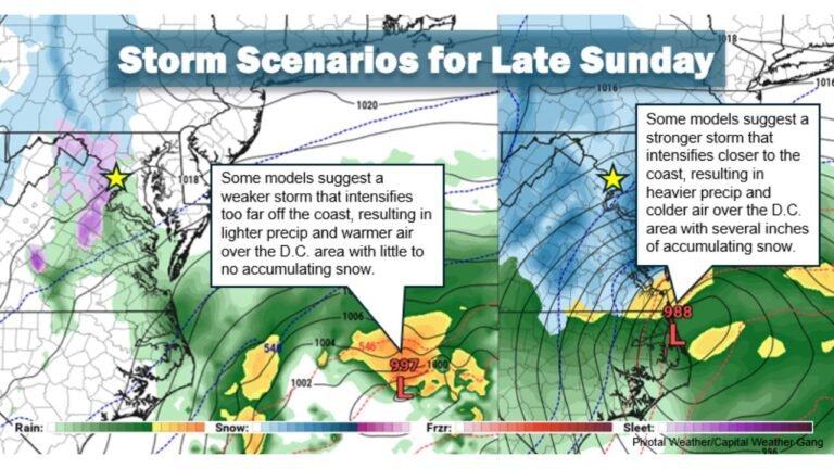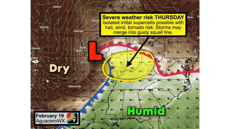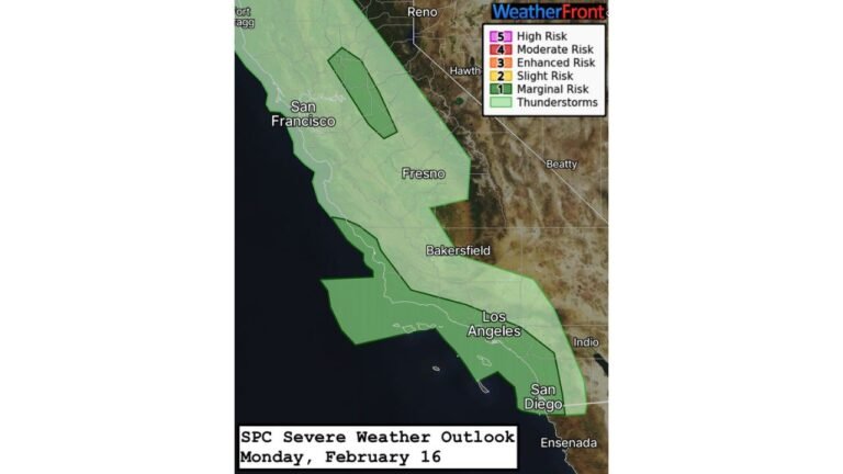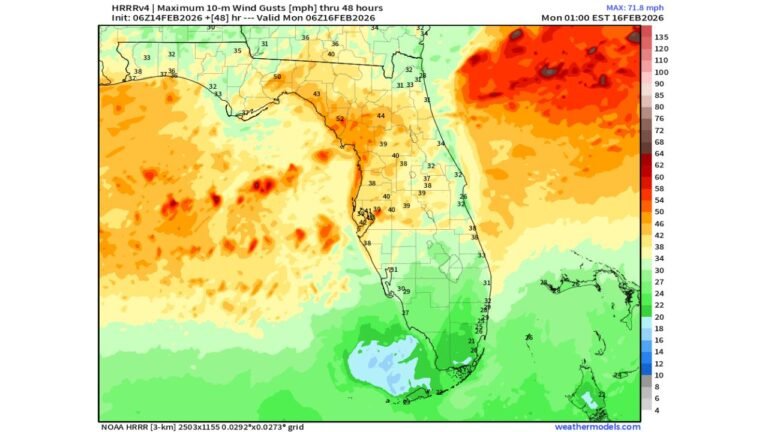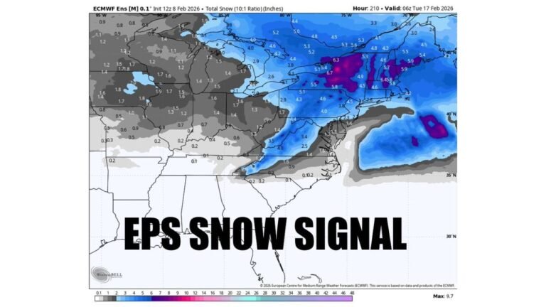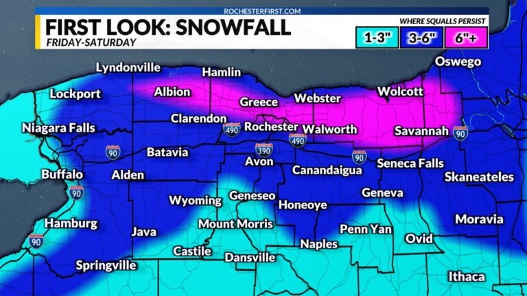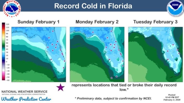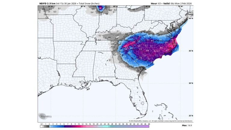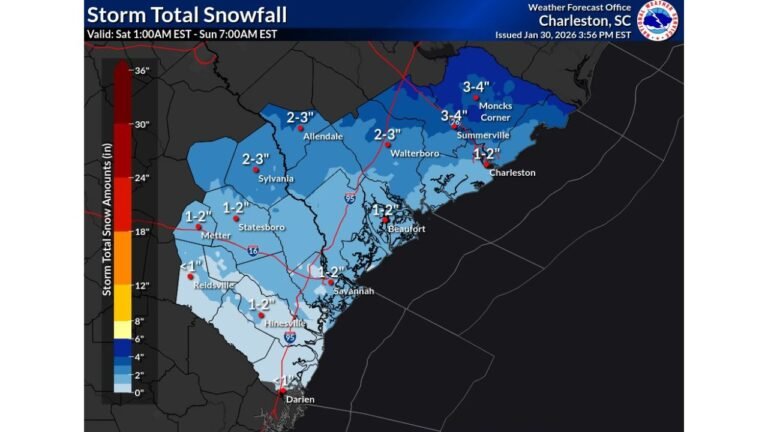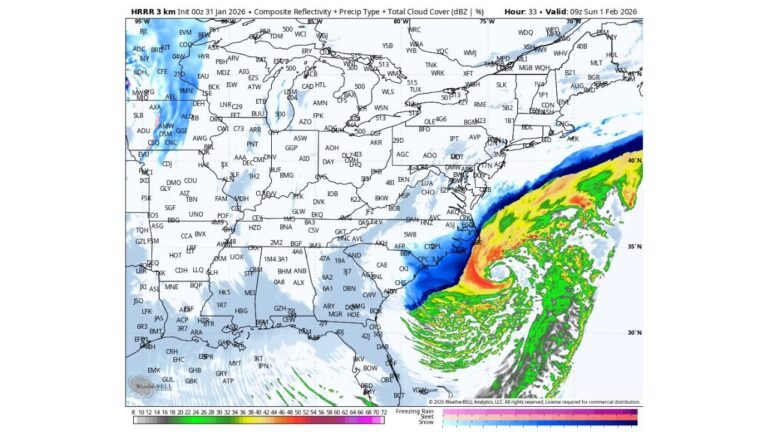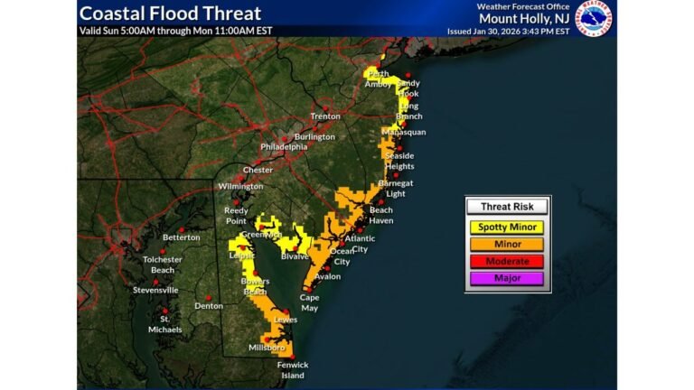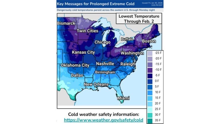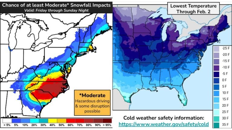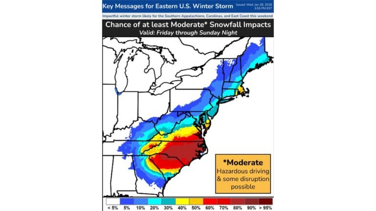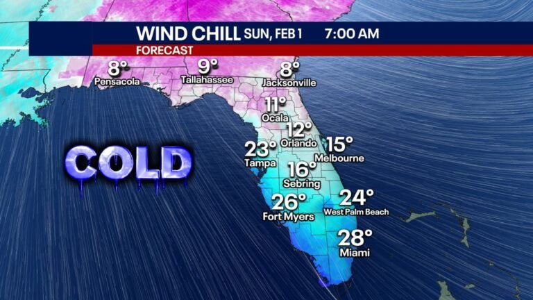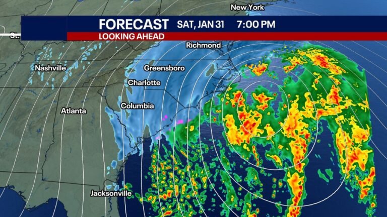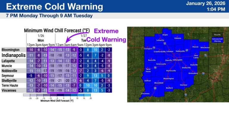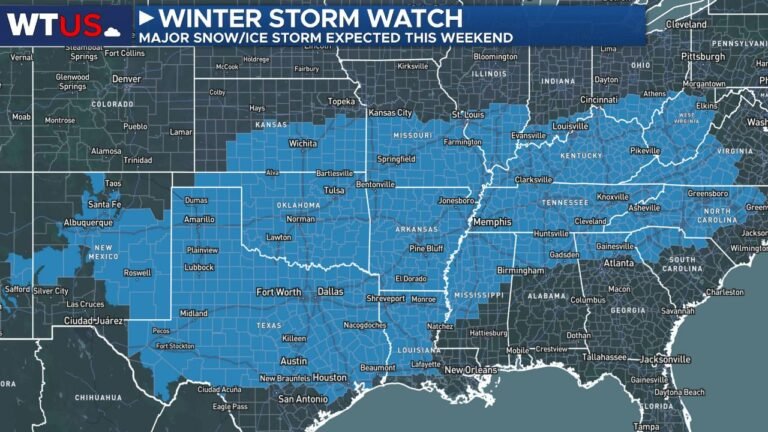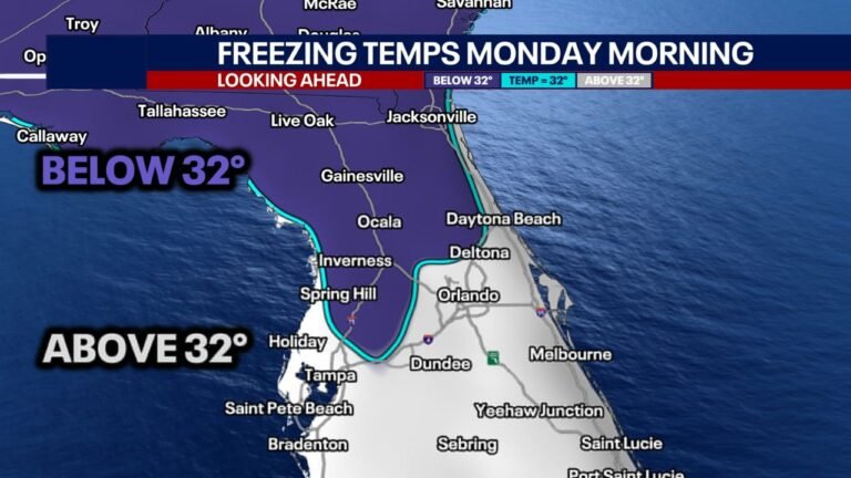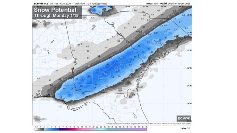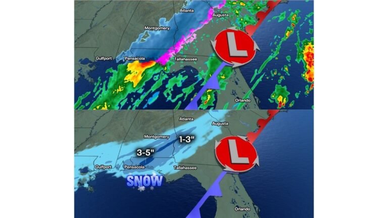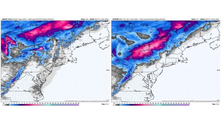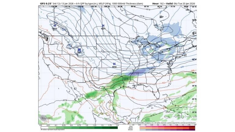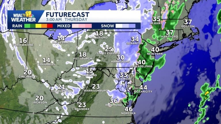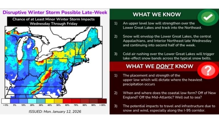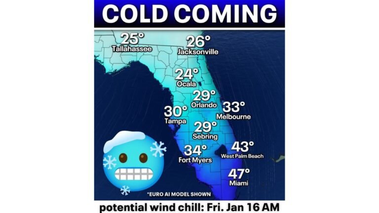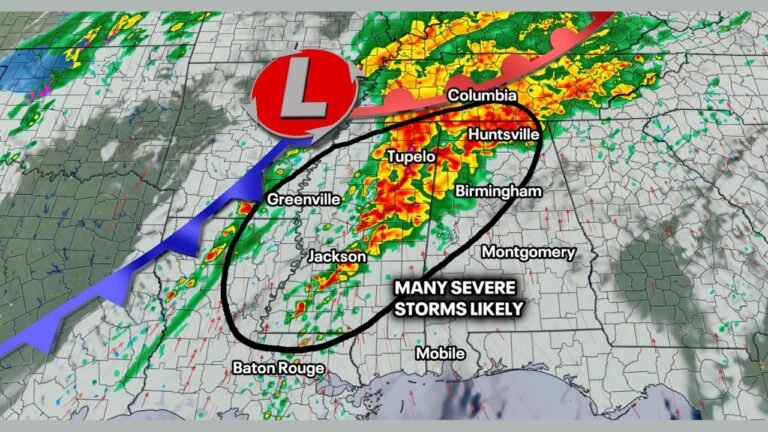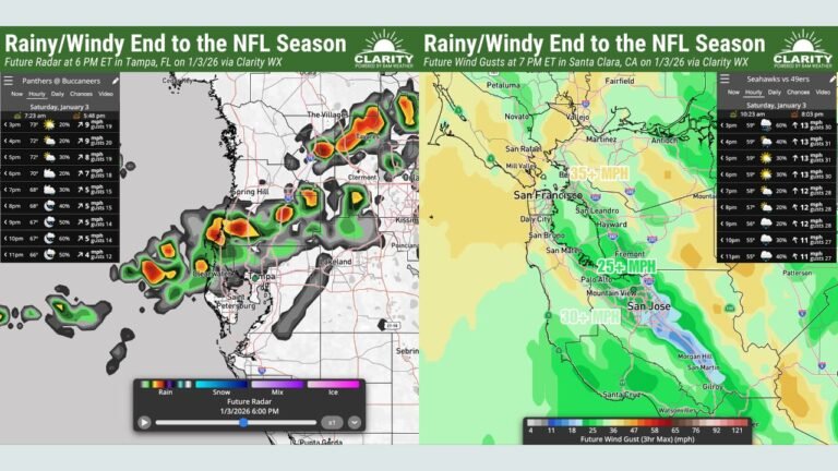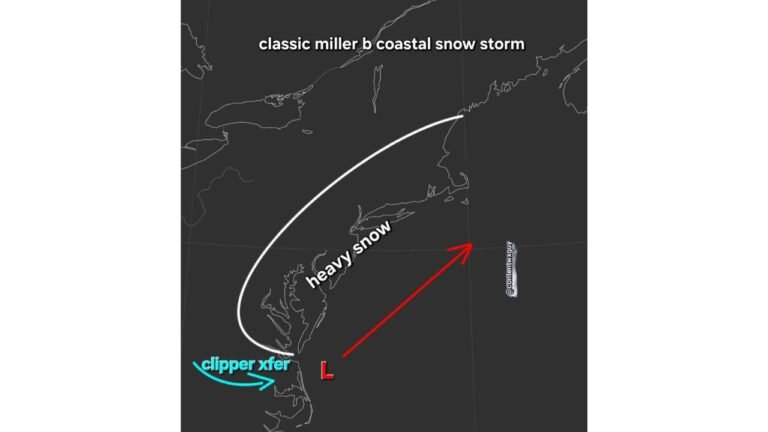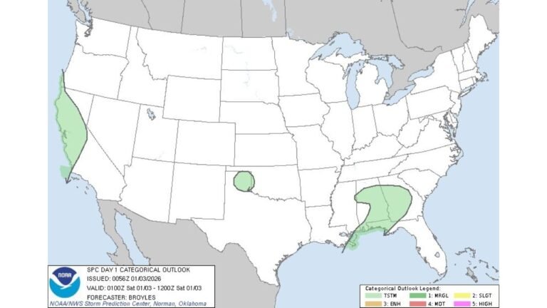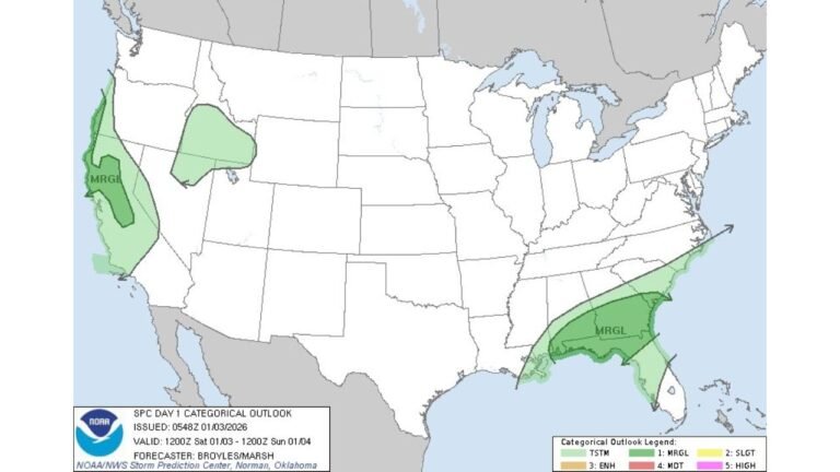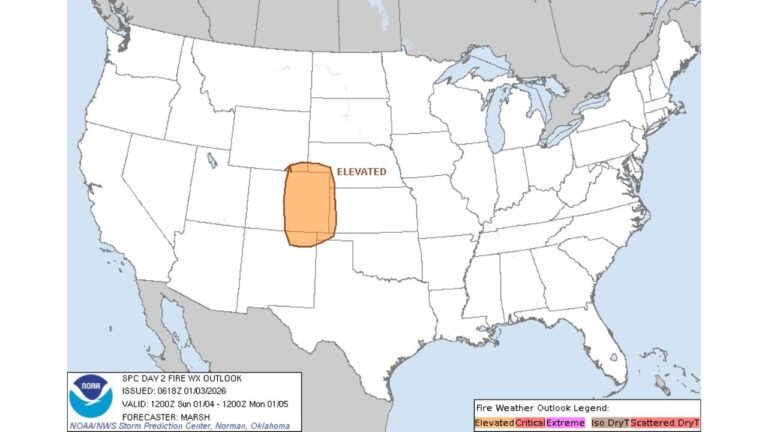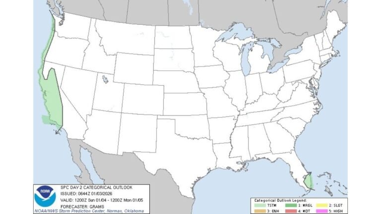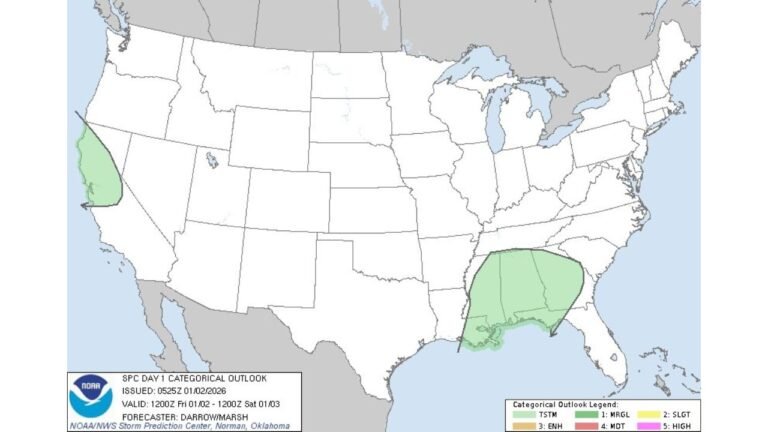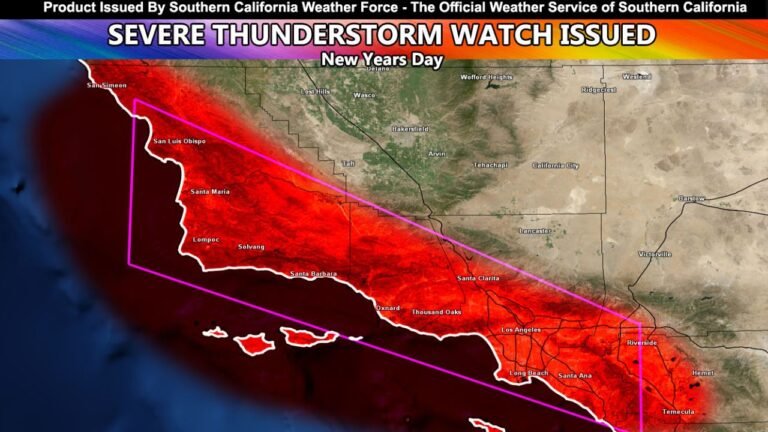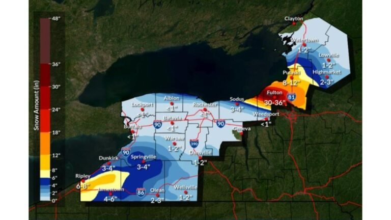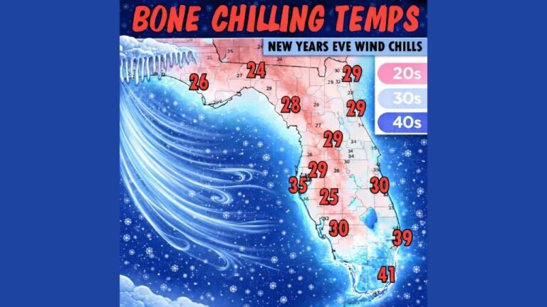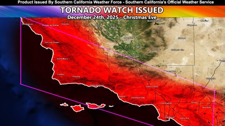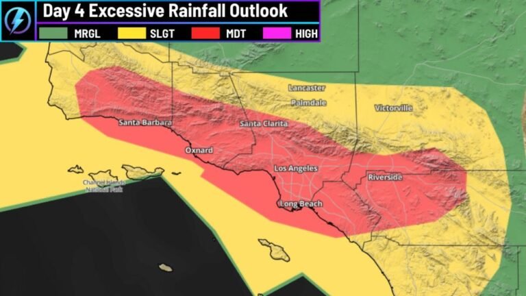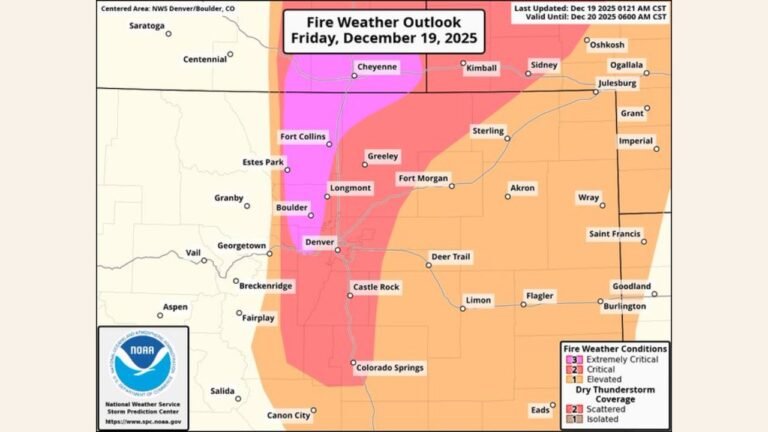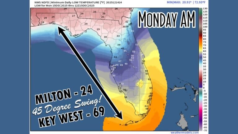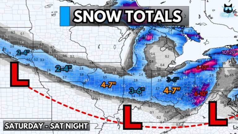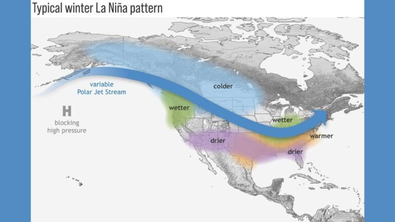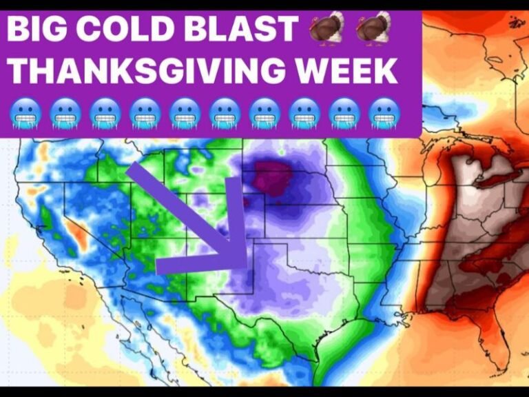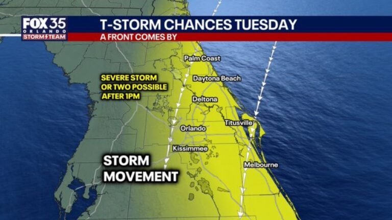
Cold Front Drops Into Central Florida Tuesday Bringing Strong Storm Risk From Orlando to Daytona Beach and Melbourne With Heavy Rain Threat East of I-4
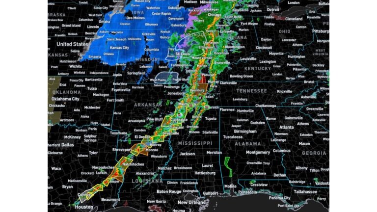
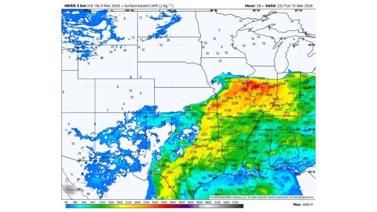
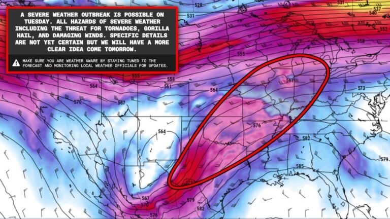
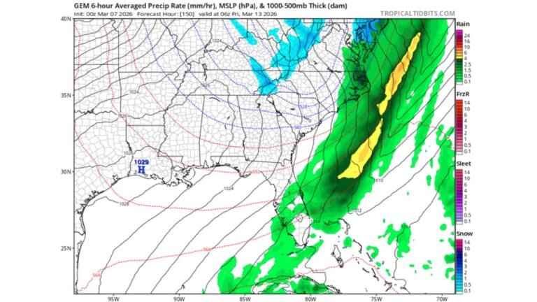
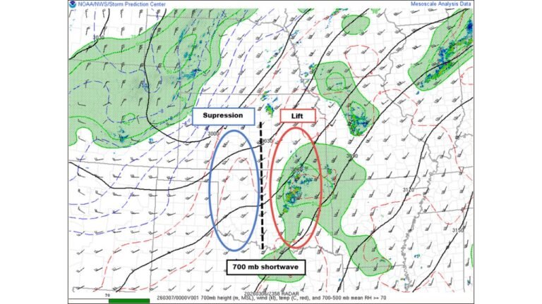
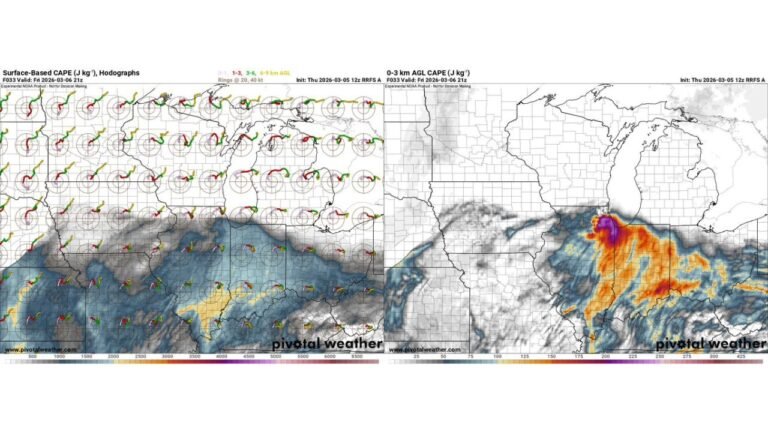
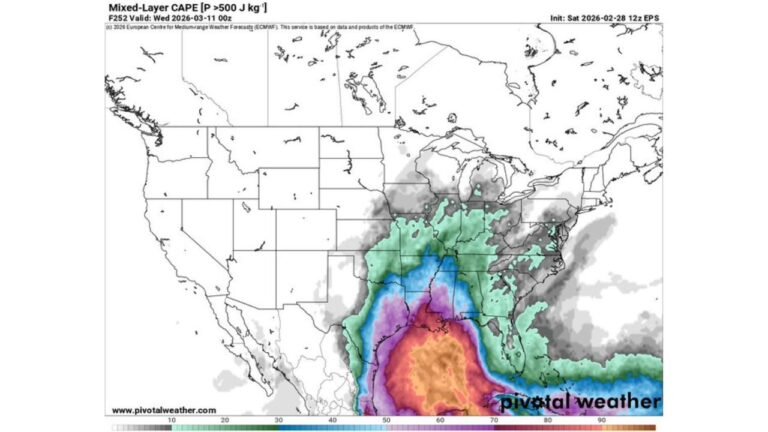
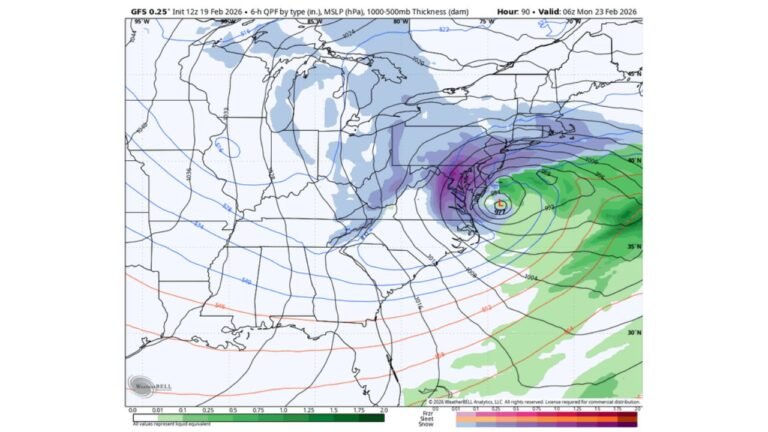
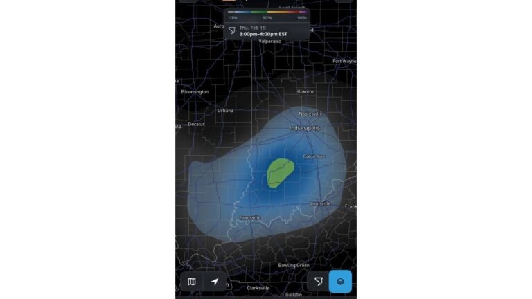
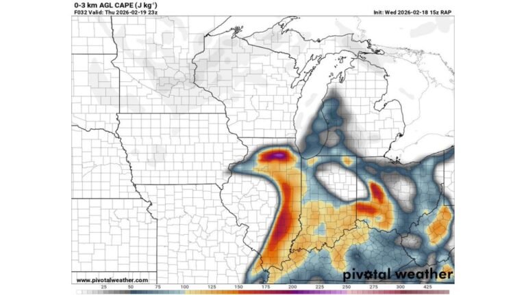
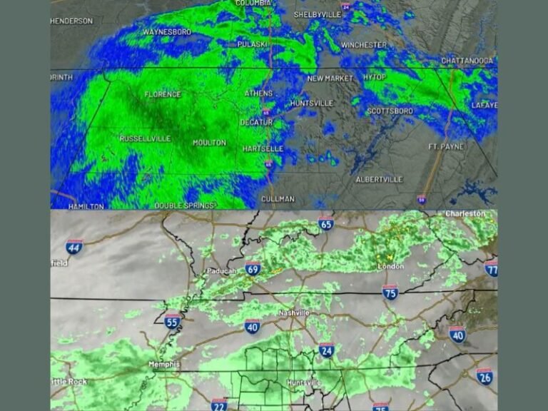
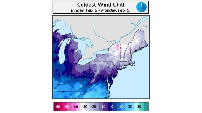
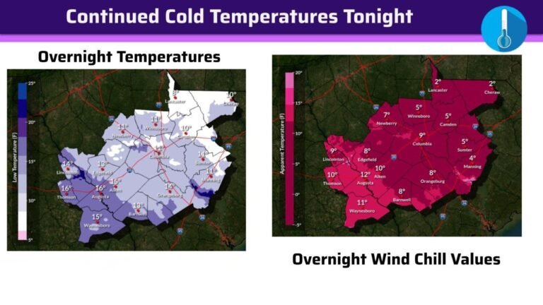
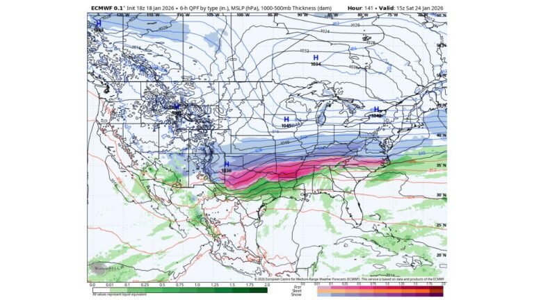
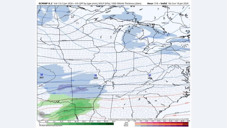
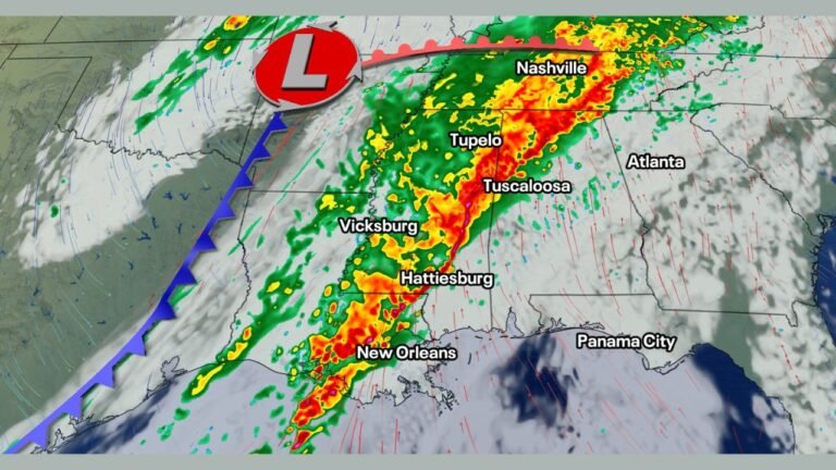
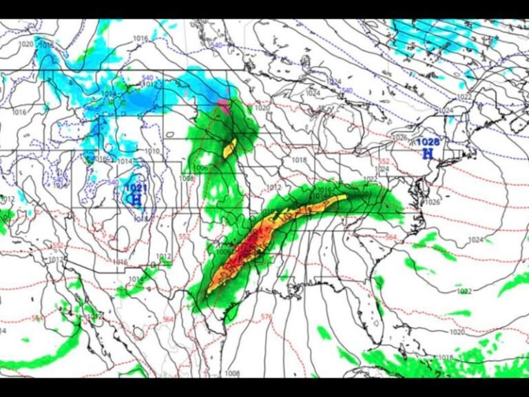
CENTRAL FLORIDA — A cold front sliding south from the north is expected to move through Central Florida Tuesday afternoon into the evening, bringing a corridor of showers and thunderstorms that could turn locally strong or even severe in isolated spots. Forecast guidance shows storm development increasing after 1 p.m., with the greatest impact zone…